Shire of Leigh
| Shire of Leigh Victoria | |||||||||||||
|---|---|---|---|---|---|---|---|---|---|---|---|---|---|
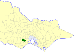 Location in Victoria | |||||||||||||
| Population | 2,340 (1992)[1] | ||||||||||||
| • Density | 2.383/km2 (6.172/sq mi) | ||||||||||||
| Established | 1861 | ||||||||||||
| Area | 982 km2 (379.2 sq mi) | ||||||||||||
| Council seat | Rokewood | ||||||||||||
| County | Grant, Grenville | ||||||||||||
| |||||||||||||
The Shire of Leigh was a local government area about 140 kilometres (87 mi) west of Melbourne, the state capital of Victoria, Australia. The shire covered an area of 982 square kilometres (379.2 sq mi), and existed from 1861 until 1994.
History
Leigh was incorporated as a road district on 27 August 1861, and became a shire on 22 March 1864.[2]
On 6 May 1994, the Shire of Leigh was abolished, and, along with the Shires of Bannockburn and Grenville, and parts of the Shire of Buninyong, was merged into the newly created Golden Plains Shire.
Wards
The Shire of Leigh was divided into three ridings in May 1965, each of which elected three councillors:
- East Riding
- Middle Riding
- West Riding
Towns and localities
Population
| Year | Population |
|---|---|
| 1954 | 1,096 |
| 1958 | 1,370* |
| 1961 | 1,460 |
| 1966 | 1,403 |
| 1971 | 1,177 |
| 1976 | 1,184 |
| 1981 | 1,285 |
| 1986 | 1,791 |
| 1991 | 2,226 |
* Estimate in 1958 Victorian Year Book.
References
- ↑ Australian Bureau of Statistics, Victoria Office (1994). Victorian Year Book. pp. 49–52. ISSN 0067-1223.
- ↑ Victorian Municipal Directory. Brunswick: Arnall & Jackson. 1992. pp. 736–737. Accessed at State Library of Victoria, La Trobe Reading Room.
Coordinates: 37°54′S 143°43′E / 37.900°S 143.717°E
This article is issued from Wikipedia - version of the 4/18/2016. The text is available under the Creative Commons Attribution/Share Alike but additional terms may apply for the media files.