Shire of Cohuna
| Shire of Cohuna Victoria | |||||||||||||
|---|---|---|---|---|---|---|---|---|---|---|---|---|---|
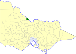 Location in Victoria | |||||||||||||
 Cohuna Shire Memorial Hall | |||||||||||||
| Population | 4,630 (1992)[1] | ||||||||||||
| • Density | 9.359/km2 (24.241/sq mi) | ||||||||||||
| Established | 1922 | ||||||||||||
| Area | 494.69 km2 (191.0 sq mi) | ||||||||||||
| Council seat | Cohuna | ||||||||||||
| County | Gunbower | ||||||||||||
| |||||||||||||
The Shire of Cohuna was a local government area on the Murray River, about 265 kilometres (165 mi) north-northwest of Melbourne, the state capital of Victoria, Australia. The shire covered an area of 494.69 square kilometres (191.0 sq mi), and existed from 1922 until 1994.
History
Cohuna was originally part of the Swan Hill Road District, which initially covered most of northwestern Victoria. Swan Hill was incorporated on 8 July 1862, and became a shire on 14 August 1871. It was renamed the Shire of Kerang on 31 December 1898.
On 8 March 1922, parts of the North East and South East Ridings severed, and were incorporated as the Shire of Cohuna.[2]
On 20 January 1995, the Shire of Cohuna was abolished, and, along with the Borough of Kerang and the Shire of Kerang, was merged into the newly created Shire of Gannawarra.[3]
Wards
The Shire of Cohuna was divided into three wards, each of which elected three councillors:
- Central Ward
- East Ward
- West Ward
Towns and localities
- Cohuna
- Gannawarra
- Gunbower
- Leitchville
- Mead
- McMillans
Population
| Year | Population |
|---|---|
| 1954 | 3,872 |
| 1958 | 4,190* |
| 1961 | 4,435 |
| 1966 | 4,664 |
| 1971 | 4,768 |
| 1976 | 4,607 |
| 1981 | 4,505 |
| 1986 | 4,332 |
| 1991 | 4,312 |
* Estimate in the 1958 Victorian Year Book.
References
- ↑ Australian Bureau of Statistics, Victoria Office (1994). Victorian Year Book. p. 52. ISSN 0067-1223.
- ↑ Victorian Municipal Directory. Brunswick: Arnall & Jackson. 1992. pp. 631–632, 718–720. Accessed at State Library of Victoria, La Trobe Reading Room.
- ↑ Australian Bureau of Statistics (1 August 1995). Victorian local government amalgamations 1994-1995: Changes to the Australian Standard Geographical Classification (PDF). Commonwealth of Australia. ISBN 0-642-23117-6. Retrieved 2008-01-05.
Coordinates: 35°48′S 144°12′E / 35.800°S 144.200°E