Borough of Kerang
| Borough of Kerang Victoria | |
|---|---|
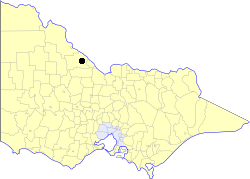 Location in Victoria | |
| Population | 4,300 (1992)[1] |
| • Density | 190.3/km2 (493/sq mi) |
| Established | 1966 |
| Area | 22.60 km2 (8.7 sq mi) |
| Council seat | Kerang |
| County | Gunbower |
The Borough of Kerang was a local government area in northwestern Victoria, Australia. The borough, for most of its history part of the surrounding Shire of Kerang, covered an area of 22.60 square kilometres (8.7 sq mi), and existed from 1966 until 1995.
History
Kerang was originally part of the Swan Hill Road District, which covered most of northwestern Victoria, and was incorporated in 1862, becoming a shire in 1871. After several other areas severed from it, it was renamed the Shire of Kerang on 31 December 1898.[2] The area around Kerang incorporated as the Borough of Kerang on 1 April 1966.
On 20 January 1995, the Borough was abolished, and merged with the Shire of Kerang and Shire of Cohuna into the Shire of Gannawarra.[3]
Wards
The Borough of Kerang was not divided into wards and its nine councillors represented all electors in the borough.
Population
| Year | Population |
|---|---|
| 1966 | 4,165 |
| 1971 | 4,103 |
| 1976 | 4,022 |
| 1981 | 4,049 |
| 1986 | 4,031 |
| 1991 | 4,024 |
* Estimate in the 1958 Victorian Year Book.
References
- ↑ Australian Bureau of Statistics, Victoria Office (1994). Victorian Year Book. p. 51. ISSN 0067-1223.
- ↑ Victorian Municipal Directory. Brunswick: Arnall & Jackson. 1992. pp. 549, 718–720. Accessed at State Library of Victoria, La Trobe Reading Room.
- ↑ Australian Bureau of Statistics (1 August 1995). Victorian local government amalgamations 1994-1995: Changes to the Australian Standard Geographical Classification (PDF). Commonwealth of Australia. p. 6. ISBN 0-642-23117-6. Retrieved 2008-01-05.
Coordinates: 35°43′S 143°55′E / 35.717°S 143.917°E