Shire of Daylesford and Glenlyon
| Shire of Daylesford and Glenlyon Victoria | |||||||||||||
|---|---|---|---|---|---|---|---|---|---|---|---|---|---|
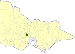 Location in Victoria | |||||||||||||
| Population | 5,980 (1992)[1] | ||||||||||||
| • Density | 9.815/km2 (25.420/sq mi) | ||||||||||||
| Established | 1860 | ||||||||||||
| Area | 609.3 km2 (235.3 sq mi) | ||||||||||||
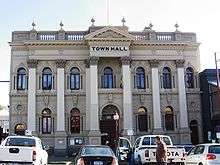
| Council seat | Daylesford | ||||||||||||
| County | Talbot | ||||||||||||
| |||||||||||||
The Shire of Daylesford and Glenlyon was a local government area about 110 kilometres (68 mi) northwest of Melbourne, the state capital of Victoria, Australia. The shire covered an area of 609.3 square kilometres (235.3 sq mi), and existed from 1860 until 1995.
History
What became the Shire of Daylesford and Glenlyon had its origins in several different local authorities:
- The Borough of Daylesford was incorporated on 23 September 1859, with an area of 16.23 km2 (6.27 sq mi), surrounding the town of Daylesford;
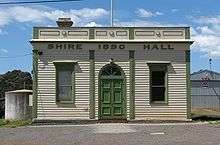
- The Shire of Glenlyon was incorporated on 24 February 1860 as a road district, becoming a shire on 12 December 1865;
- The Shire of Mount Franklin was incorporated on 11 May 1860 as a road district, becoming a shire on 27 January 1871. After the passage of the Local Government Amendment Act 1914, it was found that Mount Franklin did not meet the criteria of a shire, as its rateable income was below £1,500 per annum, so it was amalgamated on 1 October 1915 with Glenlyon.
On 3 May 1966, an Order in Council united the Borough of Daylesford with the Shire of Glenlyon, to create the new shire.[4]
On 20 January 1995, the Shire of Daylesford and Glenlyon was abolished, and, along with the Shire of Creswick and parts of the Shires of Kyneton and Talbot and Clunes, was merged into the newly created Shire of Hepburn.[5]
Wards
The Shire of Daylesford and Glenlyon was divided into four ridings on 31 May 1966, each of which elected three councillors:
- Daylesford Riding
- Glenlyon Riding
- Hepburn Riding
- Mount Franklin Riding
Towns and localities
|
|
Population
| Year | Population |
|---|---|
| 1954 | 5,489 |
| 1958 | 5,670* |
| 1961 | 4,645 |
| 1966 | 4,396 |
| 1971 | 4,105 |
| 1976 | 3,971 |
| 1981 | 4,300 |
| 1986 | 4,988 |
| 1991 | 5,679 |
* Estimate in 1958 Victorian Year Book.
References
- ↑ Australian Bureau of Statistics, Victoria Office (1994). Victorian Year Book. pp. 49–52. ISSN 0067-1223.
- ↑ "Daylesford". Travel. Melbourne: The Age. 8 February 2004. Retrieved 2008-10-12.
- ↑ "Historic hall's funds boost". The Advocate. 2006-06-06. Retrieved 2008-10-12.
- ↑ Victorian Municipal Directory. Brunswick: Arnall & Jackson. 1992. pp. 646–647. Accessed at State Library of Victoria, La Trobe Reading Room.
- ↑ Australian Bureau of Statistics (1 August 1995). Victorian local government amalgamations 1994-1995: Changes to the Australian Standard Geographical Classification (PDF). Commonwealth of Australia. p. 7. ISBN 0-642-23117-6. Retrieved 2008-01-05.
Coordinates: 37°21′S 144°09′E / 37.350°S 144.150°E