Parker County, Texas
| Parker County, Texas | |
|---|---|
|
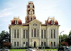
The Parker County courthouse in Weatherford | |
 Location in the U.S. state of Texas | |
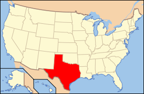 Texas's location in the U.S. | |
| Founded | 1856 |
| Seat | Weatherford |
| Largest city | Weatherford |
| Area | |
| • Total | 910 sq mi (2,357 km2) |
| • Land | 903 sq mi (2,339 km2) |
| • Water | 6.6 sq mi (17 km2), 0.7% |
| Population | |
| • (2010) | 116,927 |
| • Density | 129/sq mi (50/km²) |
| Congressional district | 12th |
| Time zone | Central: UTC-6/-5 |
| Website |
www |

Parker County is a county located in the U.S. state of Texas. As of the 2010 census, its population was 116,927.[1] The county seat is Weatherford.[2] The county was created in 1855 and organized the following year.[3] It is named for Isaac Parker, a state legislator who introduced the bill that established the county in 1855.[4][5]
Parker County is included in the Dallas-Fort Worth-Arlington, TX Metropolitan Statistical Area.
Geography
According to the U.S. Census Bureau, the county has a total area of 910 square miles (2,400 km2), of which 903 square miles (2,340 km2) is land and 6.6 square miles (17 km2) (0.7%) is water.[6] The county is intersected by the Brazos River.[7]
Highest point
Slipdown Mountain and Slipdown Bluff, at a height of 1,368 feet (417 m), are the highest points in Parker County.[8] They are located just east of the Advance Community, southwest of Poolville.
Major highways
Adjacent counties
- Wise County (north)
- Tarrant County (east)
- Johnson County (southeast)
- Hood County (south)
- Palo Pinto County (west)
- Jack County (northwest)
Demographics
| Historical population | |||
|---|---|---|---|
| Census | Pop. | %± | |
| 1860 | 4,213 | — | |
| 1870 | 4,186 | −0.6% | |
| 1880 | 15,870 | 279.1% | |
| 1890 | 21,682 | 36.6% | |
| 1900 | 25,823 | 19.1% | |
| 1910 | 26,331 | 2.0% | |
| 1920 | 23,382 | −11.2% | |
| 1930 | 18,759 | −19.8% | |
| 1940 | 20,482 | 9.2% | |
| 1950 | 21,528 | 5.1% | |
| 1960 | 22,880 | 6.3% | |
| 1970 | 33,888 | 48.1% | |
| 1980 | 44,609 | 31.6% | |
| 1990 | 64,785 | 45.2% | |
| 2000 | 88,495 | 36.6% | |
| 2010 | 116,927 | 32.1% | |
| Est. 2015 | 126,042 | [9] | 7.8% |
| U.S. Decennial Census[10] 1850–2010[11] 2010–2014[1] | |||
As of the census of 2003, there were 98,495 people, 31,131 households, and 24,313 families residing in the county. The population density was 98 people per square mile (38/km²). There were 34,084 housing units at an average density of 38 per square mile (15/km²). The racial makeup of the county was 83.17% White, 1.79% Black or African American, 0.67% Native American, 0.35% Asian, 0.02% Pacific Islander, 12.61% from other races, and 1.38% from two or more races. 7.02% of the population were Hispanic or Latino of any race.
There were 31,131 households out of which 38.00% had children under the age of 18 living with them, 65.60% were married couples living together, 8.70% had a female householder with no husband present, and 21.90% were non-families. 18.30% of all households were made up of individuals and 7.10% had someone living alone who was 65 years of age or older. The average household size was 2.75 and the average family size was 3.11. As of the 2010 census, there were about 3.4 same-sex couples per 1,000 households in the county.[12]
In the county, the population was spread out with 27.50% under the age of 18, 7.90% from 18 to 24, 29.80% from 25 to 44, 24.20% from 45 to 64, and 10.50% who were 65 years of age or older. The median age was 36 years. For every 100 females there were 104.10 males. For every 100 females age 18 and over, there were 102.10 males.
The median income for a household in the county was $45,497, and the median income for a family was $51,530. Males had a median income of $37,913 versus $25,412 for females. The per capita income for the county was $20,305. About 5.90% of families and 8.30% of the population were below the poverty line, including 9.30% of those under age 18 and 9.60% of those age 65 or over.
Communities
- Adell
- Agnes
- Aledo
- Annetta
- Annetta North
- Annetta South
- Azle (partly in Tarrant County)
- Briar (partly in Wise and Tarrant counties)
- Brock
- Cool
- Cresson (partly in Hood and Johnson counties)
- Dennis
- Fort Worth (mostly in Tarrant County with small parts in Denton, Wise and Parker counties)
- Garner
- Hudson Oaks
- Horseshoe Bend
- Millsap
- Mineral Wells (partly in Palo Pinto County)
- Peaster
- Poolville
- Reno
- Sanctuary
- Springtown
- Weatherford (county seat)
- Western Lake
- Whitt
- Willow Park
Notable people
- Orville Bullington, attorney and politician
- Oliver Loving, Loving-Goodnight Cattle Trail
- Bose Ikard, trusted cattle driver of Oliver Loving and Charles Goodnight
- Mary Martin, star of stage and screen
- S.W.T. Lanham, last Confederate governor of Texas
- Jim Wright, youngest mayor of Weatherford, TX, Speaker of the U.S. House of Representatives
- Douglas Chandor (1897-1953), international portrait artist [13]
See also
- List of museums in North Texas
- National Register of Historic Places listings in Parker County, Texas
References
- 1 2 "State & County QuickFacts". United States Census Bureau. Retrieved December 22, 2013.
- ↑ "Find a County". National Association of Counties. Archived from the original on May 31, 2011. Retrieved 2011-06-07.
- ↑ "Texas: Individual County Chronologies". Texas Atlas of Historical County Boundaries. The Newberry Library. 2008. Retrieved May 26, 2015.
- ↑ "PARKER COUNTY". Retrieved 24 March 2016.
- ↑ "PARKER, ISAAC". Retrieved 24 March 2016.
- ↑ "2010 Census Gazetteer Files". United States Census Bureau. August 22, 2012. Retrieved May 6, 2015.
- ↑
 Ripley, George; Dana, Charles A., eds. (1879). "Parker". The American Cyclopædia.
- ↑ "Parker County Highpoint Trip Report". Retrieved 24 March 2016.
- ↑ "County Totals Dataset: Population, Population Change and Estimated Components of Population Change: April 1, 2010 to July 1, 2015". Retrieved July 2, 2016.
- ↑ "U.S. Decennial Census". United States Census Bureau. Archived from the original on May 11, 2015. Retrieved May 6, 2015.
- ↑ "Texas Almanac: Population History of Counties from 1850–2010" (PDF). Texas Almanac. Retrieved May 6, 2015.
- ↑ Where Same-Sex Couples Live, June 26, 2015, retrieved July 6, 2015
- ↑ http://www.tshaonline.org/handbook/online/articles/fch17
External links
- Parker County government's website
- The Parker County Poor Farm
- Historic photos from the Weatherford College Library, hosted by the Portal to Texas History
- Parker County in Handbook of Texas Online
 |
Jack County | Wise County | | |
| Palo Pinto County | |
Tarrant County | ||
| ||||
| | ||||
| Hood County | Johnson County |
Municipalities and communities of Parker County, Texas, United States | ||
|---|---|---|
| Cities | | |
| Towns | ||
| CDPs | ||
| Other unincorporated communities | ||
| Footnotes | ‡This populated place also has portions in an adjacent county or counties | |

Coordinates: 32°47′N 97°49′W / 32.78°N 97.81°W