Madison County, Texas
| Madison County, Texas | |
|---|---|
|
The Madison County Courthouse in Madisonville | |
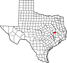 Location in the U.S. state of Texas | |
 Texas's location in the U.S. | |
| Founded | 1854 |
| Named for | James Madison |
| Seat | Madisonville |
| Largest city | Madisonville |
| Area | |
| • Total | 472 sq mi (1,222 km2) |
| • Land | 466 sq mi (1,207 km2) |
| • Water | 6.4 sq mi (17 km2), 1.3% |
| Population | |
| • (2010) | 13,664 |
| • Density | 29/sq mi (11/km²) |
| Congressional district | 8th |
| Time zone | Central: UTC-6/-5 |
| Website |
www |


Madison County is a county located in the U.S. state of Texas. As of the 2010 census, its population was 13,664.[1] Its seat is Madisonville.[2] The county was created in 1853 and organized the next year.[3] It is named for James Madison, the fourth president of the United States.[4]
History
The current Madison County Courthouse was built in 1970. It is at least the fifth courthouse to serve Madison County.[5]
Geography
According to the U.S. Census Bureau, the county has a total area of 472 square miles (1,220 km2), of which 466 square miles (1,210 km2) is land and 6.4 square miles (17 km2) (1.3%) is water.[6]
The county has three natural borders: its eastern boundary is defined by the Trinity River, its western boundary is defined by the Navasota River, and the portion of its southern border adjacent to Walker County is defined by Bedias Creek.[7]
Major highways
Adjacent counties
- Leon County (north)
- Houston County (northeast)
- Walker County (southeast)
- Grimes County (south)
- Brazos County (southwest)
Demographics
| Historical population | |||
|---|---|---|---|
| Census | Pop. | %± | |
| 1860 | 2,238 | — | |
| 1870 | 4,061 | 81.5% | |
| 1880 | 5,395 | 32.8% | |
| 1890 | 8,512 | 57.8% | |
| 1900 | 10,432 | 22.6% | |
| 1910 | 10,318 | −1.1% | |
| 1920 | 11,956 | 15.9% | |
| 1930 | 12,227 | 2.3% | |
| 1940 | 12,029 | −1.6% | |
| 1950 | 7,996 | −33.5% | |
| 1960 | 6,749 | −15.6% | |
| 1970 | 7,693 | 14.0% | |
| 1980 | 10,649 | 38.4% | |
| 1990 | 10,931 | 2.6% | |
| 2000 | 12,940 | 18.4% | |
| 2010 | 13,664 | 5.6% | |
| Est. 2015 | 14,065 | [8] | 2.9% |
| U.S. Decennial Census[9] 1850–2010[10] 2010–2014[1] | |||
As of the census[11] of 2000, there were 12,940 people, 3,914 households, and 2,837 families residing in the county. The population density was 28 people per square mile (11/km²). There were 4,797 housing units at an average density of 10 per square mile (4/km²). The racial makeup of the county was 66.79% White, 22.87% African American, 0.32% Native American, 0.39% Asian, 0.03% Pacific Islander, 7.90% from other races, and 1.72% from two or more races. 15.78% of the population were Hispanic or Latino of any race.
There were 3,914 households out of which 31.50% had children under the age of 18 living with them, 57.10% were married couples living together, 11.70% had a female householder with no husband present, and 27.50% were non-families. 24.50% of all households were made up of individuals and 12.40% had someone living alone who was 65 years of age or older. The average household size was 2.57 and the average family size was 3.05.
In the county, the population was spread out with 21.10% under the age of 18, 13.00% from 18 to 24, 31.90% from 25 to 44, 20.00% from 45 to 64, and 14.00% who were 65 years of age or older. The median age was 33 years. For every 100 females there were 142.60 males. For every 100 females age 18 and over, there were 155.10 males.
The median income for a household in the county was $29,418, and the median income for a family was $35,779. Males had a median income of $25,625 versus $19,777 for females. The per capita income for the county was $14,056. About 12.30% of families and 15.80% of the population were below the poverty line, including 20.00% of those under age 18 and 16.30% of those age 65 or over.
Government and infrastructure
The Ferguson Unit, a Texas Department of Criminal Justice prison for men, is located in an unincorporated area in the county.[12]
Communities
- Madisonville (county seat)
- Midway
- Normangee
- North Zulch
See also
References
- 1 2 "State & County QuickFacts". United States Census Bureau. Retrieved December 21, 2013.
- ↑ "Find a County". National Association of Counties. Retrieved 2011-06-07.
- ↑ "Texas: Individual County Chronologies". Texas Atlas of Historical County Boundaries. The Newberry Library. 2008. Retrieved May 25, 2015.
- ↑ Gannett, Henry (1905). The Origin of Certain Place Names in the United States. U.S. Government Printing Office. p. 196.
- ↑ Hodges, Ann E. "Madison County". Texas State Historical Association. Retrieved 12 April 2014.
- ↑ "2010 Census Gazetteer Files". United States Census Bureau. August 22, 2012. Retrieved May 4, 2015.
- ↑ Madison County from the Handbook of Texas Online. By Ann E. Hodges. Retrieved 5 February 2007.
- ↑ "County Totals Dataset: Population, Population Change and Estimated Components of Population Change: April 1, 2010 to July 1, 2015". Retrieved July 2, 2016.
- ↑ "U.S. Decennial Census". United States Census Bureau. Retrieved May 4, 2015.
- ↑ "Texas Almanac: Population History of Counties from 1850–2010" (PDF). Texas Almanac. Retrieved May 4, 2015.
- ↑ "American FactFinder". United States Census Bureau. Retrieved 2011-05-14.
- ↑ "Ferguson Unit." Texas Department of Criminal Justice. Retrieved on July 16, 2010.
External links
- Madison County government's website
- Madison County from the Handbook of Texas Online
 |
Leon County | Houston County | | |
| |
||||
| ||||
| | ||||
| Brazos County | Grimes County | Walker County |
Municipalities and communities of Madison County, Texas, United States | ||
|---|---|---|
| Cities | | |
| Town | ||
| Unincorporated community |
| |
| Ghost towns |
| |
| Footnotes | ‡This populated place also has portions in an adjacent county or counties | |

Coordinates: 30°58′N 95°56′W / 30.97°N 95.93°W