Robertson County, Texas
| Robertson County, Texas | |
|---|---|
|
The Robertson County Courthouse in Franklin | |
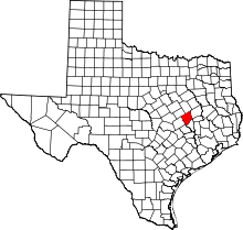 Location in the U.S. state of Texas | |
 Texas's location in the U.S. | |
| Founded | 1838 |
| Named for | Sterling C. Robertson |
| Seat | Franklin |
| Largest city | Hearne |
| Area | |
| • Total | 865 sq mi (2,240 km2) |
| • Land | 856 sq mi (2,217 km2) |
| • Water | 9.7 sq mi (25 km2), 1.1% |
| Population | |
| • (2010) | 16,622 |
| • Density | 19/sq mi (7/km²) |
| Congressional district | 17th |
| Time zone | Central: UTC-6/-5 |
| Website |
www |


Robertson County is a county located in the U.S. state of Texas. As of the 2010 census, its population was 16,622.[1] Its county seat is Franklin.[2] The county was created in 1837 and organized the following year.[3][4] It is named for Sterling C. Robertson,[5] an early settler who signed the Texas Declaration of Independence.
Robertson County is part of the College Station-Bryan, TX Metropolitan Statistical Area.
Geography
According to the U.S. Census Bureau, the county has a total area of 865 square miles (2,240 km2), of which 856 square miles (2,220 km2) is land and 9.7 square miles (25 km2) (1.1%) is water.[6]
Major highways
Additionally, State Highway OSR forms Robertson County's southeastern border, but doesn't fully enter the county.
Adjacent counties
- Limestone County (north)
- Leon County (northeast)
- Brazos County (southeast)
- Burleson County (south)
- Milam County (southwest)
- Falls County (northwest)
Demographics
| Historical population | |||
|---|---|---|---|
| Census | Pop. | %± | |
| 1850 | 934 | — | |
| 1860 | 4,997 | 435.0% | |
| 1870 | 9,990 | 99.9% | |
| 1880 | 22,383 | 124.1% | |
| 1890 | 26,506 | 18.4% | |
| 1900 | 31,480 | 18.8% | |
| 1910 | 27,454 | −12.8% | |
| 1920 | 27,933 | 1.7% | |
| 1930 | 27,240 | −2.5% | |
| 1940 | 25,710 | −5.6% | |
| 1950 | 19,908 | −22.6% | |
| 1960 | 16,157 | −18.8% | |
| 1970 | 14,389 | −10.9% | |
| 1980 | 14,653 | 1.8% | |
| 1990 | 15,511 | 5.9% | |
| 2000 | 16,000 | 3.2% | |
| 2010 | 16,622 | 3.9% | |
| Est. 2015 | 16,659 | [7] | 0.2% |
| U.S. Decennial Census[8] 1850–2010[9] 2010–2014[1] | |||
As of the census[10] of 2000, there were 16,000 people, 6,179 households, and 4,356 families residing in the county. The population density was 19 people per square mile (7/km²). There were 7,874 housing units at an average density of 9 per square mile (4/km²). The racial makeup of the county was 66.20% White, 24.19% Black or African American, 0.42% Native American, 0.16% Asian, 0.05% Pacific Islander, 7.17% from other races, and 1.79% from two or more races. 14.74% of the population were Hispanic or Latino of any race.
There were 6,179 households out of which 32.00% had children under the age of 18 living with them, 51.10% were married couples living together, 15.50% had a female householder with no husband present, and 29.50% were non-families. 26.90% of all households were made up of individuals and 14.50% had someone living alone who was 65 years of age or older. The average household size was 2.55 and the average family size was 3.09.
In the county, the population was spread out with 28.20% under the age of 18, 7.50% from 18 to 24, 24.20% from 25 to 44, 23.10% from 45 to 64, and 17.00% who were 65 years of age or older. The median age was 38 years. For every 100 females there were 91.00 males. For every 100 females age 18 and over, there were 87.70 males.
The median income for a household in the county was $28,886, and the median income for a family was $35,590. Males had a median income of $30,795 versus $21,529 for females. The per capita income for the county was $14,714. About 17.30% of families and 20.60% of the population were below the poverty line, including 28.70% of those under age 18 and 21.60% of those age 65 or over.
Communities
Cities
Unincorporated communities
Ghost towns
See also
References
- 1 2 "State & County QuickFacts". United States Census Bureau. Retrieved December 23, 2013.
- ↑ "Find a County". National Association of Counties. Retrieved 2011-06-07.
- ↑ "Texas: Individual County Chronologies". Texas Atlas of Historical County Boundaries. The Newberry Library. 2008. Retrieved June 23, 2015.
- ↑ "Roberston County". Texas Almanac. Texas State Historical Association. Retrieved June 23, 2015.
- ↑ Hailey, James L; Long, Christopher. "Robertson County". Handbook of Texas Online. Texas State Historical Association. Retrieved 12 October 2011.
- ↑ "2010 Census Gazetteer Files". United States Census Bureau. August 22, 2012. Retrieved May 9, 2015.
- ↑ "County Totals Dataset: Population, Population Change and Estimated Components of Population Change: April 1, 2010 to July 1, 2015". Retrieved July 2, 2016.
- ↑ "U.S. Decennial Census". United States Census Bureau. Retrieved May 9, 2015.
- ↑ "Texas Almanac: Population History of Counties from 1850–2010" (PDF). Texas Almanac. Retrieved May 9, 2015.
- ↑ "American FactFinder". United States Census Bureau. Retrieved 2011-05-14.
External links
| Wikimedia Commons has media related to Robertson County, Texas. |
- Robertson County government's website
- Robertson County from the Handbook of Texas Online
- Sketch of Sterling Robertson from A pictorial history of Texas, from the earliest visits of European adventurers, to A.D. 1879, hosted by the Portal to Texas History.
 |
Falls County | Limestone County | Leon County | |
| |
||||
| ||||
| | ||||
| Milam County | Burleson County | Brazos County |
Municipalities and communities of Robertson County, Texas, United States | ||
|---|---|---|
| Cities | | |
| Unincorporated communities | ||
| Ghost town | ||

Coordinates: 31°02′N 96°31′W / 31.03°N 96.51°W