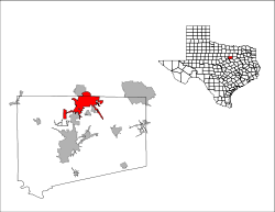
Burleson, Texas
| Burleson, Texas | ||
|---|---|---|
| City | ||
| ||
 Location of Burleson, Texas | ||
 | ||
| Country |
| |
| State |
| |
| Counties | Johnson, Tarrant | |
| Government | ||
| • Type | Council-Manager | |
| • City Council |
Mayor Ken Shetter Stuart Gillaspie Rick Green Jerry Allen Matt Aiken Dan McClendon Ronnie Johnson | |
| • City Manager | Dale Cheatham | |
| Area | ||
| • Total | 26.1 sq mi (67.5 km2) | |
| Elevation | 712 ft (217 m) | |
| Population (2013) | ||
| • Total | 40,714 [1] | |
| Time zone | Central (CST) | |
| • Summer (DST) | CDT (UTC) | |
| ZIP codes | 76028, 76097, 76058, 76031 | |
| Area code(s) | 817 | |
| FIPS code | 48-11428[2] | |
| GNIS feature ID | 1331683[3] | |
| Website | BurlesonTX.com | |
Burleson (/ˈbɜːrlᵻsən/ BUR-li-sən) is a city in Johnson and Tarrant counties in the U.S. state of Texas. It is also a suburb of Fort Worth.
History
The Missouri-Kansas-Texas Railroad, known as "the Katy", decided to extend its service from Denison to Waco. In 1881 the segment from Fort Worth to Alvarado was being laid out, and a midway depot was needed. Grenville M. Dodge, representing the railroad, purchased land for the depot and a town surrounding it from Rev. Henry C. Renfro at the site of what is now called "Old Town" Burleson. As part of the agreement, Renfro named the town Burleson, in honor of his teacher Rufus Columbus Burleson, the president of Baylor University. The first lot was sold on October 10, 1881, the date now considered to be the "founding day" of the city.
The Burleson Post Office opened in 1882, inside a retail establishment, as was common for small towns at the time. On February 20, 1895, a fire burned down most of the business district, along with several homes. One of the Katy workers, J. C. Jones, had stayed in Burleson and opened a water works for the town, drilling a deep well that provided dozens of hydrants for the residents, but they were not sufficient for extinguishing the fire. By the end of the 1800s, Burleson was an ongoing rural town, with farms all around, schools, a grocery store, cotton gins and grist mills, a general store, a druggist, a bank, even a jeweler. In 1899, a group of nine women formed a society for cultural advancement, and called it the Eumathian Club. The women acquired books, loaned them, and held readings, discussions, and music recitals. The Eumathian Club celebrated its centennial in 1999, has many notable accomplishments in its history, and is still active in Burleson to this day.
1900 saw the retirement of John W. Taylor, an area farmer who retired to a Burleson house said to be equipped with the town's first in-home bathtub. In 1909 the Texas Legislature passed a bill forming the Burleson Independent School District. In 1911 the Northern Texas Traction Company decided to install an interurban line between Fort Worth and Cleburne, with Burleson as one stop along the way. Construction began in 1912, and the first day of service was September 1, 1912, with some 1200 passengers on the ten passenger runs that day. Two freight runs per day were made as well. The interurban line provided for the first time two very important things to Burleson: easy access to Fort Worth and Cleburne, and electricity. The interurban station was operated out of a drugstore, whose proprietor became ticket master, and who served those coming and going with pastries and soda from the soda fountain. The old drugstore/station still exists, as the Burleson Heritage Museum at the Burleson Visitor's Center, as well as two of the interurban cars from that era.
Also in 1912, a petition was sent to the Johnson County judge proposing to incorporate the "Town of Burleson", including a survey of the town limits that included most of the original town as set out by Grenville Dodge. An election was held, the petition passed, and the county judge ordered it so on May 21, 1912. Burleson was incorporated.
The 1920 census shows the population of Burleson to be 241.
In 1930 the population was 591. Due to the increasing popularity of automobiles, combined with the Great Depression, the interurban line between Fort Worth, through Burleson, to Cleburne closed in 1931.
In 1940 the population decreased to 573, as people had left Burleson during the Great Depression to find jobs wherever they could. In 1950 the population recovered to 791, and grew to 2,345 in 1960, as Burleson started to become a suburb of Fort Worth, perhaps partly due to the opening of Interstate 35 through Burleson that year. The community has gradually depended less on agriculture as the decades passed. By 1970 the population was 7,713, by 1980 11,734. In 1990 the population of Burleson was 16,113, in 2000 the population grew to 20,976, and in 2010 there were 36,690 people in Burleson.[4]
Geography
Burleson is located at 32°32′9″N 97°19′38″W / 32.53583°N 97.32722°W (32.535939, -97.327257).[5]
As of 2010, the city had a total area of 26.1 square miles (67.5 km2).[6]
Most of Burleson lies between 700 and 800 feet (213 to 243 meters) in elevation. The surface water drains into the Trinity River basin.
Surrounding municipalities
 |
Crowley (4 miles) |
Everman (8 miles) |
Rendon (8 miles) |
|
| |
||||
| ||||
| | ||||
| Joshua (8 miles) |
Briaroaks (4 miles) |
Alvarado (12 miles) |
Climate
The climate is characterized by hot, humid summers and generally mild to cool winters. According to the Köppen Climate Classification system, Burleson has a humid subtropical climate, abbreviated "Cfa" on climate maps.[7] July and August are typically the hottest months, with highs averaging around 95°F and lows around 72°F. December and January are the coldest months, with highs averaging 56°F and lows around 34°F. Average annual rainfall is 37 inches per year.
Education
Burleson is served primarily by the Burleson Independent School District (BISD),the Joshua Independent School District (JISD), the Everman Independent School District (EISD), and a small part of the Mansfield Independent School District (MISD).
The Burleson Higher Education Center provides a local campus for Hill College and Texas Wesleyan University.
Demographics
| Historical population | |||
|---|---|---|---|
| Census | Pop. | %± | |
| 1920 | 241 | — | |
| 1930 | 591 | 145.2% | |
| 1940 | 573 | −3.0% | |
| 1950 | 791 | 38.0% | |
| 1960 | 2,345 | 196.5% | |
| 1970 | 7,713 | 228.9% | |
| 1980 | 11,734 | 52.1% | |
| 1990 | 16,113 | 37.3% | |
| 2000 | 20,976 | 30.2% | |
| 2010 | 36,690 | 74.9% | |
| Est. 2015 | 43,625 | [8] | 18.9% |
As of the [10] 2010 Census, there were 36,696 people and 14,018 Households. The population density was 1,410.8 inhabitants per square mile. The racial makeup of the city was 90.6% White (83.2% Non-Hispanic), 2.3% African American, 1.1% Asian, and 2.2% from two or more races. Hispanic or Latino of any race were 11.5% of the population.
As of the census[2] of 2000, there were 20,977 people, 7,610 households, and 5,981 families residing in the city. The population density was 1,067.7 inhabitants per square mile (412.2/km²). There were 7,794 housing units at an average density of 396.7 per square mile (153.1/km²). The racial makeup of the city was 95.62% White, 0.40% African American, 0.52% Native American, 0.53% Asian, 0.05% Pacific Islander, 1.46% from other races, and 1.42% from two or more races. Hispanic or Latino of any race were 5.41% of the population.
There were 7,610 households of which 41.3% had children under the age of 18 living with them, 64.0% were married couples living together, 11.2% had a female householder with no husband present, and 21.4% are classified as non-families according to the United States Census Bureau. Of 7,610 households, 287 are unmarried partner households: 238 heterosexual, 23 same-sex male, and 26 same-sex female households.
18.3% of all households were made up of individuals and 7.3% had someone living alone who was 65 years of age or older. The average household size was 2.74 and the average family size was 3.11.
The age distribution of the city is 29.1% under the age of 18, 7.8% from 18 to 24, 31.9% from 25 to 44, 21.1% from 45 to 64, and 10.1% who were 65 years of age or older. The median age was 34 years. For every 100 females there were 94.4 males. For every 100 females age 18 and over, there were 89.0 males.
The median income for a household in the city was $50,432, and the median income for a family was $56,031. Males had a median income of $40,567 versus $27,032 for females. The per capita income for the city was $20,175. About 4.9% of families and 6.0% of the population were below the poverty line, including 6.5% of those under age 18 and 9.6% of those age 65 or over.
Economy
The average household income is $69,000. There are 1,300 businesses in Burleson which employ a total of 10,500 people.
Top employers
According to Burleson’s 2014 Comprehensive Annual Financial Report,[11] the top employers in the city are:
| # | Employer | # of Employees |
|---|---|---|
| 1 | Burleson ISD | 1,603 |
| 2 | Walmart | 420 |
| 3 | City of Burleson | 385 |
| 4 | H.E.B. Grocery | 380 |
| 5 | Champion Buildings Mfg | 319 |
| 6 | Basden Steel | 150 |
| 7 | Lowe’s | 145 |
| 8 | KWS Manufacturing | 133 |
| 9 | Thomas Conveyor Mfg | 117 |
| 10 | Target | 115 |
Airport
Fort Worth Spinks Airport, on the northern edge of Burleson city limits, serves Burleson's local general aviation needs. Burleson is about 40 miles from Dallas/Fort Worth International Airport via major highways.
Notable people
- Robert B. Anderson, former Secretary of the Treasury, Deputy Secretary of Defense, and Secretary of the Navy in the Eisenhower administration
- Kelly Clarkson, American Grammy Award winning pop rock, singer-songwriter and American Idol Season 1 winner
- Ethan Couch, criminal known for receiving a light sentence after being convicted of 4 counts of intoxicated manslaughter due to his "affluenza" defense.[12]
- Stacy Sykora, United States women's national volleyball team player 1999-2010
- Casey Donahew, country music singer in the Casey Donahew Band
- Liz Lee, the main character in the TV series My Life as Liz
References
- ↑ http://factfinder.census.gov/faces/nav/jsf/pages/community_facts.xhtml
- 1 2 "American FactFinder". United States Census Bureau. Archived from the original on 2013-09-11. Retrieved 2008-01-31.
- ↑ "US Board on Geographic Names". United States Geological Survey. 2007-10-25. Retrieved 2008-01-31.
- ↑ Haley, James (2012). Burleson Century (1 ed.). Utica, NE: Houchen Bindery. pp. 74–172. ISBN 978-0-578-10592-5.
- ↑ "US Gazetteer files: 2010, 2000, and 1990". United States Census Bureau. 2011-02-12. Retrieved 2011-04-23.
- ↑ "Geographic Identifiers: 2010 Demographic Profile Data (DP-1): Burleson city, Texas". U.S. Census Bureau, American Factfinder. Archived from the original on September 11, 2013. Retrieved November 29, 2011.
- ↑ Climate Summary for Burleson, Texas
- ↑ "Annual Estimates of the Resident Population for Incorporated Places: April 1, 2010 to July 1, 2015". Retrieved July 2, 2016.
- ↑ "Census of Population and Housing". Census.gov. Archived from the original on May 11, 2015. Retrieved June 4, 2015.
- ↑ http://www.census.gov/quickfacts/table/PST045215/48051
- ↑ City of Burleson CAFR Retrieved 2015-07-08
- ↑ Mooney, Michael J. "The Worst Parents Ever" (Archive). D Magazine. May 2015. Retrieved on December 22, 2015.
External links
Municipalities and communities of Johnson County, Texas, United States | ||
|---|---|---|
| Cities |  | |
| Towns | ||
| Unincorporated community | ||
| Footnotes | ‡This populated place also has portions in an adjacent county or counties | |
Municipalities and communities of Tarrant County, Texas, United States | ||
|---|---|---|
| Cities |
|  |
| Towns | ||
| CDPs | ||
| Unincorporated communities | ||
| Historical communities | ||
| Ghost towns | ||
| Footnotes | ‡ This populated place also has portions in an adjacent county or counties ‡‡ Previously considered a census-designated place | |
