Coleman County, Texas
| Coleman County, Texas | |
|---|---|
|
The Coleman County Courthouse in Coleman | |
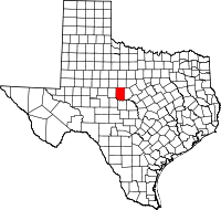 Location in the U.S. state of Texas | |
 Texas's location in the U.S. | |
| Founded | 1864 |
| Seat | Coleman |
| Largest city | Coleman |
| Area | |
| • Total | 1,281 sq mi (3,318 km2) |
| • Land | 1,262 sq mi (3,269 km2) |
| • Water | 19 sq mi (49 km2), 1.5% |
| Population | |
| • (2010) | 8,895 |
| • Density | 7.0/sq mi (3/km²) |
| Congressional district | 11th |
| Time zone | Central: UTC-6/-5 |
| Website |
www |

Coleman County is a county located in the U.S. state of Texas. As of the 2010 census, its population was 8,895.[1] The county seat is Coleman.[2] The county was founded in 1858 and organized in 1864.[3] It is named for Robert M. Coleman, a signer of the Texas Declaration of Independence and soldier at the Battle of San Jacinto.
History
- 10000 b.c. – Indigenous peoples of the Americas are the first inhabitants. Later inhabitants are the Jumano, Lipan Apache and Comanche.[4]
- 1632 Father Salas leads an expedition to the upper Colorado.[4]
- 1650 Captains Hernán Martín and Diego del Castillo explore the western portion of the county to the Concho River and return with pearls.[4]
- 1654 Diego de Guadalajara follows the same path as Martín and Castillo.[4]
- 1683–84 Juan Domínguez de Mendoza establishes a short-lived mission.[5]
- 1855 The county’s oldest community of Trickham is founded as a cowboy trading post for the ranching activities of John Chisum.[6]
- 1858 Coleman County is formed from Brown and Travis counties. The county is named for Robert M. Coleman, a signer of the Texas Declaration of Independence.[4]
- 1861 Rich Coffey settles the communities of Leaday and Voss.[7]
- 1876 Site is chosen for Coleman.[8]
- 1879 The community Santa Anna is established. It is named after the Santa Anna Mountains, which, in turn, are named after Comanche Chief Santana.[9]
- 1908 The first oil well comes in near Trickham.[10]
- 1917 Oil is discovered north of Coleman on the J. P. Morris ranch.[4]
- 1923 Coleman County Medical Center opens.[4]
- 1925 Tenant farmers are 63 percent of local agriculture.[4]
- 1930 Coleman County population peaks at 23,669[4]
- 1948 The oilfields produce over a million barrels a year.[4]
- 2000 Wind Clean Corporation, harnessing energy from wind power, is founded.[4]
Geography
According to the U.S. Census Bureau, the county has a total area of 1,281 square miles (3,320 km2), of which 1,262 square miles (3,270 km2) is land and 19 square miles (49 km2) (1.5%) is water.[11]
Major highways
Adjacent counties
- Callahan County (north)
- Brown County (east)
- McCulloch County (south)
- Concho County (southwest)
- Runnels County (west)
- Taylor County (northwest)
Demographics
| Historical population | |||
|---|---|---|---|
| Census | Pop. | %± | |
| 1870 | 347 | — | |
| 1880 | 3,603 | 938.3% | |
| 1890 | 6,112 | 69.6% | |
| 1900 | 10,077 | 64.9% | |
| 1910 | 22,618 | 124.5% | |
| 1920 | 18,805 | −16.9% | |
| 1930 | 23,669 | 25.9% | |
| 1940 | 20,571 | −13.1% | |
| 1950 | 15,503 | −24.6% | |
| 1960 | 12,458 | −19.6% | |
| 1970 | 10,288 | −17.4% | |
| 1980 | 10,439 | 1.5% | |
| 1990 | 9,710 | −7.0% | |
| 2000 | 9,235 | −4.9% | |
| 2010 | 8,895 | −3.7% | |
| Est. 2015 | 8,338 | [12] | −6.3% |
| U.S. Decennial Census[13] 1850–2010[14] 2010–2014[1] | |||
As of the census[15] of 2000, there were 9,235 people, 3,889 households, and 2,609 families residing in the county. The population density was 7 people per square mile (3/km²). There were 5,248 housing units at an average density of 4 per square mile (2/km²). The racial makeup of the county was 88.53% White, 2.19% Black or African American, 0.62% Native American, 0.22% Asian, 0.01% Pacific Islander, 6.53% from other races, and 1.91% from two or more races. 13.96% of the population were Hispanic or Latino of any race.
There were 3,889 households out of which 27.20% had children under the age of 18 living with them, 53.80% were married couples living together, 9.30% had a female householder with no husband present, and 32.90% were non-families. 30.20% of all households were made up of individuals and 17.40% had someone living alone who was 65 years of age or older. The average household size was 2.33 and the average family size was 2.88.
In the county, the population was spread out with 23.60% under the age of 18, 6.60% from 18 to 24, 22.70% from 25 to 44, 24.00% from 45 to 64, and 23.00% who were 65 years of age or older. The median age was 43 years. For every 100 females there were 92.20 males. For every 100 females age 18 and over, there were 88.10 males.
The median income for a household in the county was $25,658, and the median income for a family was $31,168. Males had a median income of $25,993 versus $17,378 for females. The per capita income for the county was $14,911. About 15.50% of families and 19.90% of the population were below the poverty line, including 27.40% of those under age 18 and 14.90% of those age 65 or over.
Education
The following school districts serve Coleman County:
- Bangs ISD (mostly in Brown County)
- Coleman ISD
- Cross Plains ISD (mostly in Callahan County; small portions in Eastland, Brown counties)
- Panther Creek Consolidated ISD (small portion in Runnels County)
- Santa Anna ISD
Communities
Cities
Town
Unincorporated communities
References
- 1 2 "State & County QuickFacts". United States Census Bureau. Retrieved December 9, 2013.
- ↑ "Find a County". National Association of Counties. Archived from the original on 2011-05-31. Retrieved 2011-06-07.
- ↑ "Texas: Individual County Chronologies". Texas Atlas of Historical County Boundaries. The Newberry Library. 2008. Retrieved May 21, 2015.
- 1 2 3 4 5 6 7 8 9 10 11 Tate, Rusty. "Coleman County". Handbook of Texas Online. Texas State Historical Association. Retrieved 29 November 2010.
- ↑ Hundell, Ken and Sharon (2005). Spirits of the Border V: The History and Mystery of the Lone Star State. Omega Press. p. 176. ISBN 978-0-9626087-9-7.
- ↑ "Trickham, Texas". Texas Escapes. Texas Escapes - Blueprints For Travel, LLC. Retrieved 29 November 2010.
- ↑ Lucko, Paul M. "Richard Coffey". Handbook of Texas Online. Texas State Historical Association. Retrieved 29 November 2010.
- ↑ "Coleman, Texas". Texas Escapes. Texas Escapes - Blueprints For Travel, LLC. Retrieved 29 November 2010.
- ↑ "Santa Anna, Texas". Texas Escapes. Texas Escapes - Blueprints For Travel, LLC. Retrieved 29 November 2010.
- ↑ Warner, C A; Thompson, Ernest O (2007). Texas Oil & Gas Since 1543. Copano Bay Press. p. 213. ISBN 978-0-9767799-5-7.
- ↑ "2010 Census Gazetteer Files". United States Census Bureau. August 22, 2012. Retrieved April 21, 2015.
- ↑ "County Totals Dataset: Population, Population Change and Estimated Components of Population Change: April 1, 2010 to July 1, 2015". Retrieved July 2, 2016.
- ↑ "U.S. Decennial Census". United States Census Bureau. Archived from the original on May 11, 2015. Retrieved April 21, 2015.
- ↑ "Texas Almanac: Population History of Counties from 1850–2010" (PDF). Texas Almanac. Retrieved April 21, 2015.
- ↑ "American FactFinder". United States Census Bureau. Archived from the original on 2013-09-11. Retrieved 2011-05-14.
External links
- Coleman County government's website
- Coleman County in Handbook of Texas Online at the University of Texas
- Historic Coleman County materials, hosted by the Portal to Texas History.
 |
Taylor County | Callahan County | | |
| Runnels County | |
Brown County | ||
| ||||
| | ||||
| Concho County | McCulloch County |
Municipalities and communities of Coleman County, Texas, United States | ||
|---|---|---|
| Cities | | |
| Town | ||
| Unincorporated communities | ||

Coordinates: 31°46′N 99°27′W / 31.77°N 99.45°W