Dallam County, Texas
| Dallam County, Texas | |
|---|---|
|
The Dallam County Courthouse in downtown Dalhart was constructed in 1922. | |
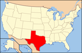
 Location in the U.S. state of Texas | |
 Texas's location in the U.S. | |
| Founded | 1891 |
| Seat | Dalhart |
| Largest city | Dalhart |
| Area | |
| • Total | 1,505 sq mi (3,898 km2) |
| • Land | 1,503 sq mi (3,893 km2) |
| • Water | 2.0 sq mi (5 km2), 0.1% |
| Population | |
| • (2010) | 6,703 |
| • Density | 4.5/sq mi (2/km²) |
| Time zone | Central: UTC-6/-5 |
| Website |
www |

Dallam County is a county located in the northwestern corner of the U.S. state of Texas. As of the 2010 census, its population was 6,703.[1] Its county seat is Dalhart.[2] The county was founded in 1876 and later organized in 1891.[3] It is named for James Wilmer Dallam, a lawyer and newspaper publisher.
Dallam is the northernmost of the ten Texas counties that from 1885–1912 constituted the legendary XIT Ranch. The ranch is still celebrated through the XIT Museum in Dalhart and the annual XIT Rodeo and Reunion held the first long weekend in August.
History
Dallam County was formed in 1876 from portions of Bexar County. It was named after James Wilmer Dallam, the lawyer who made the first digest of Texas laws.[4] The first settlement in the area followed in 1870, which resulted in the Red River War of 1874 and 1875 with the native Comanche and Kiowa tribes. In 1900-01, the Chicago, Rock Island and Pacific Railroad company built a stretch from Enid, Oklahoma to Tucumcari, New Mexico, which ran through the county. The location where the tracks met those of the Fort Worth and Denver Railway was named Dalhart. The name is taken from the first letters of Dallam County and Hartley County, between which the town's area is divided. Within a short time, the small railroad stop turned into a sizable town and was named county seat in 1903.
Dallam County was one of the hardest hit areas in the Dust Bowl.[5]

Geography
According to the U.S. Census Bureau, the county has a total area of 1,505 square miles (3,900 km2), of which 1,503 square miles (3,890 km2) is land and 2.0 square miles (5.2 km2) (0.1%) is water.[6]
Major Highways
Adjacent counties
- Cimarron County, Oklahoma (north)
- Sherman County (east)
- Hartley County (south)
- Union County, New Mexico (west)
- Moore County (southeast)
National protected area
Demographics
| Historical population | |||
|---|---|---|---|
| Census | Pop. | %± | |
| 1890 | 112 | — | |
| 1900 | 146 | 30.4% | |
| 1910 | 4,001 | 2,640.4% | |
| 1920 | 4,528 | 13.2% | |
| 1930 | 7,830 | 72.9% | |
| 1940 | 6,494 | −17.1% | |
| 1950 | 7,640 | 17.6% | |
| 1960 | 6,302 | −17.5% | |
| 1970 | 6,012 | −4.6% | |
| 1980 | 6,531 | 8.6% | |
| 1990 | 5,461 | −16.4% | |
| 2000 | 6,222 | 13.9% | |
| 2010 | 6,703 | 7.7% | |
| Est. 2015 | 7,121 | [7] | 6.2% |
| U.S. Decennial Census[8] 1850–2010[9] 2010–2014[1] | |||
As of the census[10] of 2000, there were 6,222 people, 2,317 households, and 1,628 families residing in the county. The population density was 4 people per square mile (2/km²). There were 2,697 housing units at an average density of 2 per square mile (1/km²). The racial makeup of the county was 82.64% White, 1.64% Black or African American, 0.90% Native American, 0.21% Asian, 12.41% from other races, and 2.20% from two or more races. 28.38% of the population were Hispanic or Latino of any race.
There were 2,317 households out of which 39.00% had children under the age of 18 living with them, 55.10% were married couples living together, 9.70% had a female householder with no husband present, and 29.70% were non-families. 26.20% of all households were made up of individuals and 10.00% had someone living alone who was 65 years of age or older. The average household size was 2.68 and the average family size was 3.24.
In the county, the population was spread out with 31.80% under the age of 18, 8.60% from 18 to 24, 28.80% from 25 to 44, 20.60% from 45 to 64, and 10.30% who were 65 years of age or older. The median age was 31 years. For every 100 females there were 102.00 males. For every 100 females age 18 and over, there were 101.30 males.
The median income for a household in the county was $27,946, and the median income for a family was $33,558. Males had a median income of $27,244 versus $19,000 for females. The per capita income for the county was $13,653. About 11.30% of families and 14.10% of the population were below the poverty line, including 15.40% of those under age 18 and 24.80% of those age 65 or over.
Politics
Dallam County is located within District 86 of the Texas House of Representatives. The seat has been held by Amarillo attorney John T. Smithee, a Republican, since 1985. Dallam County as a whole is heavily Republican in orientation.
Education
The following school districts serve Dallam County:
- Dalhart Independent School District
- Stratford Independent School District
- Texline Independent School District
Communities
City
- Dalhart (county seat) (partly in Hartley County)
Towns
Unincorporated community
Ghost Town
See also
- List of museums in the Texas Panhandle
- National Register of Historic Places listings in Dallam County, Texas
References
- 1 2 "State & County QuickFacts". United States Census Bureau. Retrieved December 10, 2013.
- ↑ "Find a County". National Association of Counties. Archived from the original on May 31, 2011. Retrieved 2011-06-07.
- ↑ "Texas: Individual County Chronologies". Texas Atlas of Historical County Boundaries. The Newberry Library. 2008. Retrieved May 21, 2015.
- ↑ Gannett, Henry (1905). The Origin of Certain Place Names in the United States. Govt. Print. Off. p. 99.
- ↑ Laskin, David (December 17, 2005). "Laying Bare Dust Bowl's Scar Tissue". The New York Times. Retrieved 17 January 2014.
- ↑ "2010 Census Gazetteer Files". United States Census Bureau. August 22, 2012. Retrieved April 22, 2015.
- ↑ "County Totals Dataset: Population, Population Change and Estimated Components of Population Change: April 1, 2010 to July 1, 2015". Retrieved July 2, 2016.
- ↑ "U.S. Decennial Census". United States Census Bureau. Archived from the original on May 11, 2015. Retrieved April 22, 2015.
- ↑ "Texas Almanac: Population History of Counties from 1850–2010" (PDF). Texas Almanac. Retrieved April 22, 2015.
- ↑ "American FactFinder". United States Census Bureau. Archived from the original on September 11, 2013. Retrieved 2011-05-14.
External links
| Wikimedia Commons has media related to Dallam County, Texas. |
- Dallam County commissioners’ website
- Dallam County in Handbook of Texas Online at the University of Texas
- Dallam County Profile from the Texas Association of Counties
- The XIT Ranch claims to have been the largest range in the world "under fence"
 |
Cimarron County, Oklahoma | | ||
| Union County, New Mexico | |
Sherman County | ||
| ||||
| | ||||
| Hartley County |
Municipalities and communities of Dallam County, Texas, United States | ||
|---|---|---|
| City | | |
| Town | ||
| Unincorporated communities | ||
| Ghost town | ||
| Footnotes | ‡This populated place also has portions in an adjacent county or counties | |

Coordinates: 36°17′N 102°35′W / 36.29°N 102.59°W