Leon County, Texas
| Leon County, Texas | |
|---|---|
|
The Leon County Courthouse in Centerville, originally built of slate brick in 1887. Two previous structures have occupied the current site. | |
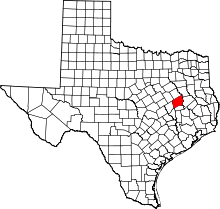 Location in the U.S. state of Texas | |
 Texas's location in the U.S. | |
| Founded | 1846 |
| Named for | Martín De León |
| Seat | Centerville |
| Largest city | Buffalo |
| Area | |
| • Total | 1,081 sq mi (2,800 km2) |
| • Land | 1,073 sq mi (2,779 km2) |
| • Water | 7.5 sq mi (19 km2), 0.7% |
| Population | |
| • (2010) | 16,801 |
| • Density | 16/sq mi (6/km²) |
| Congressional districts | 8th, 17th |
| Time zone | Central: UTC-6/-5 |
| Website |
www |


Leon County is a county located in the U.S. state of Texas. As of the 2010 census, its population was 16,801.[1] Its county seat is Centerville.[2]
History
The legislature of the Republic of Texas authorized Leon County in 1846 from part of Robertson County, and named it in honor of Martín De León, the founder of Victoria, Texas. However, local tradition holds that it is named for a yellow wolf of the region commonly called the león ("lion" in Spanish). The county was organized that same year with its first county seat at Leona. In 1851 the county seat was moved to Centerville since Leona was in the far southern part of the county.
The 1886 Leon County Courthouse was designed by architect George Edwin Dickey of Houston, incorporating remnants of an earlier 1858 courthouse that was destroyed by fire. The courthouse was rededicated on July 1, 2007 following a full restoration to a 1909 date.[3]
Geography
According to the U.S. Census Bureau, the county has a total area of 1,081 square miles (2,800 km2), of which 1,073 square miles (2,780 km2) is land and 7.5 square miles (19 km2) (0.7%) is water.[4]
Major highways
Additionally, State Highway OSR runs along the south and southwest county line of Leon County where it borders with Madison County.
Adjacent counties
- Freestone County (north)
- Anderson County (northeast)
- Houston County (east)
- Madison County (south)
- Robertson County (west)
- Limestone County (northwest)
Demographics
| Historical population | |||
|---|---|---|---|
| Census | Pop. | %± | |
| 1850 | 1,946 | — | |
| 1860 | 6,781 | 248.5% | |
| 1870 | 6,523 | −3.8% | |
| 1880 | 12,817 | 96.5% | |
| 1890 | 13,841 | 8.0% | |
| 1900 | 18,072 | 30.6% | |
| 1910 | 16,583 | −8.2% | |
| 1920 | 18,286 | 10.3% | |
| 1930 | 19,898 | 8.8% | |
| 1940 | 17,733 | −10.9% | |
| 1950 | 12,024 | −32.2% | |
| 1960 | 9,951 | −17.2% | |
| 1970 | 8,738 | −12.2% | |
| 1980 | 9,594 | 9.8% | |
| 1990 | 12,665 | 32.0% | |
| 2000 | 15,335 | 21.1% | |
| 2010 | 16,801 | 9.6% | |
| Est. 2015 | 17,086 | [5] | 1.7% |
| U.S. Decennial Census[6] 1850–2010[7] 2010–2014[1] | |||
As of the census[8] of 2000, there were 15,335 people, 6,189 households, and 4,511 families residing in the county. The population density was 14 people per square mile (6/km²). There were 8,299 housing units at an average density of 8 per square mile (3/km²). The racial makeup of the county was 83.53% White, 10.39% Black or African American, 0.34% Native American, 0.18% Asian, 0.01% Pacific Islander, 4.50% from other races, and 1.06% from two or more races. 7.91% of the population were Hispanic or Latino of any race.
There were 6,189 households out of which 28.20% had children under the age of 18 living with them, 60.20% were married couples living together, 9.20% had a female householder with no husband present, and 27.10% were non-families. 24.80% of all households were made up of individuals and 13.10% had someone living alone who was 65 years of age or older. The average household size was 2.46 and the average family size was 2.92.
In the county, the population was spread out with 24.30% under the age of 18, 6.70% from 18 to 24, 23.40% from 25 to 44, 25.60% from 45 to 64, and 20.00% who were 65 years of age or older. The median age was 42 years. For every 100 females there were 96.40 males. For every 100 females age 18 and over, there were 92.70 males.
The median income for a household in the county was $30,981, and the median income for a family was $38,029. Males had a median income of $32,036 versus $19,607 for females. The per capita income for the county was $17,599. About 12.60% of families and 15.60% of the population were below the poverty line, including 21.20% of those under age 18 and 14.30% of those age 65 or over.

Politics
Leon County is so heavily Republican that in 2014 none of the statewide GOP nominees fell below 87 percent of the votes cast. U.S. Representative Kevin Brady of Texas's 8th congressional district led the ticket with 97 percent of the ballots cast in Leon County.[9]
Communities
Cities and towns
- Buffalo
- Centerville (county seat)
- Jewett
- Leona
- Marquez
Towns
- Normangee
- Oakwood (small part in Freestone County)
Census-designated place
Unincorporated communities
Ghost towns
- Egypt
- Eunice
- Robbins
See also
References
- 1 2 "State & County QuickFacts". United States Census Bureau. Retrieved December 19, 2013.
- ↑ "Find a County". National Association of Counties. Retrieved 2011-06-07.
- ↑ Texas Historical Commission.
- ↑ "2010 Census Gazetteer Files". United States Census Bureau. August 22, 2012. Retrieved May 3, 2015.
- ↑ "County Totals Dataset: Population, Population Change and Estimated Components of Population Change: April 1, 2010 to July 1, 2015". Retrieved July 2, 2016.
- ↑ "U.S. Decennial Census". United States Census Bureau. Retrieved May 3, 2015.
- ↑ "Texas Almanac: Population History of Counties from 1850–2010" (PDF). Texas Almanac. Retrieved May 3, 2015.
- ↑ "American FactFinder". United States Census Bureau. Retrieved 2011-05-14.
- ↑ "2014 General Election, Leon County". Texas Secretary of State. Retrieved November 21, 2014.
External links
 |
Limestone County | Freestone County | Anderson County | |
| Robertson County | |
Houston County | ||
| ||||
| | ||||
| Madison County |
Municipalities and communities of Leon County, Texas, United States | ||
|---|---|---|
| Cities | | |
| Towns | ||
| CDP | ||
| Other unincorporated communities | ||
| Ghost town | ||
| Footnotes | ‡This populated place also has portions in an adjacent county or counties | |

Coordinates: 31°18′N 96°00′W / 31.30°N 96.00°W