Taylor County, Texas
| Taylor County, Texas | |
|---|---|
|
New Taylor County Courthouse in Abilene | |
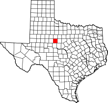 Location in the U.S. state of Texas | |
 Texas's location in the U.S. | |
| Founded | 1878 |
| Named for | Edward, George, and James Taylor, Asa Taylor (Alamo Defender) Asa |
| Seat | Abilene |
| Largest city | Abilene |
| Area | |
| • Total | 919 sq mi (2,380 km2) |
| • Land | 916 sq mi (2,372 km2) |
| • Water | 3.8 sq mi (10 km2), 0.4% |
| Population | |
| • (2010) | 131,506 |
| • Density | 144/sq mi (56/km²) |
| Congressional district | 19th |
| Time zone | Central: UTC-6/-5 |
| Website |
www |


Taylor County is a county located in the U.S. state of Texas. As of the 2010 census, its population was 131,506.[1] Its county seat is Abilene.[2] The county was created in 1858 and later organized in 1878.[3] It is named for Edward Taylor, George Taylor, and James Taylor, three brothers who died at the Battle of the Alamo.
Taylor County is included in the Abilene, TX Metropolitan Statistical Area, and is considered part of West Texas.
History
- Among first inhabitants were the Penteka.[4]
- 1849 Capt. Randolph Marcy, U. S. Army engineer passes through scouting out West Texas to California routes.[5]
- 1858 The Texas legislature establishes Taylor County from Bexar and Travis counties. The county is named for Alamo defenders Edward, James, and George Taylor. Butterfield Overland Mail establishes the Mountain Pass Station at Merkel, in continual use until 1861.[4]
- 1872 First cattlemen venture into present Taylor County.[4]
- 1878 Taylor County is organized. Buffalo Gap is named county seat.[4][6]
- 1880 Texas & Pacific Railroad signs an agreement to run tracks through the future city of Abilene.[5]
- 1881 Abilene is established and named after Abilene, Kansas.[7]
- 1883 Abilene becomes the county seat.[7] Wagon train of ten Baptist families arrives in the county.[4]
- 1890 Abilene Board of Trade is organized.There are 587 farms and ranches in the county.[4]
- 1891 Hardin-Simmons University is established as Abilene Baptist College by the Sweetwater Baptist Association.[8]
- 1897 Lytle Lake is created.[4]
- 1904 State Epileptic Colony opens in Abilene.[9]
- 1906 Abilene Christian University opens its doors as Childers Classical Institute.[10]
- 1924 Hendricks Medical Center opens in Abilene as West Texas Baptist Sanitarium. West Texas Historical Association is chartered in Abilene.[4]
- 1926 The first senior class of McMurry University graduates.[11]
- 1929 Oil is discovered in the county.[12]
- 1933 Abilene donates land for use by the Civilian Conservation Corps.[13]
- 1942 Dyess Air Force Base is established as Abilene AFB. It is named in honor of Texas native and Bataan Death March survivor Lieutenant Colonel William Dyess.[14]
- 1950 The Abilene Philharmonic Orchestra is created, with Jay Dietzer as the first conductor.[4]
- 1956 Buffalo Gap Historic Village opens.[15]
- 1998 The Ranch Horse Association of America is formed in Abilene.[16]
Geography
According to the U.S. Census Bureau, the county has a total area of 919 square miles (2,380 km2), of which 916 square miles (2,370 km2) is land and 3.8 square miles (9.8 km2) (0.4%) is water.[17]
Major highways
.svg.png) Interstate 20
Interstate 20 Interstate 20 Business
 U.S. Highway 83
 U.S. Highway 84
 U.S. Highway 277
 State Highway 36
 State Highway 153
 State Highway 351
 Loop 322
Adjacent counties
- Jones County (north)
- Shackelford County (northeast)
- Callahan County (east)
- Coleman County (southeast)
- Runnels County (south)
- Nolan County (west)
- Mitchell County (northwest)
Demographics
| Historical population | |||
|---|---|---|---|
| Census | Pop. | %± | |
| 1880 | 1,736 | — | |
| 1890 | 6,957 | 300.7% | |
| 1900 | 10,499 | 50.9% | |
| 1910 | 26,293 | 150.4% | |
| 1920 | 24,081 | −8.4% | |
| 1930 | 41,023 | 70.4% | |
| 1940 | 44,147 | 7.6% | |
| 1950 | 63,370 | 43.5% | |
| 1960 | 101,078 | 59.5% | |
| 1970 | 97,853 | −3.2% | |
| 1980 | 110,932 | 13.4% | |
| 1990 | 119,655 | 7.9% | |
| 2000 | 126,555 | 5.8% | |
| 2010 | 131,506 | 3.9% | |
| Est. 2015 | 136,051 | [18] | 3.5% |
| U.S. Decennial Census[19] 1850–2010[20] 2010–2014[1] | |||
As of the census[21] of 2000, there were 126,555 people, 47,274 households, and 32,524 families residing in the county. The population density was 138 people per square mile (53/km²). There were 52,056 housing units at an average density of 57 per square mile (22/km²). The racial makeup of the county was 80.61% White, 6.73% Black or African American, 0.58% Native American, 1.25% Asian, 0.07% Pacific Islander, 8.35% from other races, and 2.42% from two or more races. 17.64% of the population were Hispanic or Latino of any race.
There were 47,274 households out of which 34.70% had children under the age of 18 living with them, 53.80% were married couples living together, 11.50% had a female householder with no husband present, and 31.20% were non-families. 25.70% of all households were made up of individuals and 9.70% had someone living alone who was 65 years of age or older. The average household size was 2.54 and the average family size was 3.07.
In the county, the population was spread out with 26.60% under the age of 18, 13.80% from 18 to 24, 27.80% from 25 to 44, 19.30% from 45 to 64, and 12.40% who were 65 years of age or older. The median age was 32 years. For every 100 females there were 94.10 males. For every 100 females age 18 and over, there were 91.10 males.
The median income for a household in the county was $34,035, and the median income for a family was $40,859. Males had a median income of $28,964 versus $21,021 for females. The per capita income for the county was $17,176. About 10.40% of families and 14.50% of the population were below the poverty line, including 17.60% of those under age 18 and 9.20% of those age 65 or over.
Communities
Cities
- Abilene (county seat) (small part in Jones County)
- Tuscola
- Tye
Towns
Census-designated place
Unincorporated communities
See also
- Abilene State Park, recreational facility
- Horse Hollow Wind Energy Center, the world's largest wind farm
- Gary D. McCaleb, former mayor of Abilene
- List of museums in West Texas
- National Register of Historic Places listings in Taylor County, Texas
- Charles Perry, incoming 2011 member of the Texas House of Representatives from Lubbock, was born in Taylor County in 1962.
References
- 1 2 "State & County QuickFacts". United States Census Bureau. Retrieved December 26, 2013.
- ↑ "Find a County". National Association of Counties. Retrieved 2011-06-07.
- ↑ "Texas: Individual County Chronologies". Texas Atlas of Historical County Boundaries. The Newberry Library. 2008. Retrieved May 27, 2015.
- 1 2 3 4 5 6 7 8 9 Leffler, John. "Taylor County, Texas". Handbook of Texas Online. Texas State Historical Association. Retrieved 29 November 2010.
- 1 2 Hundell, Ken and Sharon (2005). Spirits of the Border V: The History and Mystery of the Lone Star State. Omega Press. pp. 118–119. ISBN 978-0-9626087-9-7.
- ↑ "Buffalo Gap, Texas". Texas Escapes. Texas Escapes - Blueprints For Travel, LLC. Retrieved 29 November 2010.
- 1 2 "Abilene, Texas". Texas Escapes. Texas Escapes - Blueprints For Travel, LLC. Retrieved 29 November 2010.
- ↑ Early Jr, Joseph E; McBeth, Harry Leon (2004). A Texas Baptist History Sourcebook: A Companion to McBeth's Texas Baptists. University of North Texas Press. p. 139. ISBN 978-1-57441-176-8.
- ↑ "Epileptic Colony Open". The journal of the American Medical Association. American Medical Association. 41: 973. 1903.
- ↑ Foster, Douglas A; Blowers, Paul M; Dunnavant, Anthony L; Williams, D Newell (2005). The Encyclopedia of the Stone-Campbell Movement. Wm. B. Eerdmans Publishing Company. p. 1. ISBN 978-0-8028-3898-8.
- ↑ Downs, Fane. "McMurry University". Handbook of Texas Online. Texas State Historical Association. Retrieved 30 November 2010.
- ↑ Warner, C A; Thompson, Ernest O (2007). Texas Oil & Gas Since 1543. Copano Bay Press. p. 227. ISBN 978-0-9767799-5-7.
- ↑ Ebeling, Walter (1990). Fruited Plain: The Story of American Agriculture. University of California Press. p. 249. ISBN 978-0-520-03751-9.
- ↑ Leatherwood, Art. "Dyess Air Force Base". Handbook of Texas Online. Texas State Historical Association. Retrieved 30 November 2010.
- ↑ Aston, B W; Taylor, Ira Donathon (1997). Along the Texas Forts Trail. University of North Texas Press. p. 49. ISBN 978-1-57441-035-8.
- ↑ Sellers, Laren (2005). Training and Showing the Versatility Ranch Horse. The Lyons Press. p. 114. ISBN 978-1-59228-555-6.
- ↑ "2010 Census Gazetteer Files". United States Census Bureau. August 22, 2012. Retrieved May 11, 2015.
- ↑ "County Totals Dataset: Population, Population Change and Estimated Components of Population Change: April 1, 2010 to July 1, 2015". Retrieved July 2, 2016.
- ↑ "U.S. Decennial Census". United States Census Bureau. Retrieved May 11, 2015.
- ↑ "Texas Almanac: Population History of Counties from 1850–2010" (PDF). Texas Almanac. Retrieved May 11, 2015.
- ↑ "American FactFinder". United States Census Bureau. Retrieved 2011-05-14.
External links
- Taylor County Official Site
- Central Appraisal District of Taylor County
- Taylor County from the Handbook of Texas Online
- Taylor at DMOZ
Further reading
- Zachry, Juanita Daniel A History of Rural Taylor County Nortex Press, 1980. ISBN 089015239X.
 |
Jones County | | ||
| Nolan County | |
Callahan County | ||
| ||||
| | ||||
| Runnels County | Coleman County |
Municipalities and communities of Taylor County, Texas, United States | ||
|---|---|---|
| Cities | | |
| Towns | ||
| CDP | ||
| Unincorporated communities | ||
| Footnotes | ‡This populated place also has portions in an adjacent county or counties | |

Coordinates: 32°19′N 99°53′W / 32.31°N 99.88°W