Irion County, Texas
| Irion County, Texas | |
|---|---|
|
The Irion County Courthouse in Mertzon | |
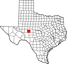 Location in the U.S. state of Texas | |
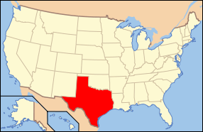 Texas's location in the U.S. | |
| Founded | 1889 |
| Named for | Robert Anderson Irion |
| Seat | Mertzon |
| Largest city | Mertzon |
| Area | |
| • Total | 1,052 sq mi (2,725 km2) |
| • Land | 1,052 sq mi (2,725 km2) |
| • Water | 0.07 sq mi (0 km2), 0.01% |
| Population | |
| • (2010) | 1,599 |
| • Density | 1.5/sq mi (1/km²) |
| Congressional district | 11th |
| Time zone | Central: UTC-6/-5 |
| Website |
www |

Irion County (/ˈaɪəri.ən/ IRE-ee-ən) is a county located on the Edwards Plateau in the U.S. state of Texas. As of the 2010 census, its population was 1,599.[1] Its county seat is Mertzon.[2] The county is named for Robert Anderson Irion, a secretary of state of the Republic of Texas.
Irion County is included in the San Angelo, TX Metropolitan Statistical Area.
History
- First inhabitants Tonkawa and Kickapoo.[3]
- 1650 Captains Hernán Martín and Diego del Castillo explore the region.[4]
- 1684 Juan Domínguez de Mendoza and Nicolás López report on local Indians.[3]
- 1761 Spanish soldier Felipe Rábago y Terán passes through the area.[5]
- 1858 -1861 Butterfield Overland Mail crosses the region.[3]
- 1876 John Arden brings the first flock of sheep from California. Billy Childress establishes the longhorn 7D Ranch.[6]
- 1889 The Texas legislature forms Irion County from Tom Green County. Sherwood becomes the county seat.[7]
- 1928 Oil is discovered in Irion County.[8]
- 1936 Mertzon becomes county seat.[9]
Geography
According to the U.S. Census Bureau, the county has a total area of 1,052 square miles (2,720 km2), of which 1,052 square miles (2,720 km2) is land and 0.07 square miles (0.18 km2) (0.01%) is water.[10] The Spraberry Trend, the third-largest oil field in the United States by remaining reserves, underlies much of the county.[11]
Major Highways
Adjacent counties
- Tom Green County (north and east)
- Schleicher County (southeast)
- Crockett County (southwest)
- Reagan County (west)
Demographics
| Historical population | |||
|---|---|---|---|
| Census | Pop. | %± | |
| 1890 | 870 | — | |
| 1900 | 848 | −2.5% | |
| 1910 | 1,283 | 51.3% | |
| 1920 | 1,610 | 25.5% | |
| 1930 | 2,049 | 27.3% | |
| 1940 | 1,963 | −4.2% | |
| 1950 | 1,590 | −19.0% | |
| 1960 | 1,183 | −25.6% | |
| 1970 | 1,070 | −9.6% | |
| 1980 | 1,386 | 29.5% | |
| 1990 | 1,629 | 17.5% | |
| 2000 | 1,771 | 8.7% | |
| 2010 | 1,599 | −9.7% | |
| Est. 2015 | 1,554 | [12] | −2.8% |
| U.S. Decennial Census[13] 1850–2010[14] 2010–2014[1] | |||
As of the census[15] of 2000, there were 1,771 people, 694 households, and 523 families residing in the county. The population density was 2 people per square mile (1/km²). There were 914 housing units at an average density of 1 per square mile (0/km²). The racial makeup of the county was 90.68% White, 0.40% Black or African American, 0.79% Native American, 6.55% from other races, and 1.58% from two or more races. 24.62% of the population were Hispanic or Latino of any race.
There were 694 households out of which 32.40% had children under the age of 18 living with them, 64.80% were married couples living together, 6.60% had a female householder with no husband present, and 24.50% were non-families. 21.80% of all households were made up of individuals and 11.20% had someone living alone who was 65 years of age or older. The average household size was 2.55 and the average family size was 2.97.
In the county, the population was spread out with 26.70% under the age of 18, 4.70% from 18 to 24, 26.90% from 25 to 44, 26.10% from 45 to 64, and 15.60% who were 65 years of age or older. The median age was 40 years. For every 100 females there were 100.30 males. For every 100 females age 18 and over, there were 99.40 males.
The median income for a household in the county was $37,500, and the median income for a family was $45,458. Males had a median income of $35,642 versus $20,395 for females. The per capita income for the county was $20,515. About 8.30% of families and 8.40% of the population were below the poverty line, including 7.20% of those under age 18 and 7.90% of those age 65 or over.
Communities
City
- Mertzon (county seat)
Unincorporated community
Ghost Town
Notable natives
- Laura Bullion, female Old West outlaw, born in Knickerbocker.[16]
See also
References
- 1 2 "State & County QuickFacts". United States Census Bureau. Retrieved December 17, 2013.
- ↑ "Find a County". National Association of Counties. Retrieved 2011-06-07.
- 1 2 3 Hunt, William R; Leffler, John. "Irion County". Handbook of Texas Online. Texas State Historical Association. Retrieved 29 November 2010.
- ↑ Morris, John Miller (2003). El Llano Estacado: Exploration and Imagination on the High Plains of Texas and New Mexico, 1536-1860. Texas State Historical Assn. p. 146. ISBN 978-0-87611-195-6.
- ↑ Chipman, Donald E; Joseph, Hariett Denise (1999). "Felipe Rábago y Terán Sinful Captain". Notable Men and Women of Spanish Texas. University of Texas Press. pp. 103–123. ISBN 978-0-292-71218-8.
- ↑ Lanning, James and Judy (1995). Texas Cowboys: Memories of the Early Days. TAMU Press. p. 57. ISBN 978-0-89096-658-7.
- ↑ "Sherwood, Texas". Texas Escapes. Texas Escapes - Blueprints For Travel, LLC. Retrieved 29 November 2010.
- ↑ Warner, C A; Thompson, Ernest O (2007). Texas Oil & Gas Since 1543. Copano Bay Press. p. 299. ISBN 978-0-9767799-5-7.
- ↑ "Mertzon, Texas". Texas Escapes. Texas Escapes - Blueprints For Travel, LLC. Retrieved 29 November 2010.
- ↑ "2010 Census Gazetteer Files". United States Census Bureau. August 22, 2012. Retrieved April 30, 2015.
- ↑ Top 100 Oil and Gas Fields
- ↑ "County Totals Dataset: Population, Population Change and Estimated Components of Population Change: April 1, 2010 to July 1, 2015". Retrieved July 2, 2016.
- ↑ "U.S. Decennial Census". United States Census Bureau. Retrieved April 30, 2015.
- ↑ "Texas Almanac: Population History of Counties from 1850–2010" (PDF). Texas Almanac. Retrieved April 30, 2015.
- ↑ "American FactFinder". United States Census Bureau. Retrieved 2011-05-14.
- ↑ Magness, Perre, Cohort of Butch, Sundance 'retired' here, Commercial Appeal, Memphis, Jan. 12, 1995, page EC2
External links
- Irion County government website
- Irion County from the Handbook of Texas Online
- Inventory of county records, Irion County courthouse, Mertzon, Texas, hosted by the Portal to Texas History
- Irion County Profile from the Texas Association of Counties
 |
Tom Green County | | ||
| Reagan County | |
Tom Green County | ||
| ||||
| | ||||
| Crockett County | Schleicher County |
Municipalities and communities of Irion County, Texas, United States | ||
|---|---|---|
| City | | |
| Unincorporated communities | ||
| Ghost Town | ||

Coordinates: 31°18′N 100°59′W / 31.30°N 100.98°W