Real County, Texas
| Real County, Texas | |
|---|---|
|
The Real County Courthouse in Leakey, built in 1918 from local limestone, and renovated in 1978 | |
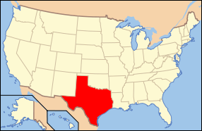
 Location in the U.S. state of Texas | |
 Texas's location in the U.S. | |
| Founded | 1913 |
| Seat | Leakey |
| Largest city | Camp Wood |
| Area | |
| • Total | 700 sq mi (1,813 km2) |
| • Land | 699 sq mi (1,810 km2) |
| • Water | 0.9 sq mi (2 km2), 0.1% |
| Population | |
| • (2010) | 3,309 |
| • Density | 4.7/sq mi (2/km²) |
| Congressional district | 21st |
| Time zone | Central: UTC-6/-5 |
| Website |
www |


Real County (/ˈriː.ɔːl/ REE-awl) is a county located on the Edwards Plateau in the U.S. state of Texas. As of the 2010 census, its population was 3,309.[1] The county seat is Leakey.[2] The county is named for Julius Real (1860–1944), a former member of the Texas State Senate.
The Alto Frio Baptist Encampment is located in an isolated area of Real County southeast of Leakey.
History
- 1762-1771 Looking for protection from Comanches, Lipan Apache chief El Gran Cabezón persuades Franciscans and the Spanish military to establish San Lorenzo de la Santa Cruz Mission on the Nueces River. The mission was abandoned in 1771[3]
- 1856 John and Nancy Leakey settle in Frio Canyon.[4]
- 1857 The original Camp Wood is established on the Nueces River near the site of the former San Lorenzo mission.[5]
- 1864 Lipan Apaches attack the family of George Schwander in the abandoned ruins of the San Lorenzo mission.[6]
- 1868 Theophilus Watkins, F. Smith and Newman Patterson construct a gravity flow irrigation canal from the Frio River that operates for a century.[7][8]
- 1879 Indians attack and kill Jennie Coalson, wife of Nic Coalson, and two children at Half Moon Prairie.[9]
- 1881 Lipan Apaches strike the McLauren home at Buzzard's Roost in the Frio Canyon. Last Indian raid in southwest Texas.[10]
- 1910 Crop farming declines in the county, livestock ranching gains prominence, in particular angora goats.[9]
- 1913 On April 3,[11] the Texas state legislature establishes Real County from parts of Edwards, Bandera, and Kerr counties. Leakey is the county seat.[9]
- 1920 Camp Wood township is founded and becomes a railroad terminus to transport heart cedar.[12]
- 1924 Charles A. Lindbergh lands in Real County.[13][14]
- 1948 Farm Road 337 is completed.[9][15]
Geography
According to the U.S. Census Bureau, the county has a total area of 700 square miles (1,800 km2), of which 699 square miles (1,810 km2) is land and 0.9 square miles (2.3 km2) (0.1%) is water.[16]
Major highways
Adjacent counties
- Edwards County (west)
- Kerr County (northeast)
- Bandera County (east)
- Uvalde County (south)
Demographics
| Historical population | |||
|---|---|---|---|
| Census | Pop. | %± | |
| 1920 | 1,461 | — | |
| 1930 | 2,197 | 50.4% | |
| 1940 | 2,420 | 10.2% | |
| 1950 | 2,479 | 2.4% | |
| 1960 | 2,079 | −16.1% | |
| 1970 | 2,013 | −3.2% | |
| 1980 | 2,469 | 22.7% | |
| 1990 | 2,412 | −2.3% | |
| 2000 | 3,047 | 26.3% | |
| 2010 | 3,309 | 8.6% | |
| Est. 2015 | 3,307 | [17] | −0.1% |
| U.S. Decennial Census[18] 1850–2010[19] 2010–2014[1] | |||
As of the census[20] of 2000, 3,047 people, 1,245 households, and 869 families resided in the county. The population density was 4/mi2 (2/km²). The 2,007 housing units averaged 3/mi2 (1/km²). The racial makeup of the county was 91.40% White, 0.20% Black or African American, 0.62% Native American, 0.20% Asian, 0.03% Pacific Islander, 6.01% from other races, and 1.54% from two or more races. Hispanics or Latinos of any race were about 22.58% of the population.
Of the 1,245 households, 26.50% had children under the age of 18 living with them, 58.40% were married couples living together, 7.60% had a female householder with no husband present, and 30.20% were not families. About 28.20% of all households were made up of individuals and 14.80% had someone living alone who was 65 years of age or older. The average household size was 2.38 and the average family size was 2.88.
In the county, the population was distributed as 23.40% under the age of 18, 5.40% from 18 to 24, 21.50% from 25 to 44, 28.80% from 45 to 64, and 20.80% who were 65 years of age or older. The median age was 45 years. For every 100 females, there were 97.90 males. For every 100 females age 18 and over, there were 95.70 males.
The median income for a household in the county was $25,118, and for a family was $29,839. Males had a median income of $21,076 versus $18,352 for females. The per capita income for the county was $14,321. About 17.40% of families and 21.20% of the population were below the poverty line, including 30.60% of those under age 18 and 15.00% of those age 65 or over.
Communities
Cities
Unincorporated communities
See also
- List of museums in Central Texas
- National Register of Historic Places listings in Real County, Texas
References
- 1 2 "State & County QuickFacts". United States Census Bureau. Retrieved December 23, 2013.
- ↑ "Find a County". National Association of Counties. Retrieved 2011-06-07.
- ↑ Chipman, Donald E. "San Lorenzo de la Santa Cruz Mission". Handbook of Texas Online. Texas State Historical Association. Retrieved 16 December 2010.
- ↑ "John Leakey". Texas State Historical Markers. William Nienke, Sam Morrow. Retrieved 16 December 2010.
- ↑ Minton, John. "Original Camp Wood". Handbook of Texas Online. Texas State Historical Association. Retrieved 16 December 2010.
- ↑ Michno, Gregory and Susan (2007). A Fate Worse Than Death: Indian Captivities in the West 1830-1885. Caxton Press. p. 253. ISBN 978-0-87004-451-9.
- ↑ Lewis, Sallie. "Theophilus Watkins". Handbook of Texas Online. Texas State Historical Association. Retrieved 16 December 2010.
- ↑ Minton, John. "Rio Frio, Texas". Handbook of Texas Online. Texas State Historical Association. Retrieved 16 December 2010.
- 1 2 3 4 Minton, John. "Real County, Texas". Handbook of Texas Online. Texas State Historical Association. Retrieved 16 December 2010.
- ↑ "Site of McLauren Massacre - Leakey, Real County, Texas". Texas State Historical Markers. William Nienke, Sam Morrow. Retrieved 16 December 2010.
- ↑ "The Formation of Real County"
- ↑ Minton, John. "Camp Wood Township". Handbook of Texas Online. Texas State Historical Association. Retrieved 16 December 2010.
- ↑ Cox, Mike. "Lindbergh". Texas Escapes. Texas Escapes - Blueprints For Travel, LLC. Retrieved 16 December 2010.
- ↑ "Charles A. Lindbergh in Texas - Camp Wood, Real County, Texas". Texas State Historical Markers. William Nienke, Sam Morrow. Retrieved 16 December 2010.
- ↑ "FM337". Texas Escapes. Texas Escapes - Blueprints For Travel, LLC. Retrieved 16 December 2010.
- ↑ "2010 Census Gazetteer Files". United States Census Bureau. August 22, 2012. Retrieved May 9, 2015.
- ↑ "County Totals Dataset: Population, Population Change and Estimated Components of Population Change: April 1, 2010 to July 1, 2015". Retrieved July 2, 2016.
- ↑ "U.S. Decennial Census". United States Census Bureau. Retrieved May 9, 2015.
- ↑ "Texas Almanac: Population History of Counties from 1850–2010" (PDF). Texas Almanac. Retrieved May 9, 2015.
- ↑ "American FactFinder". United States Census Bureau. Retrieved 2011-05-14.
External links
| Wikimedia Commons has media related to Real County, Texas. |
 |
Edwards County | Kerr County | | |
| Edwards County | |
Bandera County | ||
| ||||
| | ||||
| Uvalde County |
Municipalities and communities of Real County, Texas, United States | ||
|---|---|---|
| Cities | | |
| Unincorporated community | ||

Coordinates: 29°50′N 99°49′W / 29.84°N 99.81°W