Mazerolles, Charente
| Mazerolles | |
|---|---|
|
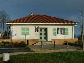
Town hall | |
 Mazerolles | |
|
Location within Nouvelle-Aquitaine region  Mazerolles | |
| Coordinates: 45°44′54″N 0°32′05″E / 45.7483°N 0.5347°ECoordinates: 45°44′54″N 0°32′05″E / 45.7483°N 0.5347°E | |
| Country | France |
| Region | Nouvelle-Aquitaine |
| Department | Charente |
| Arrondissement | Confolens |
| Canton | Montembœuf |
| Intercommunality | Haute-Charente |
| Government | |
| • Mayor (2008–2014) | Michel Coq |
| Area1 | 17.45 km2 (6.74 sq mi) |
| Population (2008)2 | 328 |
| • Density | 19/km2 (49/sq mi) |
| Time zone | CET (UTC+1) |
| • Summer (DST) | CEST (UTC+2) |
| INSEE/Postal code | 16213 / 16310 |
| Elevation |
207–353 m (679–1,158 ft) (avg. 345 m or 1,132 ft) |
|
1 French Land Register data, which excludes lakes, ponds, glaciers > 1 km² (0.386 sq mi or 247 acres) and river estuaries. 2 Population without double counting: residents of multiple communes (e.g., students and military personnel) only counted once. | |
Mazerolles is a commune in the Charente department in southwestern France.
Population
| Historical population | ||
|---|---|---|
| Year | Pop. | ±% |
| 1793 | 762 | — |
| 1800 | 925 | +21.4% |
| 1806 | 757 | −18.2% |
| 1821 | 785 | +3.7% |
| 1831 | 999 | +27.3% |
| 1841 | 971 | −2.8% |
| 1846 | 1,004 | +3.4% |
| 1851 | 967 | −3.7% |
| 1856 | 945 | −2.3% |
| 1861 | 915 | −3.2% |
| 1866 | 945 | +3.3% |
| 1872 | 858 | −9.2% |
| 1876 | 864 | +0.7% |
| 1881 | 822 | −4.9% |
| 1886 | 901 | +9.6% |
| 1891 | 881 | −2.2% |
| 1896 | 809 | −8.2% |
| 1901 | 809 | +0.0% |
| 1906 | 784 | −3.1% |
| 1911 | 721 | −8.0% |
| 1921 | 622 | −13.7% |
| 1926 | 635 | +2.1% |
| 1931 | 602 | −5.2% |
| 1936 | 554 | −8.0% |
| 1946 | 496 | −10.5% |
| 1954 | 452 | −8.9% |
| 1962 | 442 | −2.2% |
| 1968 | 404 | −8.6% |
| 1975 | 331 | −18.1% |
| 1982 | 309 | −6.6% |
| 1990 | 309 | +0.0% |
| 1999 | 312 | +1.0% |
| 2008 | 328 | +5.1% |
See also
References
| Wikimedia Commons has media related to Mazerolles (Charente). |
This article is issued from Wikipedia - version of the 7/20/2016. The text is available under the Creative Commons Attribution/Share Alike but additional terms may apply for the media files.