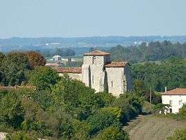
Sainte-Souline
| Sainte-Souline | |
|---|---|
 | |
 Sainte-Souline | |
|
Location within Nouvelle-Aquitaine region  Sainte-Souline | |
| Coordinates: 45°22′49″N 0°00′55″W / 45.3803°N 0.0153°WCoordinates: 45°22′49″N 0°00′55″W / 45.3803°N 0.0153°W | |
| Country | France |
| Region | Nouvelle-Aquitaine |
| Department | Charente |
| Arrondissement | Cognac |
| Canton | Brossac |
| Intercommunality | Sud-Charente |
| Government | |
| • Mayor (2008–2014) | Christian Gohin |
| Area1 | 7.32 km2 (2.83 sq mi) |
| Population (2008)2 | 126 |
| • Density | 17/km2 (45/sq mi) |
| Time zone | CET (UTC+1) |
| • Summer (DST) | CEST (UTC+2) |
| INSEE/Postal code | 16354 / 16480 |
| Elevation |
98–186 m (322–610 ft) (avg. 172 m or 564 ft) |
|
1 French Land Register data, which excludes lakes, ponds, glaciers > 1 km² (0.386 sq mi or 247 acres) and river estuaries. 2 Population without double counting: residents of multiple communes (e.g., students and military personnel) only counted once. | |
Sainte-Souline is a commune in the Charente department in southwestern France.
Population
| Historical population | ||
|---|---|---|
| Year | Pop. | ±% |
| 1793 | 414 | — |
| 1800 | 370 | −10.6% |
| 1806 | 372 | +0.5% |
| 1821 | 403 | +8.3% |
| 1831 | 365 | −9.4% |
| 1841 | 366 | +0.3% |
| 1846 | 360 | −1.6% |
| 1851 | 368 | +2.2% |
| 1856 | 360 | −2.2% |
| 1861 | 361 | +0.3% |
| 1866 | 360 | −0.3% |
| 1872 | 305 | −15.3% |
| 1876 | 324 | +6.2% |
| 1881 | 306 | −5.6% |
| 1886 | 280 | −8.5% |
| 1891 | 261 | −6.8% |
| 1896 | 252 | −3.4% |
| 1901 | 264 | +4.8% |
| 1906 | 261 | −1.1% |
| 1911 | 262 | +0.4% |
| 1921 | 238 | −9.2% |
| 1926 | 231 | −2.9% |
| 1931 | 232 | +0.4% |
| 1936 | 233 | +0.4% |
| 1946 | 190 | −18.5% |
| 1954 | 167 | −12.1% |
| 1962 | 190 | +13.8% |
| 1968 | 159 | −16.3% |
| 1975 | 112 | −29.6% |
| 1982 | 121 | +8.0% |
| 1990 | 104 | −14.0% |
| 1999 | 113 | +8.7% |
| 2008 | 126 | +11.5% |
See also
References
| Wikimedia Commons has media related to Sainte-Souline. |
This article is issued from Wikipedia - version of the 2/10/2016. The text is available under the Creative Commons Attribution/Share Alike but additional terms may apply for the media files.