Longré
| Longré | |
|---|---|
|
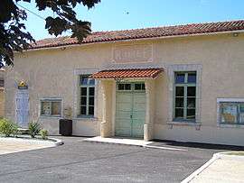
Town hall | |
 Longré | |
|
Location within Nouvelle-Aquitaine region  Longré | |
| Coordinates: 46°00′09″N 0°00′41″W / 46.0025°N 0.0114°WCoordinates: 46°00′09″N 0°00′41″W / 46.0025°N 0.0114°W | |
| Country | France |
| Region | Nouvelle-Aquitaine |
| Department | Charente |
| Arrondissement | Confolens |
| Canton | Villefagnan |
| Intercommunality | Pays de Villefagnan |
| Government | |
| • Mayor (2008–2014) | Jacky Papot |
| Area1 | 14.73 km2 (5.69 sq mi) |
| Population (2008)2 | 220 |
| • Density | 15/km2 (39/sq mi) |
| Time zone | CET (UTC+1) |
| • Summer (DST) | CEST (UTC+2) |
| INSEE/Postal code | 16190 / 16240 |
| Elevation |
73–131 m (240–430 ft) (avg. 83 m or 272 ft) |
|
1 French Land Register data, which excludes lakes, ponds, glaciers > 1 km² (0.386 sq mi or 247 acres) and river estuaries. 2 Population without double counting: residents of multiple communes (e.g., students and military personnel) only counted once. | |
Longré is a commune in the Charente department in southwestern France.
Population
| Historical population | ||
|---|---|---|
| Year | Pop. | ±% |
| 1793 | 482 | — |
| 1800 | 556 | +15.4% |
| 1806 | 661 | +18.9% |
| 1821 | 615 | −7.0% |
| 1831 | 720 | +17.1% |
| 1841 | 671 | −6.8% |
| 1846 | 642 | −4.3% |
| 1851 | 599 | −6.7% |
| 1856 | 686 | +14.5% |
| 1861 | 714 | +4.1% |
| 1866 | 645 | −9.7% |
| 1872 | 625 | −3.1% |
| 1876 | 660 | +5.6% |
| 1881 | 629 | −4.7% |
| 1886 | 554 | −11.9% |
| 1891 | 514 | −7.2% |
| 1896 | 478 | −7.0% |
| 1901 | 440 | −7.9% |
| 1906 | 466 | +5.9% |
| 1911 | 435 | −6.7% |
| 1921 | 423 | −2.8% |
| 1926 | 405 | −4.3% |
| 1931 | 395 | −2.5% |
| 1936 | 428 | +8.4% |
| 1946 | 381 | −11.0% |
| 1954 | 361 | −5.2% |
| 1962 | 346 | −4.2% |
| 1968 | 325 | −6.1% |
| 1975 | 355 | +9.2% |
| 1982 | 323 | −9.0% |
| 1990 | 251 | −22.3% |
| 1999 | 219 | −12.7% |
| 2008 | 220 | +0.5% |
See also
References
| Wikimedia Commons has media related to Longré. |
This article is issued from Wikipedia - version of the 2/22/2013. The text is available under the Creative Commons Attribution/Share Alike but additional terms may apply for the media files.