Angeac-Charente
| Angeac-Charente | |
|---|---|
|
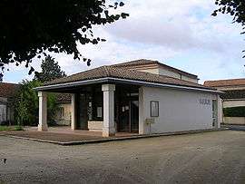
Town hall | |
 Angeac-Charente | |
|
Location within Nouvelle-Aquitaine region  Angeac-Charente | |
| Coordinates: 45°37′53″N 0°04′26″W / 45.6314°N 0.0739°WCoordinates: 45°37′53″N 0°04′26″W / 45.6314°N 0.0739°W | |
| Country | France |
| Region | Nouvelle-Aquitaine |
| Department | Charente |
| Arrondissement | Cognac |
| Canton | Châteauneuf-sur-Charente |
| Intercommunality | Région de Châteauneuf |
| Government | |
| • Mayor (2008–2014) | Christian Dufront |
| Area1 | 10.81 km2 (4.17 sq mi) |
| Population (2008)2 | 380 |
| • Density | 35/km2 (91/sq mi) |
| Time zone | CET (UTC+1) |
| • Summer (DST) | CEST (UTC+2) |
| INSEE/Postal code | 16013 / 16120 |
| Elevation |
15–100 m (49–328 ft) (avg. 25 m or 82 ft) |
|
1 French Land Register data, which excludes lakes, ponds, glaciers > 1 km² (0.386 sq mi or 247 acres) and river estuaries. 2 Population without double counting: residents of multiple communes (e.g., students and military personnel) only counted once. | |
Angeac-Charente is a commune in the Charente department in southwestern France.
Population
| Historical population | ||
|---|---|---|
| Year | Pop. | ±% |
| 1793 | 743 | — |
| 1800 | 740 | −0.4% |
| 1806 | 722 | −2.4% |
| 1821 | 774 | +7.2% |
| 1831 | 727 | −6.1% |
| 1841 | 640 | −12.0% |
| 1846 | 620 | −3.1% |
| 1851 | 625 | +0.8% |
| 1856 | 609 | −2.6% |
| 1861 | 624 | +2.5% |
| 1866 | 604 | −3.2% |
| 1872 | 609 | +0.8% |
| 1876 | 579 | −4.9% |
| 1881 | 557 | −3.8% |
| 1886 | 536 | −3.8% |
| 1891 | 499 | −6.9% |
| 1896 | 527 | +5.6% |
| 1901 | 522 | −0.9% |
| 1906 | 493 | −5.6% |
| 1911 | 457 | −7.3% |
| 1921 | 442 | −3.3% |
| 1926 | 429 | −2.9% |
| 1931 | 426 | −0.7% |
| 1936 | 441 | +3.5% |
| 1946 | 439 | −0.5% |
| 1954 | 450 | +2.5% |
| 1962 | 447 | −0.7% |
| 1968 | 389 | −13.0% |
| 1975 | 393 | +1.0% |
| 1982 | 378 | −3.8% |
| 1990 | 387 | +2.4% |
| 1999 | 399 | +3.1% |
| 2008 | 380 | −4.8% |
See also
References
| Wikimedia Commons has media related to Angeac-Charente. |
This article is issued from Wikipedia - version of the 6/9/2015. The text is available under the Creative Commons Attribution/Share Alike but additional terms may apply for the media files.