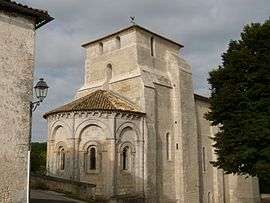
Barret, Charente
| Barret | |
|---|---|
 | |
 Barret | |
|
Location within Nouvelle-Aquitaine region  Barret | |
| Coordinates: 45°29′24″N 0°12′14″W / 45.49°N 0.2039°WCoordinates: 45°29′24″N 0°12′14″W / 45.49°N 0.2039°W | |
| Country | France |
| Region | Nouvelle-Aquitaine |
| Department | Charente |
| Arrondissement | Cognac |
| Canton | Barbezieux-Saint-Hilaire |
| Intercommunality | 3B - Sud-Charente |
| Government | |
| • Mayor (2008–2014) | Dominique Chatelier |
| Area1 | 22.37 km2 (8.64 sq mi) |
| Population (2008)2 | 898 |
| • Density | 40/km2 (100/sq mi) |
| Time zone | CET (UTC+1) |
| • Summer (DST) | CEST (UTC+2) |
| INSEE/Postal code | 16030 / 16300 |
| Elevation |
34–127 m (112–417 ft) (avg. 67 m or 220 ft) |
|
1 French Land Register data, which excludes lakes, ponds, glaciers > 1 km² (0.386 sq mi or 247 acres) and river estuaries. 2 Population without double counting: residents of multiple communes (e.g., students and military personnel) only counted once. | |
Barret is a commune in the Charente department in southwestern France.
Population
| Historical population | ||
|---|---|---|
| Year | Pop. | ±% |
| 1793 | 1,182 | — |
| 1800 | 1,031 | −12.8% |
| 1806 | 1,168 | +13.3% |
| 1821 | 1,242 | +6.3% |
| 1831 | 1,286 | +3.5% |
| 1841 | 1,247 | −3.0% |
| 1846 | 1,343 | +7.7% |
| 1851 | 1,337 | −0.4% |
| 1856 | 1,302 | −2.6% |
| 1861 | 1,261 | −3.1% |
| 1866 | 1,257 | −0.3% |
| 1872 | 1,198 | −4.7% |
| 1876 | 1,142 | −4.7% |
| 1881 | 1,066 | −6.7% |
| 1886 | 970 | −9.0% |
| 1891 | 933 | −3.8% |
| 1896 | 920 | −1.4% |
| 1901 | 914 | −0.7% |
| 1906 | 935 | +2.3% |
| 1911 | 923 | −1.3% |
| 1921 | 834 | −9.6% |
| 1926 | 856 | +2.6% |
| 1931 | 848 | −0.9% |
| 1936 | 797 | −6.0% |
| 1946 | 731 | −8.3% |
| 1954 | 732 | +0.1% |
| 1962 | 747 | +2.0% |
| 1968 | 750 | +0.4% |
| 1975 | 810 | +8.0% |
| 1982 | 862 | +6.4% |
| 1990 | 951 | +10.3% |
| 1999 | 867 | −8.8% |
| 2008 | 898 | +3.6% |
See also
References
| Wikimedia Commons has media related to Barret. |
This article is issued from Wikipedia - version of the 2/22/2013. The text is available under the Creative Commons Attribution/Share Alike but additional terms may apply for the media files.