Fleurac, Charente
| Fleurac | |
|---|---|
|
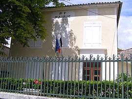
Town hall | |
 Fleurac | |
|
Location within Nouvelle-Aquitaine region  Fleurac | |
| Coordinates: 45°43′18″N 0°04′56″W / 45.7217°N 0.0822°WCoordinates: 45°43′18″N 0°04′56″W / 45.7217°N 0.0822°W | |
| Country | France |
| Region | Nouvelle-Aquitaine |
| Department | Charente |
| Arrondissement | Cognac |
| Canton | Jarnac |
| Intercommunality | Jarnac |
| Government | |
| • Mayor (2008–2014) | Nicole Deschamphamlaère |
| Area1 | 2.17 km2 (0.84 sq mi) |
| Population (2008)2 | 228 |
| • Density | 110/km2 (270/sq mi) |
| Time zone | CET (UTC+1) |
| • Summer (DST) | CEST (UTC+2) |
| INSEE/Postal code | 16139 / 16200 |
| Elevation |
49–92 m (161–302 ft) (avg. 64 m or 210 ft) |
|
1 French Land Register data, which excludes lakes, ponds, glaciers > 1 km² (0.386 sq mi or 247 acres) and river estuaries. 2 Population without double counting: residents of multiple communes (e.g., students and military personnel) only counted once. | |
Fleurac is a commune in the Charente department in southwestern France.
Population
| Historical population | ||
|---|---|---|
| Year | Pop. | ±% |
| 1793 | 349 | — |
| 1800 | 400 | +14.6% |
| 1806 | 422 | +5.5% |
| 1821 | 379 | −10.2% |
| 1831 | 392 | +3.4% |
| 1841 | 347 | −11.5% |
| 1846 | 355 | +2.3% |
| 1851 | 383 | +7.9% |
| 1856 | 420 | +9.7% |
| 1861 | 405 | −3.6% |
| 1866 | 351 | −13.3% |
| 1872 | 353 | +0.6% |
| 1876 | 320 | −9.3% |
| 1881 | 318 | −0.6% |
| 1886 | 278 | −12.6% |
| 1891 | 253 | −9.0% |
| 1896 | 251 | −0.8% |
| 1901 | 245 | −2.4% |
| 1906 | 242 | −1.2% |
| 1911 | 245 | +1.2% |
| 1921 | 225 | −8.2% |
| 1926 | 203 | −9.8% |
| 1931 | 204 | +0.5% |
| 1936 | 191 | −6.4% |
| 1946 | 192 | +0.5% |
| 1954 | 208 | +8.3% |
| 1962 | 244 | +17.3% |
| 1968 | 251 | +2.9% |
| 1975 | 257 | +2.4% |
| 1982 | 238 | −7.4% |
| 1990 | 244 | +2.5% |
| 1999 | 232 | −4.9% |
| 2008 | 228 | −1.7% |
See also
References
| Wikimedia Commons has media related to Fleurac (Charente). |
This article is issued from Wikipedia - version of the 3/15/2016. The text is available under the Creative Commons Attribution/Share Alike but additional terms may apply for the media files.