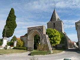
Saint-Laurent-de-Belzagot
| Saint-Laurent-de-Belzagot | |
|---|---|
 | |
 Saint-Laurent-de-Belzagot | |
|
Location within Nouvelle-Aquitaine region  Saint-Laurent-de-Belzagot | |
| Coordinates: 45°23′28″N 0°07′08″E / 45.3911°N 0.1189°ECoordinates: 45°23′28″N 0°07′08″E / 45.3911°N 0.1189°E | |
| Country | France |
| Region | Nouvelle-Aquitaine |
| Department | Charente |
| Arrondissement | Angoulême |
| Canton | Montmoreau-Saint-Cybard |
| Intercommunality | Montmorélien |
| Government | |
| • Mayor (2008–2014) | Philippe Michelet |
| Area1 | 9.99 km2 (3.86 sq mi) |
| Population (2008)2 | 353 |
| • Density | 35/km2 (92/sq mi) |
| Time zone | CET (UTC+1) |
| • Summer (DST) | CEST (UTC+2) |
| INSEE/Postal code | 16328 / 16190 |
| Elevation |
59–172 m (194–564 ft) (avg. 110 m or 360 ft) |
|
1 French Land Register data, which excludes lakes, ponds, glaciers > 1 km² (0.386 sq mi or 247 acres) and river estuaries. 2 Population without double counting: residents of multiple communes (e.g., students and military personnel) only counted once. | |
Saint-Laurent-de-Belzagot is a commune in the Charente department in southwestern France.
Population
| Historical population | ||
|---|---|---|
| Year | Pop. | ±% |
| 1793 | 528 | — |
| 1806 | 495 | −6.2% |
| 1821 | 487 | −1.6% |
| 1831 | 554 | +13.8% |
| 1841 | 495 | −10.6% |
| 1846 | 559 | +12.9% |
| 1851 | 548 | −2.0% |
| 1856 | 517 | −5.7% |
| 1861 | 491 | −5.0% |
| 1866 | 481 | −2.0% |
| 1872 | 459 | −4.6% |
| 1876 | 443 | −3.5% |
| 1881 | 429 | −3.2% |
| 1886 | 431 | +0.5% |
| 1891 | 430 | −0.2% |
| 1896 | 375 | −12.8% |
| 1901 | 354 | −5.6% |
| 1906 | 387 | +9.3% |
| 1911 | 390 | +0.8% |
| 1921 | 367 | −5.9% |
| 1926 | 355 | −3.3% |
| 1931 | 315 | −11.3% |
| 1936 | 328 | +4.1% |
| 1946 | 333 | +1.5% |
| 1954 | 315 | −5.4% |
| 1962 | 308 | −2.2% |
| 1968 | 286 | −7.1% |
| 1975 | 289 | +1.0% |
| 1982 | 290 | +0.3% |
| 1990 | 326 | +12.4% |
| 1999 | 351 | +7.7% |
| 2008 | 353 | +0.6% |
See also
References
| Wikimedia Commons has media related to Saint-Laurent-de-Belzagot. |
This article is issued from Wikipedia - version of the 2/23/2013. The text is available under the Creative Commons Attribution/Share Alike but additional terms may apply for the media files.