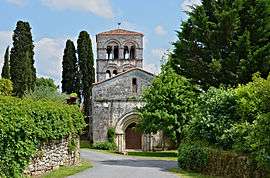
Édon
| Édon | |
|---|---|
 | |
 Édon | |
|
Location within Nouvelle-Aquitaine region  Édon | |
| Coordinates: 45°29′22″N 0°21′18″E / 45.4894°N 0.355°ECoordinates: 45°29′22″N 0°21′18″E / 45.4894°N 0.355°E | |
| Country | France |
| Region | Nouvelle-Aquitaine |
| Department | Charente |
| Arrondissement | Angoulême |
| Canton | Villebois-Lavalette |
| Intercommunality | Horte et Lavalette |
| Government | |
| • Mayor (2008–2014) | Patrice Petit |
| Area1 | 16.49 km2 (6.37 sq mi) |
| Population (2008)2 | 252 |
| • Density | 15/km2 (40/sq mi) |
| Time zone | CET (UTC+1) |
| • Summer (DST) | CEST (UTC+2) |
| INSEE/Postal code | 16125 / 16320 |
| Elevation |
85–227 m (279–745 ft) (avg. 153 m or 502 ft) |
|
1 French Land Register data, which excludes lakes, ponds, glaciers > 1 km² (0.386 sq mi or 247 acres) and river estuaries. 2 Population without double counting: residents of multiple communes (e.g., students and military personnel) only counted once. | |
Édon is a commune in the Charente department in southwestern France.
Geography
The Lizonne (locally called Nizonne) forms the commune's southeastern border.
Population
| Historical population | ||
|---|---|---|
| Year | Pop. | ±% |
| 1793 | 800 | — |
| 1800 | 799 | −0.1% |
| 1806 | 727 | −9.0% |
| 1821 | 796 | +9.5% |
| 1831 | 815 | +2.4% |
| 1841 | 854 | +4.8% |
| 1846 | 871 | +2.0% |
| 1851 | 874 | +0.3% |
| 1856 | 873 | −0.1% |
| 1861 | 810 | −7.2% |
| 1866 | 715 | −11.7% |
| 1872 | 660 | −7.7% |
| 1876 | 665 | +0.8% |
| 1881 | 623 | −6.3% |
| 1886 | 612 | −1.8% |
| 1891 | 554 | −9.5% |
| 1896 | 531 | −4.2% |
| 1901 | 505 | −4.9% |
| 1906 | 562 | +11.3% |
| 1911 | 560 | −0.4% |
| 1921 | 402 | −28.2% |
| 1926 | 384 | −4.5% |
| 1931 | 384 | +0.0% |
| 1936 | 348 | −9.4% |
| 1946 | 303 | −12.9% |
| 1954 | 294 | −3.0% |
| 1962 | 278 | −5.4% |
| 1968 | 284 | +2.2% |
| 1975 | 256 | −9.9% |
| 1982 | 286 | +11.7% |
| 1990 | 306 | +7.0% |
| 1999 | 224 | −26.8% |
| 2008 | 252 | +12.5% |
See also
References
| Wikimedia Commons has media related to Édon. |
This article is issued from Wikipedia - version of the 6/8/2013. The text is available under the Creative Commons Attribution/Share Alike but additional terms may apply for the media files.