Benest
| Benest | ||
|---|---|---|
|
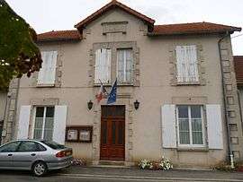
Town hall | ||
| ||
 Benest | ||
|
Location within Nouvelle-Aquitaine region  Benest | ||
| Coordinates: 46°02′21″N 0°27′10″E / 46.0392°N 0.4528°ECoordinates: 46°02′21″N 0°27′10″E / 46.0392°N 0.4528°E | ||
| Country | France | |
| Region | Nouvelle-Aquitaine | |
| Department | Charente | |
| Arrondissement | Confolens | |
| Canton | Champagne-Mouton | |
| Intercommunality | Confolentais | |
| Government | ||
| • Mayor (2008–2014) | Jean-Jacques Meyer | |
| Area1 | 21.10 km2 (8.15 sq mi) | |
| Population (2008)2 | 361 | |
| • Density | 17/km2 (44/sq mi) | |
| Time zone | CET (UTC+1) | |
| • Summer (DST) | CEST (UTC+2) | |
| INSEE/Postal code | 16038 / 16350 | |
| Elevation |
132–192 m (433–630 ft) (avg. 160 m or 520 ft) | |
|
1 French Land Register data, which excludes lakes, ponds, glaciers > 1 km² (0.386 sq mi or 247 acres) and river estuaries. 2 Population without double counting: residents of multiple communes (e.g., students and military personnel) only counted once. | ||

Benest is a commune in the Charente department in southwestern France.
Population
| Historical population | ||
|---|---|---|
| Year | Pop. | ±% |
| 1793 | 1,400 | — |
| 1800 | 1,262 | −9.9% |
| 1806 | 1,378 | +9.2% |
| 1821 | 1,395 | +1.2% |
| 1831 | 1,480 | +6.1% |
| 1841 | 1,485 | +0.3% |
| 1846 | 1,524 | +2.6% |
| 1851 | 1,466 | −3.8% |
| 1856 | 1,578 | +7.6% |
| 1861 | 1,419 | −10.1% |
| 1866 | 1,443 | +1.7% |
| 1872 | 1,426 | −1.2% |
| 1876 | 1,330 | −6.7% |
| 1881 | 1,322 | −0.6% |
| 1886 | 1,327 | +0.4% |
| 1891 | 1,311 | −1.2% |
| 1896 | 1,267 | −3.4% |
| 1901 | 1,282 | +1.2% |
| 1906 | 1,296 | +1.1% |
| 1911 | 1,266 | −2.3% |
| 1921 | 920 | −27.3% |
| 1926 | 995 | +8.2% |
| 1931 | 972 | −2.3% |
| 1936 | 947 | −2.6% |
| 1946 | 909 | −4.0% |
| 1954 | 867 | −4.6% |
| 1962 | 739 | −14.8% |
| 1968 | 663 | −10.3% |
| 1975 | 547 | −17.5% |
| 1982 | 470 | −14.1% |
| 1990 | 425 | −9.6% |
| 1999 | 382 | −10.1% |
| 2008 | 361 | −5.5% |
See also
References
| Wikimedia Commons has media related to Benest. |
This article is issued from Wikipedia - version of the 9/17/2015. The text is available under the Creative Commons Attribution/Share Alike but additional terms may apply for the media files.