Saco, California
| Saco | |
|---|---|
| Unincorporated community | |
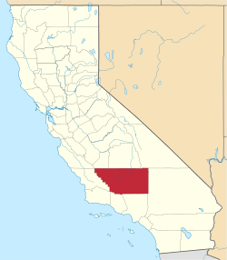
 Saco  Saco Location in California | |
| Coordinates: 35°26′40″N 119°05′32″W / 35.44444°N 119.09222°WCoordinates: 35°26′40″N 119°05′32″W / 35.44444°N 119.09222°W | |
| Country | United States |
| State | California |
| County | Kern County |
| Elevation[1] | 453 ft (138 m) |
Saco (formerly, Jewetta) is an unincorporated community in Kern County, California.[1] It is located on the Southern Pacific Railroad 7 miles (11 km) northwest of Bakersfield,[2] at an elevation of 453 feet (138 m).[1]
The Jewetta post office operated from 1893 to 1903, with a closure during 1896 to 1898.[2] The name Jewetta honors Solomon and Philo D. Jewett, pioneers.[2]
References
This article is issued from Wikipedia - version of the 7/5/2016. The text is available under the Creative Commons Attribution/Share Alike but additional terms may apply for the media files.