Greenfield, Kern County, California
| Greenfield | |
|---|---|
| census-designated place | |
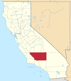
 Greenfield Location in California | |
| Coordinates: 35°16′08″N 119°00′10″W / 35.26889°N 119.00278°WCoordinates: 35°16′08″N 119°00′10″W / 35.26889°N 119.00278°W | |
| Country |
|
| State |
|
| County | Kern County |
| Area[1] | |
| • Total | 1.488 sq mi (3.855 km2) |
| • Land | 5.842 sq mi (3.855 km2) |
| • Water | 0 sq mi (0 km2) 0% |
| Elevation[2] | 351 ft (107 m) |
| Population (2010) | |
| • Total | 3,991 |
| • Density | 2,700/sq mi (1,000/km2) |
| Time zone | Pacific (PST) (UTC-8) |
| • Summer (DST) | PDT (UTC-7) |
| GNIS feature IDs | 243007; 2628815 |
| U.S. Geological Survey Geographic Names Information System: Greenfield, Kern County, California; U.S. Geological Survey Geographic Names Information System: Greenfield, Kern County, California | |
Greenfield (formerly, Delkern)[3] is a census-designated place[4] in Kern County, California.[2] It is located 7 miles (11 km) south of Bakersfield,[3] at an elevation of 351 feet (107 m).[2] The population was 3,991 at the 2010 census.
The Delkern post office was opened in 1949.[3] That name derives from Kern Delta, a designation for the surrounding area.[3]
Demographics
The 2010 United States Census[5] reported that Greenfield had a population of 3,991. The population density was 2,681.4 people per square mile (1,035.3/km²). The racial makeup of Greenfield was 2,512 (62.9%) White, 71 (1.8%) African American, 63 (1.6%) Native American, 45 (1.1%) Asian, 1 (0.0%) Pacific Islander, 1,112 (27.9%) from other races, and 187 (4.7%) from two or more races. Hispanic or Latino of any race were 2,263 persons (56.7%).
The Census reported that 3,991 people (100% of the population) lived in households, 0 (0%) lived in non-institutionalized group quarters, and 0 (0%) were institutionalized.
There were 1,244 households, out of which 522 (42.0%) had children under the age of 18 living in them, 709 (57.0%) were opposite-sex married couples living together, 149 (12.0%) had a female householder with no husband present, 106 (8.5%) had a male householder with no wife present. There were 74 (5.9%) unmarried opposite-sex partnerships, and 6 (0.5%) same-sex married couples or partnerships. 225 households (18.1%) were made up of individuals and 97 (7.8%) had someone living alone who was 65 years of age or older. The average household size was 3.21. There were 964 families (77.5% of all households); the average family size was 3.63.
The population was spread out with 1,126 people (28.2%) under the age of 18, 428 people (10.7%) aged 18 to 24, 928 people (23.3%) aged 25 to 44, 1,125 people (28.2%) aged 45 to 64, and 384 people (9.6%) who were 65 years of age or older. The median age was 34.4 years. For every 100 females there were 106.3 males. For every 100 females age 18 and over, there were 105.4 males.
There were 1,358 housing units at an average density of 912.4 per square mile (352.3/km²), of which 870 (69.9%) were owner-occupied, and 374 (30.1%) were occupied by renters. The homeowner vacancy rate was 3.0%; the rental vacancy rate was 8.5%. 2,660 people (66.6% of the population) lived in owner-occupied housing units and 1,331 people (33.4%) lived in rental housing units.
References
- ↑ U.S. Census
- 1 2 3 U.S. Geological Survey Geographic Names Information System: Greenfield, Kern County, California
- 1 2 3 4 Durham, David L. (1998). California's Geographic Names: A Gazetteer of Historic and Modern Names of the State. Clovis, Calif.: Word Dancer Press. p. 1042. ISBN 1-884995-14-4.
- ↑ U.S. Geological Survey Geographic Names Information System: Greenfield, Kern County, California
- ↑ "2010 Census Interactive Population Search: CA - Greenfield CDP". U.S. Census Bureau. Retrieved July 12, 2014.