Cinco, California
| Cinco | |
|---|---|
| Unincorporated community | |
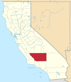
 Cinco  Cinco Location in California | |
| Coordinates: 35°15′48″N 118°02′10″W / 35.26333°N 118.03611°WCoordinates: 35°15′48″N 118°02′10″W / 35.26333°N 118.03611°W | |
| Country | United States |
| State | California |
| County | Kern County |
| Elevation[1] | 2,149 ft (655 m) |
Cinco is an unincorporated community in Kern County, California.[1]
It is located on the southwestern edge of Fremont Valley 6 miles (9.7 km), east of and at the foot of the Sierra Nevada (U.S.) Mountains, south of Red Rock Canyon State Park (California).[2] at an elevation of 2149 feet (655 m).[1] It is southwest of Cantil, California and east of Cross Mountain.
Cinco was founded as a work camp in the early 20th century for workers on the Los Angeles Aqueduct (Owens Valley aqueduct).[2]
References
This article is issued from Wikipedia - version of the 7/5/2016. The text is available under the Creative Commons Attribution/Share Alike but additional terms may apply for the media files.