Harts Place, California
| Harts Place | |
|---|---|
| Unincorporated community | |
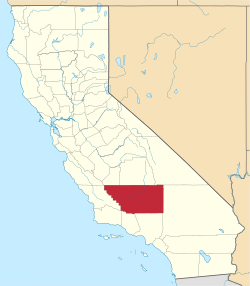
 Harts Place  Harts Place Location in California | |
| Coordinates: 35°30′03″N 117°56′55″W / 35.50083°N 117.94861°WCoordinates: 35°30′03″N 117°56′55″W / 35.50083°N 117.94861°W | |
| Country | United States |
| State | California |
| County | Kern County |
| Elevation[1] | 3,084 ft (940 m) |
Harts Place is an unincorporated community in Kern County, California.[1]
It is located 13 miles (21 km) southwest of Inyokern on California State Route 14,[2] at an elevation of 3084 feet (940 m).[1]
Harts Place was a Mojave Desert roadside gas station, cafe, store, and garage on the old State Route 14, south of the junction with U.S. Route 395 in California, until faster travel in the late 1960s.
References
This article is issued from Wikipedia - version of the 7/5/2016. The text is available under the Creative Commons Attribution/Share Alike but additional terms may apply for the media files.