Westlock County
| Westlock County | ||
|---|---|---|
| Municipal district | ||
| ||
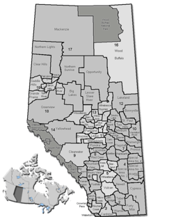 Location of Westlock County in Alberta | ||
| Coordinates: 54°09′8″N 113°51′4″W / 54.15222°N 113.85111°WCoordinates: 54°09′8″N 113°51′4″W / 54.15222°N 113.85111°W | ||
| Country |
| |
| Province |
| |
| Region | Central Alberta | |
| Census division | No. 13 | |
| Established | 1943 | |
| Incorporated | 1998 (County) | |
| Government[1] | ||
| • Reeve | Don Savage (acting) | |
| • Governing body | Westlock County Council | |
| • Office location | Westlock | |
| Area (2011)[2] | ||
| • Total | 3,170.71 km2 (1,224.22 sq mi) | |
| Population (2011)[2] | ||
| • Total | 7,644 | |
| • Density | 2.4/km2 (6/sq mi) | |
| • Dwellings | 2,589 | |
| Time zone | MST (UTC−7) | |
| • Summer (DST) | MDT (UTC−6) | |
| Website |
westlockcounty | |
Westlock County is a municipal district in central Alberta north of Edmonton. The county was formerly known as the Municipal District of Westlock No. 92, and was created in 1943 from the merger of five smaller municipal districts.
The county lies on the boundary of two of Canada's largest watershed basins. To the north is the Athabasca River, which drains into the Arctic Ocean via the Mackenzie River. To the south is the Sturgeon River which drains via the North Saskatchewan into Hudson Bay.
Communities and localities
|
The following urban municipalities are surrounded by Westlock County:[3]
The following hamlets are located within Westlock County:[3] |
The following localities are located within Westlock County:[4]
|
Demographics
In the 2011 Census, Westlock County had a population of 7,644 living in 2,696 of its 2,925 total dwellings, a 10.6% change from its 2006 population of 6,910. With a land area of 3,170.71 km2 (1,224.22 sq mi), it had a population density of 2.4/km2 (6.2/sq mi) in 2011.[2]
In 2006, Westlock County had a population of 6,910 living in 2,589 dwellings, an 0.7% increase from 2001. The municipal district has a land area of 3,174.60 km2 (1,225.72 sq mi) and a population density of 2.2/km2 (5.7/sq mi).[5]
According to the Canada 2001 Census:
- Population: 6,859 (2001)
- % Change (1996-2001): −1.4
- Dwellings: 2,634
- Area (km2.): 3,168.21
- Density (persons per km2.): 2.2
The county consists of 3,167 square kilometres (1,200 mi2) with a population of 6,958. Approximately 1,300 farmers in the county grow crops and raise livestock on 2974 square kilometres (734,829 acres) with a combined investment of over C$500 million in land, buildings, equipment and livestock.
In 2001, 295 of the county's residents identified as Aboriginal.
Government
The municipal government consists of a reeve and six other elected councillors who work with a permanent staff of 32.
See also
References
- ↑ "Municipal Officials Search". Alberta Municipal Affairs. December 16, 2016. Retrieved December 18, 2016.
- 1 2 3 "Population and dwelling counts, for Canada, provinces and territories, and census subdivisions (municipalities), 2011 and 2006 censuses (Alberta)". Statistics Canada. 2012-02-08. Retrieved 2012-02-08.
- 1 2 "Specialized and Rural Municipalities and Their Communities" (PDF). Alberta Municipal Affairs. 2012-03-01. Retrieved 2012-08-12.
- ↑ "Standard Geographical Classification (SGC) 2006, Economic Regions: 4813028 - Westlock County, geographical codes and localities, 2006". Statistics Canada. 2010-03-05. Retrieved 2012-08-12.
- ↑ Statistics Canada. "Canada 2006 Census: Westlock County - Community Profile". Retrieved 2007-06-11.
External links
 |
Woodlands County | Municipal District of Lesser Slave River No. 124 | Athabasca County | |
| County of Barrhead No. 11 | |
Thorhild County | ||
| ||||
| | ||||
| Lac Ste. Anne County | Sturgeon County | Sturgeon County |