Athabasca County
| Athabasca County | ||
|---|---|---|
| Municipal district | ||
| ||
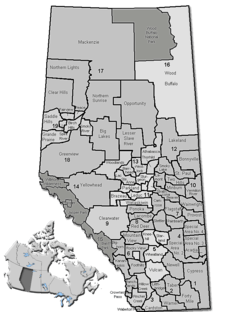 Location of Athabasca County in Alberta | ||
| Coordinates: 54°43′N 113°17′W / 54.717°N 113.283°WCoordinates: 54°43′N 113°17′W / 54.717°N 113.283°W | ||
| Country |
| |
| Province |
| |
| Region | Northern Alberta | |
| Census division | No. 13 | |
| Established | 1947 | |
| Incorporated | 1959 (County) | |
| Government[1] | ||
| • Reeve | Doris Splane | |
| • Governing body |
Athabasca County Council
| |
| • CAO | Ryan Maier | |
| • Office location | Athabasca | |
| Area (2011)[2] | ||
| • Total | 6,122.75 km2 (2,364.01 sq mi) | |
| Population (2011)[2] | ||
| • Total | 7,662 | |
| • Density | 1.3/km2 (3/sq mi) | |
| • Dwellings | 3,799 | |
| Time zone | MST (UTC-7) | |
| • Summer (DST) | MDT (UTC-6) | |
| Website | Official website | |
Athabasca County is a municipal district in north central Alberta, Canada. It is located northeast of Edmonton and is in Census Division No. 13. Prior to an official renaming on December 1, 2009, Athabasca County was officially known as the County of Athabasca No. 12.[3]
Communities and localities
|
The following urban municipalities are surrounded by Athabasca County:[4]
The following hamlets are located within Athabasca County:[4] |
The following localities are located within Athabasca County:[5]
|
Demographics
In the 2011 Census, Athabasca County had a population of 7,662 living in 2,965 of its 3,835 total dwellings, a 1.2% change from its 2006 adjusted population of 7,572. With a land area of 6,122.75 km2 (2,364.01 sq mi), it had a population density of 1.3/km2 (3.2/sq mi) in 2011.[2]
In 2006, Athabasca County had a population of 7,587 living in 3,799 dwellings, a 0.9% increase from 2001.[6] However, this population has since been revised by Statistics Canada to 7,592.[7] Using the pre-revised Statistics Canada data, Athabasca County had a land area of 6,126.43 km2 (2,365.43 sq mi) and a population density of 1.2/km2 (3.1/sq mi) in 2006.[6]
| Visible minority and Aboriginal population (Canada 2006 Census) | |||
|---|---|---|---|
| Population group | Population | % of total population | |
| White | 6,650 | 87.7% | |
| Visible minority group Source:[8] | South Asian | 0 | 0% |
| Chinese | 15 | 0.2% | |
| Black | 35 | 0.5% | |
| Filipino | 20 | 0.3% | |
| Latin American | 0 | 0% | |
| Arab | 15 | 0.2% | |
| Southeast Asian | 25 | 0.3% | |
| West Asian | 0 | 0% | |
| Korean | 0 | 0% | |
| Japanese | 15 | 0.2% | |
| Visible minority, n.i.e. | 0 | 0% | |
| Multiple visible minority | 0 | 0% | |
| Total visible minority population | 125 | 1.6% | |
| Aboriginal group Source:[9] | First Nations | 310 | 4.1% |
| Métis | 500 | 6.6% | |
| Inuit | 0 | 0% | |
| Aboriginal, n.i.e. | 0 | 0% | |
| Multiple Aboriginal identity | 0 | 0% | |
| Total Aboriginal population | 810 | 10.7% | |
| Total population | 7,585 | 100% | |
See also
References
- ↑ "Municipal Officials Search". Alberta Municipal Affairs. November 18, 2016. Retrieved November 21, 2016.
- 1 2 3 "Population and dwelling counts, for Canada, provinces and territories, and census subdivisions (municipalities), 2011 and 2006 censuses (Alberta)". Statistics Canada. 2012-02-08. Retrieved 2012-02-08.
- ↑ Province of Alberta. "Order in Council (O.C.) 563/2009". Retrieved 2009-12-06.
- 1 2 "Specialized and Rural Municipalities and Their Communities" (PDF). Alberta Municipal Affairs. 2012-03-01. Retrieved 2012-08-11.
- ↑ "Standard Geographical Classification (SGC) 2006, Economic Regions: 4813044 - Athabasca County No. 12, geographical codes and localities, 2006". Statistics Canada. 2010-03-05. Retrieved 2012-08-11.
- 1 2 Statistics Canada. "Canada 2006 Census: Athabasca County - Community Profile". Retrieved 2007-06-10.
- ↑ Statistics Canada (2009-02-09). "2006 Census corrections and updates". Retrieved 2010-11-28.
- ↑ Community Profiles from the 2006 Census, Statistics Canada - Census Subdivision
- ↑ Aboriginal Population Profile from the 2006 Census, Statistics Canada - Census Subdivision
External links
 |
Municipal District of Lesser Slave River No. 124 | Municipal District of Opportunity No. 17 | Lac La Biche County | |
| |
Lac La Biche County | |||
| ||||
| | ||||
| Westlock County | Thorhild County | Smoky Lake County |