Municipal District of Taber
| Municipal District of Taber | ||
|---|---|---|
| Municipal district | ||
| ||
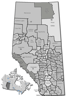 Location of Taber (municipal district) in Alberta | ||
| Coordinates: 49°47′5″N 112°09′3″W / 49.78472°N 112.15083°WCoordinates: 49°47′5″N 112°09′3″W / 49.78472°N 112.15083°W | ||
| Country |
| |
| Province |
| |
| Region | Southern Alberta | |
| Census division | No. 2 | |
| Established | 1954 | |
| Incorporated | 1954 | |
| Government[1] | ||
| • Reeve | Brian Brewin | |
| • Governing body | Municipal District of Taber Council | |
| • Office location | Taber | |
| Area (2011)[2] | ||
| • Total | 4,203.79 km2 (1,623.09 sq mi) | |
| Population (2011)[2] | ||
| • Total | 6,851 | |
| • Density | 1.6/km2 (4/sq mi) | |
| • Dwellings | 1,852 | |
| Time zone | MST (UTC-7) | |
| Website |
mdtaber | |
The Municipal District of Taber is a municipal district in southern Alberta, Canada. It is located in Census Division 2.
Geography
Communities and localities
|
The following urban municipalities are surrounded by the Municipal District of Taber:[3]
The following hamlets are located within the Municipal District of Taber:[3] |
The following localities are located within the Municipal District of Taber:[4]
|
Demographics
The Municipal District of Taber's 2016 municipal census counted a population of 7,173,[5] a 0.9% increase over its 2013 municipal census population of 7,116.[6] By its five hamlets, the 2013 municipal census population breaks down into 289 residents in Enchant, 778 in Grassy Lake, 163 in Hays, 115 in Johnson's Addition and 41 in Purple Springs, resulting in a remaining rural area population of 5,730.[6]
In the 2011 Census, the Municipal District of Taber had a population of 6,851 living in 1,834 of its 2,022 total dwellings, a 9.2% change from its 2006 adjusted population of 6,275. With a land area of 4,203.79 km2 (1,623.09 sq mi), it had a population density of 1.6/km2 (4.2/sq mi) in 2011.[2]
In 2006, the Municipal District of Taber had a population of 6,280 living in 1,852 dwellings, a 4.5% increase from 6,012 in 2001. The municipal district has a land area of 4,204.38 km2 (1,623.32 sq mi) and a population density of 1.5/km2 (3.9/sq mi).[7]
See also
References
- ↑ "Municipal Officials Search". Alberta Municipal Affairs. November 18, 2016. Retrieved November 21, 2016.
- 1 2 3 "Population and dwelling counts, for Canada, provinces and territories, and census subdivisions (municipalities), 2011 and 2006 censuses (Alberta)". Statistics Canada. January 30, 2013. Retrieved August 29, 2013.
- 1 2 "Specialized and Rural Municipalities and Their Communities" (PDF). Alberta Municipal Affairs. 2012-03-01. Retrieved 2012-08-12.
- ↑ "Standard Geographical Classification (SGC) 2006, Economic Regions: 4802021 - Taber, geographical codes and localities, 2006". Statistics Canada. 2010-03-05. Retrieved 2012-08-12.
- ↑ "MD Connection (newsletter): 2016 Municipal Census is Complete!". Municipal District of Taber. Summer 2016. p. 6. Retrieved July 14, 2016.
- 1 2 "MD Connection (newsletter): Fountain of Youth?" (PDF). Municipal District of Taber. Summer 2013. p. 7. Retrieved August 29, 2013.
- ↑ "Taber - Community Profile". Statistics Canada. December 6, 2010. Retrieved August 29, 2013.
External links
| Wikimedia Commons has media related to Taber, Alberta (municipal district). |
 |
Vulcan County | County of Newell | Cypress County | |
| Lethbridge County | |
County of Forty Mile No. 8 | ||
| ||||
| | ||||
| County of Warner No. 5 | County of Warner No. 5 | County of Forty Mile No. 8 |