Municipal District of Bighorn No. 8
| Municipal District of Bighorn No. 8 | ||
|---|---|---|
| Municipal district | ||
| ||
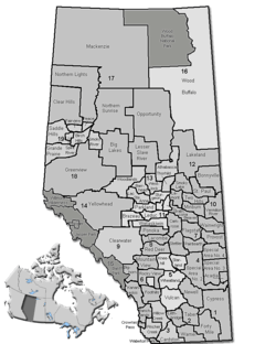 Location of Bighorn No. 8 in Alberta | ||
| Coordinates: 51°21′0″N 115°04′0″W / 51.35000°N 115.06667°WCoordinates: 51°21′0″N 115°04′0″W / 51.35000°N 115.06667°W | ||
| Country |
| |
| Province |
| |
| Region | Calgary Region | |
| Census division | No. 15 | |
| Incorporated | 1988 | |
| Government[1] | ||
| • Reeve | Dene Cooper | |
| • Governing body | M.D. of Bighorn Council | |
| • Office location | Exshaw | |
| Area (2011)[2] | ||
| • Total | 2,767.94 km2 (1,068.71 sq mi) | |
| Population (2011)[2] | ||
| • Total | 1,341 | |
| • Density | 0.5/km2 (1/sq mi) | |
| • Dwellings | 676 | |
| Time zone | MST (UTC−7) | |
| • Summer (DST) | MDT (UTC−6) | |
| Website |
mdbighorn | |
The Municipal District of Bighorn No. 8 is a municipal district situated in Census Division No. 15 of Alberta, Canada. It is located between Calgary and Banff National Park, north of Kananaskis Improvement District. Highway 1 (the Trans-Canada Highway) bisects this county.
It was created as a municipal district on January 1, 1988 from the former Improvement District No. 8,[3] absorbing the Town of Canmore in the early 90's.
Communities and localities
|
The following urban municipalities are surrounded by the Municipal District of Bighorn No. 8:[4]
The following hamlets are located within the Municipal District of Bighorn No. 8:[4]
|
The following localities are located within the Municipal District of Bighorn No. 8:[5]
|
Demographics
In the 2011 Census, the Municipal District of Bighorn No. 8 had a population of 1,341 living in 547 of its 797 total dwellings, a 6.1% change from its 2006 population of 1,264. With a land area of 2,767.94 km2 (1,068.71 sq mi), it had a population density of 0.5/km2 (1.3/sq mi) in 2011.[2]
In 2006, the Municipal District (M.D.) of Bighorn No. 8 had a population of 1,264 living in 676 dwellings, a 2.6% decrease from 2001.[6] However, this population has since been revised by Statistics Canada to 1,454.[7] Using the pre-revised Statistics Canada data, the M.D. of Bighorn No. 8 had a land area of 2,767.94 km2 (1,068.71 sq mi) and a population density of 0.5/km2 (1.3/sq mi) in 2006.[6]
The Canada 2001 Census reported that the M.D. of Bighorn No. 8 had a population of 1,298, scattered over 2,810 km2, with total number of private dwellings being 758. Its population density was 0.5 /km2.[8]
See also
References
- ↑ Alberta Municipal Affairs: Municipal Officials Search
- 1 2 3 "Population and dwelling counts, for Canada, provinces and territories, and census subdivisions (municipalities), 2011 and 2006 censuses (Alberta)". Statistics Canada. 2012-02-08. Retrieved 2012-02-08.
- ↑ Municipal District of Bighorn No. 8 profile - Alberta Municipal Affairs
- 1 2 "Specialized and Rural Municipalities and Their Communities" (PDF). Alberta Municipal Affairs. 2012-03-01. Retrieved 2012-08-11.
- ↑ "Standard Geographical Classification (SGC) 2006, Economic Regions: 4815015 - Bighorn No. 8, geographical codes and localities, 2006". Statistics Canada. 2010-03-05. Retrieved 2012-08-11.
- 1 2 Statistics Canada. "Canada 2006 Census: Bighorn No. 8 - Community Profile". Retrieved 2007-06-11.
- ↑ Statistics Canada (2009-02-09). "2006 Census corrections and updates". Retrieved 2010-11-28.
- ↑ Bighorn No. 8 Community Profile - Statistics Canada. 2002. 2001 Community Profiles. Released June 27, 2002. Last modified: 2005-11-30. Statistics Canada Catalogue no. 93F0053XIE
External links

| Subdivisions | |||||||||||
|---|---|---|---|---|---|---|---|---|---|---|---|
| Communities | |||||||||||
| Cities and urban service areas | |||||||||||
| Rural municipalities |
| ||||||||||
| Specialized municipalities | |||||||||||
| |||||||||||