U.S. Route 63 in Arkansas
| ||||
|---|---|---|---|---|
_map.svg.png) | ||||
| Route information | ||||
| Maintained by AHTD | ||||
| Major junctions | ||||
| South end: |
| |||
| ||||
| Highway system | ||||
| ||||
.svg.png)
U.S. Route 63 (US 63) is a north-south U.S. highway that begins in Ruston, LA. In the US state of Arkansas the highway enters the state from Louisiana concurrent with US 167 in Junction City. The highway zigzags through the state serving the major cities of Pine Bluff, West Memphis and Jonesboro. The highway exits the state at Mammoth Spring traveling into Missouri.
US 63 shares many overlaps with other highways in Arkansas. This includes I-40 and I-55. Once the freeway section is extended further south to I-55 at Turrell, US 63 from here to Jonesboro will become part of I-555.
Route description
U.S. 63 enters into Arkansas from Louisiana concurrent with US 167 in Junction City. Just a few miles into the state, the two highways run on the eastern edge of El Dorado as an expressway. US 167 splits here, traveling towards Hampton. US 63 bypasses the town of Warren, crossing US 270. US 63 passes through the rural Cleveland County, then enters into Jefferson County.
In Jefferson County, US 63 serves the city of Pine Bluff. US 63 bypasses the city, running on the last 3 miles of I-530. Also in Pine Bluff, the highway overlaps with US 65 and US 79. US 63 runs northeast with US 79 until Stuttgart, where the highway runs north to Hazen. Just north of Hazen, US 63 overlaps with I-40 to West Memphis. In West Memphis, US 63 runs north with I-55.
U.S. 63 runs with I-55 until Turrell, where it leaves the interstate and runs concurrent with I-555 until Jonesboro, until I-555 terminates. US 49 overlaps the two roadways for two miles in central Jonesboro. US 63/I-555 serves as a by-pass for southern Jonesboro. In Hoxie, US 63 intersects with US 67. Northwest of here near Portia the highway overlaps with US 412.
In Imboden US 62 joins this overlap. In Hardy, US 63 leaves the two highways. In Mammoth Spring, US 63 crosses into Missouri, traveling to West Plains.
History
Portions of U.S. 63 in northern Arkansas have their origins in the work of the Ozark Trails Association, which established a network of roads in northern Arkansas and southern Missouri beginning in the 1910s. A portion of roadway was mapped out in Arkansas between Mammoth Spring and Memphis, Tennessee, and built c. 1918-22. This roadway was eventually designated Highway A-7, and was later designated U.S. 63. Some of the original infrastructure of this early construction has survived the 1927 Mississippi flood and the realignment of U.S. 63 in 1967. Northwest of Tyronza, Old U.S. 63 runs for about 1-1/4 miles of original concrete pavement;[1] it was listed on the National Register of Historic Places in 2009.[2] Four bridges built in the 1920s (three before the 1927 flood and one after, are also on the National Register; three southeast of Marked Tree, and one southeast of Tyronza.[3][4]
Major intersections
| County | Location | mi | km | Exit | Destinations | Notes | ||
|---|---|---|---|---|---|---|---|---|
| Union | Junction City | Louisiana state line | ||||||
| | south end of AR 7 overlap | |||||||
| El Dorado | interchange; US 82 exit 22 | |||||||
| 15 | interchange | |||||||
| interchange; north end of US 167 / AR 7 overlap; US 63 north follows exit 16 | ||||||||
| Old Union | ||||||||
| | ||||||||
| Bradley | | |||||||
| | south end of AR 160 overlap | |||||||
| Hermitage | north end of AR 160 overlap | |||||||
| Carmel | south end of AR 8 overlap | |||||||
| | ||||||||
| Warren | ||||||||
| north end of AR 8 overlap | ||||||||
| Cleveland | Rye | south end of AR 35 overlap | ||||||
| Pansy | north end of AR 35 overlap | |||||||
| Calmer | south end of AR 114 overlap | |||||||
| north end of AR 114 overlap | ||||||||
| Jefferson | | south end of AR 54 overlap | ||||||
| Pinebergen | north end of AR 54 overlap | |||||||
| Pine Bluff | south end of I-530 / US 65 / US 79 overlap; US 63 south follows exit 43 | |||||||
| | 44 | |||||||
| Pine Bluff | 46 | north end of I-530 / US 65 overlap; south end of US 65B overlap; US 63 north follows exit 46 | ||||||
| north end of US 65B overlap | ||||||||
| | ||||||||
| Altheimer | ||||||||
| Arkansas | Humphrey | |||||||
| | ||||||||
| | ||||||||
| | ||||||||
| Stuttgart | north end of US 79 overlap | |||||||
| | ||||||||
| Prairie | | |||||||
| | south end of AR 86 overlap | |||||||
| Siedenstricker | north end of AR 86 overlap | |||||||
| Hazen | south end of US 70 overlap | |||||||
| north end of US 70 overlap | ||||||||
| south end of I-40 overlap; US 63 south follows exit 193 | ||||||||
| see I-40 | ||||||||
| Crittenden | | north end of I-40 / US 79 overlap; south end of I-55 / US 61 / US 64 overlap; US 63 north follows exit 277; US 63 south follows exit 8 | ||||||
| see I-55 | ||||||||
| Turrell | north end of I-55 / US 61 overlap; US 63 north follows exit 23; US 63 south follows exit 1A; Southern terminus of I-555 | |||||||
| Gilmore | 2 | |||||||
| Poinsett | | 7 | ||||||
| Tyronza | 8 | |||||||
| Marked Tree | 13 | |||||||
| 14 | south end of AR 14 overlap | |||||||
| | 16 | north end of AR 14 overlap | ||||||
| | 24 | |||||||
| Trumann | 29 | |||||||
| Craighead | Bay | 35 | ||||||
| Jonesboro | 36 | Nestlé Road | ||||||
| 39 | ||||||||
| 40 | ||||||||
| 42 | south end of US 49 overlap | |||||||
| 44 | ||||||||
| 45 | north end of US 49 overlap; south end of AR 18 overlap;Northern terminus of I-555 | |||||||
| 46 | ||||||||
| 47 | Washington Avenue | |||||||
| 49 | interchange; north end of freeway; north end of AR 18 overlap; | |||||||
| | ||||||||
| | ||||||||
| | ||||||||
| Greene |
No major junctions | |||||||
| Lawrence | Sedgwick | south end of AR 228 overlap | ||||||
| north end of AR 228 overlap | ||||||||
| Walnut Ridge | ||||||||
| interchange; south end of US 67 overlap | ||||||||
| Hoxie | interchange; north end of US 67 overlap | |||||||
| | ||||||||
| | south end of US 412 overlap | |||||||
| Black Rock | interchange | |||||||
| south end of AR 117 overlap | ||||||||
| north end of AR 117 overlap | ||||||||
| Imboden | south end of US 62 overlap | |||||||
| Randolph |
No major junctions | |||||||
| Lawrence | Ravenden | |||||||
| Sharp | | |||||||
| | ||||||||
| Hardy | south end of AR 175 overlap | |||||||
| north end of US 62 / US 412 / AR 175 overlap | ||||||||
| Fulton | Mammoth Spring | |||||||
| | Missouri state line | |||||||
| 1.000 mi = 1.609 km; 1.000 km = 0.621 mi | ||||||||
See also
References
- ↑ "NRHP nomination for Highway A-7, Tyronza Segment" (PDF). Arkansas Preservation. Retrieved 2014-11-24.
- ↑ National Park Service (2009-03-13). "National Register Information System". National Register of Historic Places. National Park Service.
- ↑ "NRHP nomination for Highway A-7, Bridges Historic District" (PDF). Arkansas Preservation. Retrieved 2014-11-24.
- ↑ "NRHP nomination for Highway A7, Ditch No. 6 Bridge" (PDF). Arkansas Preservation. Retrieved 2014-11-24.
External links
| Previous state: Louisiana |
Arkansas | Next state: Missouri |
Roads of Memphis | |||||||||||
|---|---|---|---|---|---|---|---|---|---|---|---|
| Interstate Highways | 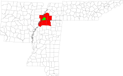 | ||||||||||
| U.S. Highways | |||||||||||
| State Highways |
| ||||||||||
| Other Highways | |||||||||||