Arkansas Highway 147
| ||||
|---|---|---|---|---|
| Route information | ||||
| Maintained by AHTD | ||||
| Length: | 25.83 mi[1] (41.57 km) | |||
| Major junctions | ||||
| South end: |
| |||
|
| ||||
| North end: |
| |||
| Location | ||||
| Counties: | Crittenden | |||
| Highway system | ||||
| ||||

Highway 147 (AR 147, Ark. 147, and Hwy. 147) is a north–south state highway in Crittenden County, Arkansas. The route of 25.83 miles (41.57 km) runs from Highway 131 at Bruins north across Interstate 40/US Route 63/US Route 79 (I-40/US 63/US 70/US 79) to US 64 near West Memphis.[2] A portion of the route make up the western routing of the Great River Road.[3]
Route description
Highway 147 begins near Horseshoe Lake, Arkansas at the southern terminus of Highway 131. The route runs north to serve as the eastern terminus of Highway 38, with Highway 147 picking up the Great River Road designation northbound. Highway 147 has another junction with Highway 131 before curving due north along the Mississippi River. The highway serves as the eastern terminus for Highway 50 south of Anthonyville, Arkansas before meeting a different Highway 131 in Edmondson. Highway 147 has a junctions with US 70 and I-40/US 63/US 79, with the former being the southern frontage road for the latter. The road continues north to terminate at US 64 near the city limits of West Memphis.[2]
Major intersections
Mile markers reset at concurrencies. The entire route is in Crittenden County.
| Location | mi[1] | km | Destinations | Notes | |
|---|---|---|---|---|---|
| Bruins | 0.00 | 0.00 | Southern terminus, AR 131 southern terminus | ||
| | 2.80 | 4.51 | AR 38 eastern terminus | ||
| Thompson Grove | 5.80 | 9.33 | AR 131 northern terminus | ||
| | 11.03 | 17.75 | |||
| Edmondson | 19.17 | 30.85 | AR 131 northern terminus | ||
| Lehi | 21.18 | 34.09 | |||
| | 21.25 | 34.20 | I-40 exit 271 | ||
| Cunningham Corner | 24.31 | 39.12 | AR 218 eastern terminus | ||
| | 25.83 | 41.57 | Northern terminus | ||
| 1.000 mi = 1.609 km; 1.000 km = 0.621 mi | |||||
See also
-
 Arkansas portal
 -
 U.S. Roads portal
References
- 1 2 Planning and Research Division (2010). "Arkansas Road Log Database". Arkansas State Highway and Transportation Department. Archived from the original (Database) on 23 June 2011. Retrieved June 9, 2011.
- 1 2 General Highway Map, Crittenden County, Arkansas (PDF) (Map). 1:62500. Cartography by Planning and Research Division. Arkansas State Highway and Transportation Department. January 2, 2007. Retrieved July 23, 2012.
- ↑ The Mississippi River plus The Great River Road (PDF) (Map). Experience Mississippi River. Archived (PDF) from the original on 10 July 2011. Retrieved June 20, 2011.
Roads of Memphis | |||||||||||
|---|---|---|---|---|---|---|---|---|---|---|---|
| Interstate Highways | 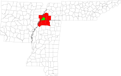 | ||||||||||
| U.S. Highways | |||||||||||
| State Highways |
| ||||||||||
| Other Highways | |||||||||||