Arkansas Highway 191
| ||||
|---|---|---|---|---|
| Route information | ||||
| Maintained by AHTD | ||||
| Length: | 2.3 mi[1] (3.7 km) | |||
| Major junctions | ||||
| South end: |
| |||
| North end: |
| |||
| Location | ||||
| Counties: | Crittenden | |||
| Highway system | ||||
| ||||

Arkansas Highway 191 (AR 191, Hwy. 191) is a 2.27-mile (3.65 km) state highway located entirely within West Memphis in the U.S. state of Arkansas. The highway runs from U.S. Highway 70 (US 70) north to Highway 77.[2] The highway is maintained by the Arkansas State Highway and Transportation Department (AHTD).
Route description
Highway 191 begins at a junction with US 70 in West Memphis. The highway heads north through a mixed residential and business area, crossing the Tenmile Bayou within this area. It crosses another bridge before reaching a junction with exit 278 of the concurrent Interstate 40 (I-40), I-55, US 61, US 64, and US 79. The route heads through an open field north of this interchange, curving westward within the field to parallel a Union Pacific Railroad line. Highway 191 terminates at an intersection with Highway 77 in an industrial area.[2][3]
History
The route which Highway 191 follows first appeared on the 1966 Arkansas state highway map.[4]
Major intersections
The entire route is in West Memphis, Crittenden County.
| mi[3] | km | Destinations | Notes | ||
|---|---|---|---|---|---|
| 0.0 | 0.0 | ||||
| 1.3 | 2.1 | ||||
| 2.3 | 3.7 | ||||
| 1.000 mi = 1.609 km; 1.000 km = 0.621 mi | |||||
See also
 Arkansas portal
 U.S. Roads portal
References
- ↑ Crittenden County State Highway Route and Section Map (PDF) (Map). Arkansas State Highway and Transportation Department. Retrieved 2010-10-17.
- 1 2 Crittenden County (PDF) (Map). Arkansas State Highway and Transportation Department. Retrieved October 17, 2010.
- 1 2 Google (January 5, 2011). "Overview map of Highway 191" (Map). Google Maps. Google. Retrieved January 5, 2011.
- ↑ 1966 Highway Map of Arkansas (Map). Arkansas State Highway Department. 1966.
Roads of Memphis | |||||||||||
|---|---|---|---|---|---|---|---|---|---|---|---|
| Interstate Highways | 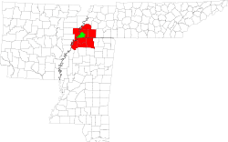 | ||||||||||
| U.S. Highways | |||||||||||
| State Highways |
| ||||||||||
| Other Highways | |||||||||||