Interstate 55
| |
|---|---|
 | |
| Route information | |
| Length: | 964.25 mi[1] (1,551.81 km) |
| Major junctions | |
| South end: |
|
|
| |
| North end: |
|
| Location | |
| States: | Louisiana, Mississippi, Tennessee, Arkansas, Missouri, Illinois |
| Highway system | |

Interstate 55 (I-55) is a major Interstate Highway in the central United States. As with most interstates that end in a five, it is a major cross-country, north-south route, connecting the Gulf of Mexico to the Great Lakes. The highway travels from LaPlace, Louisiana, at I-10 to Chicago at U.S. Route 41 (US 41, Lake Shore Drive), at McCormick Place.
The section of I-55 between Chicago and St. Louis was built as an alternate route for US 66. It crosses the Mississippi River twice: once at Memphis, Tennessee, and again at St. Louis, Missouri.
History
When it was realized that a national highway system was needed, the Federal Aid Highway Act of 1956 provided for a highway replacing the old Route 66 which I-55 filled. I-55 was originally constructed in the 1970s, to extend a section of Route 66 between I-294 and Gardner which had been converted into a freeway and had Interstate signage installed in 1960. During the rest of the 1960s, I-55 was built in portions throughout Illinois eventually connecting St. Louis to Chicago where it became the fourth direct route between them. As it goes southwards, most of the Interstate was purpose-built during the 1960s and 70s. The entire length was completed in 1979.
Route description
| mi[1] | km | |
|---|---|---|
| LA | 65.81 | 105.91 |
| MS | 290.41 | 467.37 |
| TN | 12.28 | 19.76 |
| AR | 72.22 | 116.22 |
| MO | 210.45 | 338.69 |
| IL | 293.80 | 472.72 |
| Total | 964.25 | 1,551.81 |
Louisiana
In Louisiana, I-55 runs nearly 66 miles (106 km) from south to north, from I-10 near Laplace (25 miles (40 km) west of New Orleans) to the Mississippi state line near Kentwood, Louisiana. Approximately 1⁄3 of the distance consists of the Manchac Swamp Bridge, a nearly 23-mile (37 km) causeway, often cited as the third-longest viaduct in the world.
Mississippi
In Mississippi, I-55 runs 290.5 miles (467.5 km) from the Louisiana border near Osyka, Mississippi to Southaven on the Tennessee border, just south of Memphis. Noteworthy cities and towns that I-55 passes through or close by to are McComb, Jackson, and Grenada. This highway parallels US 51 in its path roughly through the center of Mississippi. The eight miles (13 km) from Hernando to the Tennessee state line coincide with the newer I-69.
The Mississippi section of I-55 is defined in the Mississippi Code § 65-3-3.
Tennessee
I-55 in Tennessee lies entirely within the city of Memphis, passing through the southern and western parts of the city and providing a bypass of downtown for motorists who do not want to take I-240 and I-40 through downtown to cross the Mississippi River. The western portion of this highway, which passes through an industrialized section of the city, contains numerous low-clearance bridges, and also a very tight 270-degree cloverleaf turn northbound at Crump Boulevard. The Tennessee Department of Transportation currently has an interchange improvement project for this portion. Heavy truck traffic heading to and from Arkansas in this area is hence directed to detour via I-240 and I-40.
For the Tennessee stretch of the Interstate, the usual national freeway speed limit of 70 mph (115 km/h) is reduced to 65 mph (105 km/h).[2]
I-255 was the former numbering of I-240 between I-55 and I-40 through midtown Memphis, Tennessee.
Arkansas
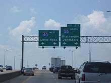
I-55 enters Arkansas from Tennessee as it crosses the Mississippi River on the Memphis & Arkansas Bridge. It overlaps I-40 for approximately 2.8 miles (4.5 km) in West Memphis. After separating from I-40, I-55 turns northward and runs with US 61, US 63, and US 64 until US 64 exits in through Marion.[3] I-55/US 61/US 63 continue north through Crittenden County through rural farms of the Arkansas delta, including an interchange with I-555/US 63 in Turrell. I-55 passes through Blytheville, where it has a junction with Highway 18 before entering Missouri.[4] I-55 parallels U.S. 61 in its path through Arkansas, which it continues to do after crossing into Missouri.
Missouri
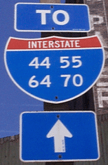
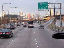
In Missouri, I-55 runs from the southeastern part of the state, at the Arkansas border, to St. Louis. In this city, I-44 merges in with I-55, and then I-64 (on the Poplar Street Bridge), when crossing the Mississippi River into Illinois.
Among the cities and towns served by I-55 in Missouri are Sikeston, Cape Girardeau, and St. Louis.
As noted above, I-55 parallels US 61 for most of its course through Missouri, from the Arkansas border to the Southern portion of St. Louis County.
Illinois
I-55 largely follows the 1940 alignment of the former US 66, now Historic US 66 (Illinois Route 66 Scenic Byway), through Illinois. Entering Illinois from the south, I-55 near the I-270/I-70 split is referred to as the Paul Simon Freeway, named for former U.S. Senator Paul Simon, who began his political career in this region. Further north, between the St. Louis area and Springfield, I-55 is named the Vince Demuzio Expressway for former Illinois State Senator Vince Demuzio. I-55 parallels the third (1940) alignment of US 66 in Illinois from East St. Louis to Joliet, passing around the state capital of Springfield and likewise around the metro areas of Bloomington-Normal and Joliet. In the Chicago area, between the I-80 interchange near Joliet and I-55's eastern terminus at US 41 (Lake Shore Drive) in Chicago, the expressway is referred to as the Adlai E. Stevenson Expressway in honor of former Illinois governor Adlai E. Stevenson II, who was also the U.S. Ambassador to the United Nations under Presidents John F. Kennedy and Lyndon B. Johnson.
When this freeway was being planned during the 1960s, the Illinois Governor Otto Kerner, Jr., made an effort to have it routed close to the larger city of Peoria instead of the straighter route through the Bloomington-Normal area. This ultimately failed plan was ridiculed in the press as the so-called "Kerner Curve." The need for a freeway connection between Springfield and Peoria was later filled by the spur route I-155. This also connects with nearby Lincoln and Morton and forms a triangle between the three population centers in Central Illinois.[5]
Junction list
- Louisiana
-
 I‑10 in LaPlace
 -
 US 51 northeast of LaPlace. The highways travel concurrently to Hammond.
 -
 I‑12 in Hammond
 -
 US 190 in Hammond
 - Mississippi
-
 US 98 in McComb. The highways travel concurrently to Summit.
 -
 US 84 south-southwest of Brookhaven
 - US 51 in Crystal Springs. The highways travel concurrently to Jackson.
-
 I‑20 / US 49 / US 51 in Jackson. I-20/I-55/US 49 travel concurrently to Richland.
 -
 I‑220 in Ridgeland
 -
 US 82 in Winona
 -
 US 278 in Batesville
 -
 I‑69 in Hernando. The highways travel concurrently to Memphis, Tennessee.
 - Tennessee
- US 51 in Memphis
-
 I‑69 / I‑240 in Memphis
 -
 US 61 in Memphis
 -


 US 61 / US 64 / US 70 / US 79 in Memphis. I-55/US 61 travels concurrently to Turrell, Arkansas. I-55/US 64 travels concurrently to Marion, Arkansas. I-55/US 70/US 79 travels concurrently to West Memphis, Arkansas.
 - Arkansas
-
 I‑40 in West Memphis. The highways travel concurrently through West Memphis.
 -
 I‑40 / US 63 / US 79 in West Memphis. I-55/US 63 travels concurrently to Turrell.
 - US 61 in Blytheville
- Missouri
- US 61 east of Steele. The highways travel concurrently to Portageville.
-

 I‑155 / US 412 in Hayti
 -
 US 61 / US 62 in New Madrid
 - US 61 / US 62 north of New Madrid
-

 I‑57 / US 60 on the Sikeston–Miner city line
 - US 62 in Miner
- US 61 in Scott City. The highways travel concurrently to Cape Cirardeau.
- US 61 in Cape Girardeau
- US 61 north-northeast of Jackson
- US 61 south-southeast of Festus
-
 US 67 in Festus
 -
 I‑255 on the Concord–Mehlville CDP line
 -
 US 50 / US 61 / US 67 on the Concord–Green Park–Mehlville line
 -
 I‑44 on the McKinley Heights–Soulard, St. Louis neighborhood line. The highways travel concurrently to Downtown St. Louis.
 -

 I‑44 / I‑64 / US 40 in Downtown, St. Louis. I-55/I-64 travels concurrently to East St. Louis, Illinois. I-55/US 40 travels concurrently to Troy, Illinois.
 - Illinois
-
 I‑64 / I‑70 in East St. Louis. I-55/I-70 travels concurrently to northwest of Troy.
 - I‑255 in Collinsville
-
 I‑70 / I‑270 northwest of Troy
 -

 I‑72 / US 36 in Springfield. The highways travel concurrently through Springfield.
 - I‑155 northwest of Lincoln
-
 US 136 southeast of McLean
 -
 I‑74 / US 51 in Bloomington. I-55/I-74 travels concurrently to northwest of Normal. I-55/US 51 travels concurrently to Normal.
 -
 US 150 in Bloomington
 -
 I‑39 / US 51 in Normal
 -
 US 24 in Chenoa
 -
 US 6 in Channahon
 -
 I‑80 in Channahon
 -
 US 52 in Shorewood
 -
 US 30 in Joliet
 -
 I‑355 on the Bolingbrook–Woodridge city line
 -
 I‑294 on the Burr Ridge–Indian Head Park–Countryside line
 -


 US 12 / US 20 / US 45 on the Countryside–Hodgkins city line
 -
 I‑90 / I‑94 in Armour Square, Chicago
 -
 US 41 in Near South Side, Chicago
Auxiliary routes
- Spur to Jonesboro, Arkansas: I-555
- Caruthersville, Missouri to Dyersburg, Tennessee: I-155
- St. Louis, Missouri, area: I-255
- Spur to Peoria, Illinois: I-155
- In the southwestern suburbs of Chicago: I-355
References
- 1 2 Staff (December 31, 2013). "Table 1: Main Routes of the Dwight D. Eisenhower National System of Interstate and Defense Highways As of December 31, 2013". Federal Highway Administration. Retrieved August 19, 2014.
- ↑ "Getting Around". City Visitors Guide. Retrieved August 24, 2013.
- ↑ General Highway Map, Crittenden County, Arkansas (PDF) (Map). 1:62500. Cartography by Planning and Research Division. Arkansas State Highway and Transportation Department. January 2, 2007. Retrieved April 26, 2012.
- ↑ General Highway Map, Mississippi County, Arkansas (PDF) (Map). 1:62500. Cartography by Planning and Research Division. Arkansas State Highway and Transportation Department. January 11, 2010. Retrieved April 26, 2012.
- ↑ Unknown (January 1, 2000). "Despite dead-end for I-55's Kerner Curve, I-74 changed area forever". Peoria Journal-Star. Retrieved February 17, 2008.
External links
| Wikimedia Commons has media related to Interstate 55. |
| Signed | |||||||||||
|---|---|---|---|---|---|---|---|---|---|---|---|
| Unsigned | |||||||||||
| Lists |
| ||||||||||
Major Interstates highlighted | |||||||||||
| ||