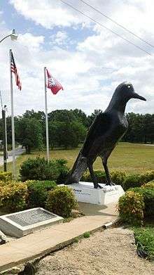
Ravenden, Arkansas
| Ravenden, Arkansas | |
|---|---|
| Town | |
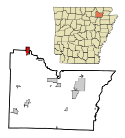 Location in Lawrence County and the state of Arkansas | |
| Coordinates: 36°14′2″N 91°15′7″W / 36.23389°N 91.25194°WCoordinates: 36°14′2″N 91°15′7″W / 36.23389°N 91.25194°W | |
| Country | United States |
| State | Arkansas |
| County | Lawrence |
| Area | |
| • Total | 2.1 sq mi (5.4 km2) |
| • Land | 2.1 sq mi (5.4 km2) |
| • Water | 0 sq mi (0 km2) |
| Elevation | 338 ft (103 m) |
| Population (2000) | |
| • Total | 511 |
| • Density | 243.3/sq mi (94.6/km2) |
| Time zone | Central (CST) (UTC-6) |
| • Summer (DST) | CDT (UTC-5) |
| ZIP code | 72459 |
| Area code(s) | 870 |
| FIPS code | 05-58250 |
| GNIS feature ID | 0058465 |
Ravenden is a town in Lawrence County, Arkansas, United States. The population was 470 at the 2010 census.
U.S. Highway 63 runs through the town, as does the Burlington-Northern Railroad. The community building, still in use, was dedicated in 1960. Ray Ellis was mayor at that time. Also in 1960, the railroad agent for the Frisco Railroad (St. Louis-San Francisco Railroad) was Charles Roark. The Frisco was bought out by, and merged with, the Burlington-Northern Railroad in 1980.
Spring River flows near Ravenden. Spring River originates at Mammoth Spring, Arkansas, its flow coming from a very large spring there. Spring River flows into Black River near Black Rock, Arkansas. The Black River, which originates in the Southeastern Missouri counties of Iron and Reynolds, flows into Arkansas in Clay County, near Corning. It flows into the White River at Jacksonport, in Jackson County, just above Newport. The White River originates in the Boston Mountains in Madison County, Arkansas. The White River, after flowing north into Missouri, cuts back south and across Arkansas. The White River joins the Mississippi River just south of Arkansas City, Arkansas, in Desha County.
There are quite a number of other cities and towns in Lawrence County. These include Walnut Ridge, the county seat, and the cities of Black Rock and Hoxie. Towns include: Alicia, College City, Imboden, Lynn, Minturn, Portia, Powhatan, Sedgwick, Smithville, and Strawberry.
Geography
Ravenden is located at 36°14′2″N 91°15′7″W / 36.23389°N 91.25194°W (36.233972, -91.251911).[1]
According to the United States Census Bureau, the town has a total area of 2.1 square miles (5.4 km2), of which, 2.1 square miles (5.4 km2) of it is land and 0.48% is water.
List Of Highways
Demographics
| Historical population | |||
|---|---|---|---|
| Census | Pop. | %± | |
| 1940 | 240 | — | |
| 1950 | 245 | 2.1% | |
| 1960 | 231 | −5.7% | |
| 1970 | 219 | −5.2% | |
| 1980 | 338 | 54.3% | |
| 1990 | 330 | −2.4% | |
| 2000 | 511 | 54.8% | |
| 2010 | 470 | −8.0% | |
| Est. 2015 | 450 | [2] | −4.3% |
As of the census[4] of 2000, there were 511 people, 209 households, and 145 families residing in the town. The population density was 246.7 people per square mile (95.3/km²). There were 254 housing units at an average density of 122.6 per square mile (47.4/km²). The racial makeup of the town was 97.26% White, 1.76% Native American, 0.59% from other races, and 0.39% from two or more races. 1.37% of the population were Hispanic or Latino of any race.
There were 209 households out of which 34.9% had children under the age of 18 living with them, 53.6% were married couples living together, 12.9% had a female householder with no husband present, and 30.6% were non-families. 26.8% of all households were made up of individuals and 9.6% had someone living alone who was 65 years of age or older. The average household size was 2.44 and the average family size was 2.97.
In the town the population was spread out with 27.6% under the age of 18, 8.8% from 18 to 24, 24.9% from 25 to 44, 23.1% from 45 to 64, and 15.7% who were 65 years of age or older. The median age was 37 years. For every 100 females there were 97.3 males. For every 100 females age 18 and over, there were 93.7 males.
The median income for a household in the town was $25,625, and the median income for a family was $29,896. Males had a median income of $23,281 versus $14,444 for females. The per capita income for the town was $10,723. About 19.5% of families and 28.4% of the population were below the poverty line, including 48.6% of those under age 18 and 15.1% of those age 65 or over.
References
- ↑ "US Gazetteer files: 2010, 2000, and 1990". United States Census Bureau. 2011-02-12. Retrieved 2011-04-23.
- ↑ "Annual Estimates of the Resident Population for Incorporated Places: April 1, 2010 to July 1, 2015". Retrieved July 2, 2016.
- ↑ "Census of Population and Housing". Census.gov. Retrieved June 4, 2015.
- ↑ "American FactFinder". United States Census Bureau. Retrieved 2008-01-31.
External links
Municipalities and communities of Lawrence County, Arkansas, United States | ||
|---|---|---|
| Cities | 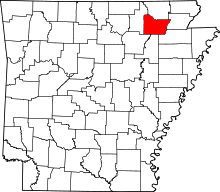 | |
| Towns | ||
| Unincorporated communities | ||