Cave City, Arkansas
| Cave City, Arkansas | |
|---|---|
| City | |
 Location in Sharp County and the state of Arkansas | |
| Coordinates: 35°56′53″N 91°33′3″W / 35.94806°N 91.55083°WCoordinates: 35°56′53″N 91°33′3″W / 35.94806°N 91.55083°W | |
| Country | United States |
| State | Arkansas |
| Counties | Independence, Sharp |
| Townships |
Barren (Independence) Cave (Sharp) |
| Settled | 1890 |
| Founded by | James Andrew Laman and John William Laman |
| Area | |
| • Total | 2.6 sq mi (6.7 km2) |
| • Land | 2.6 sq mi (6.7 km2) |
| • Water | 0 sq mi (0 km2) |
| Elevation | 676 ft (206 m) |
| Population (2010) | |
| • Total | 1,904 |
| • Density | 740/sq mi (280/km2) |
| Time zone | Central (CST) (UTC-6) |
| • Summer (DST) | CDT (UTC-5) |
| ZIP code | 72521 |
| Area code(s) | 870 |
| FIPS code | 05-12280 |
| GNIS feature ID | 0076551 |
| Website | https://www.facebook.com/cavecityarkansas |
Cave City is a city in Independence and Sharp counties in the U.S. state of Arkansas. The population was 1,904 at the 2010 census.[1] The city was named for a large cave underneath the Crystal River Tourist Camp, which is the oldest motor court in Arkansas.[2] Cave City is known for its award-winning "world's sweetest" watermelons and holds an annual watermelon festival in August.[3]
Geography
Cave City is located at 35°56′53″N 91°33′3″W / 35.94806°N 91.55083°W (35.948087, -91.550952).[4] The town is centered on, and partially located above, the Crystal River, an underground body of water located in the multi-room Crystal River Cave, for which the town is named. The beginning and ending of the water source has never been determined.
According to the United States Census Bureau, the city has a total area of 2.6 square miles (6.7 km2), all of it land.
List of highways
Demographics
| Historical population | |||
|---|---|---|---|
| Census | Pop. | %± | |
| 1910 | 278 | — | |
| 1920 | 243 | −12.6% | |
| 1930 | 296 | 21.8% | |
| 1940 | 427 | 44.3% | |
| 1950 | 442 | 3.5% | |
| 1960 | 540 | 22.2% | |
| 1970 | 807 | 49.4% | |
| 1980 | 1,634 | 102.5% | |
| 1990 | 1,503 | −8.0% | |
| 2000 | 1,946 | 29.5% | |
| 2010 | 1,904 | −2.2% | |
| Est. 2015 | 1,868 | [5] | −1.9% |
2014 Estimate[7] | |||
As of the census[8] of 2000, there were 1,946 people, 775 households, and 538 families residing in the city. The population density was 752.7 people per square mile (290.1/km²). There were 843 housing units at an average density of 326.1 per square mile (125.7/km²). The racial makeup of the city was 97.84% White, 0.57% Black or African American, 0.72% Native American, 0.05% Asian, and 0.82% from two or more races. 1.18% of the population were Hispanic or Latino of any race.

There were 775 households out of which 35.2% had children under the age of 18 living with them, 52.5% were married couples living together, 13.5% had a female householder with no husband present, and 30.5% were non-families. 27.4% of all households were made up of individuals and 15.9% had someone living alone who was 65 years of age or older. The average household size was 2.42 and the average family size was 2.91.
In the city the population was spread out with 27.3% under the age of 18, 8.5% from 18 to 24, 25.8% from 25 to 44, 18.0% from 45 to 64, and 20.4% who were 65 years of age or older. The median age was 36 years. For every 100 females there were 79.9 males. For every 100 females age 18 and over, there were 74.5 males.
The median income for a household in the city was $23,163, and the median income for a family was $27,292. Males had a median income of $21,397 versus $17,424 for females. The per capita income for the city was $11,925. About 17.0% of families and 21.3% of the population were below the poverty line, including 26.3% of those under age 18 and 15.6% of those age 65 or over.
Education
Students in the area can attend the Cave City School District.
References
- ↑ "Profile of General Population and Housing Characteristics: 2010 Demographic Profile Data (DP-1): Cave City city, Arkansas". U.S. Census Bureau, American Factfinder. Archived from the original on September 11, 2013. Retrieved August 10, 2012.
- ↑ "Cave Courts Motel - The Oldest Motor Court in Arkansas". American Profile. December 23, 2000. Retrieved 2011-08-28.
- ↑ DeLano, Patti (2005). Off the Beaten Path, Arkansas (9th ed.). Guilford, Connecticut: Morris Book Publishing. ISBN 978-0-7627-4856-3. ISSN 1537-0550.
- ↑ "US Gazetteer files: 2010, 2000, and 1990". United States Census Bureau. 2011-02-12. Retrieved 2011-04-23.
- ↑ "Annual Estimates of the Resident Population for Incorporated Places: April 1, 2010 to July 1, 2015". Retrieved July 2, 2016.
- ↑ "Census of Population and Housing". Census.gov. Archived from the original on May 11, 2015. Retrieved June 4, 2015.
- ↑ "Annual Estimates of the Resident Population for Incorporated Places: April 1, 2010 to July 1, 2014". Retrieved June 4, 2015.
- ↑ "American FactFinder". United States Census Bureau. Archived from the original on 2013-09-11. Retrieved 2008-01-31.
Municipalities and communities of Independence County, Arkansas, United States | ||
|---|---|---|
| Cities |  | |
| Towns | ||
| Unincorporated communities |
| |
| Ghost towns |
| |
| Footnotes | ‡This populated place also has portions in an adjacent county or counties | |
Municipalities and communities of Sharp County, Arkansas, United States | ||
|---|---|---|
| Cities | 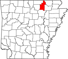 | |
| Towns | ||
| Unincorporated communities |
| |
| Footnotes | ‡This populated place also has portions in an adjacent county or counties | |