Arkansas Highway 88
| ||||
|---|---|---|---|---|
 | ||||
| Route information | ||||
| Maintained by AHTD | ||||
| Highway system | ||||
| ||||


Highway 88 (AR 88, Ark. 88, and Hwy. 88) is an east–west highway in Arkansas. Its western terminus is at the Oklahoma state line where it continues as Oklahoma State Highway 1. Between the Oklahoma state line and U.S. Highway 71 in Mena, Highway 88 is also called Talimena Scenic Drive, and is both an Arkansas Scenic Byway and a National Scenic Byway.[1]
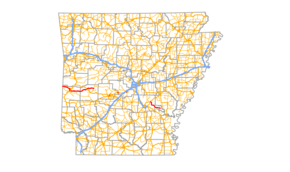
At Mena, it runs along the north direction of U.S. 71 (geographically east) for 2 miles (3.2 km) until U.S. 71 turns back to the north. From there, Highway 88 continues east for 24 miles (39 km) parallelling the Ouachita River and passing through the communities of Ink, Cherry Hill, Pine Ridge and Oden before intersecting U.S. Highway 270 at Pencil Bluff. Highway 88 then continues east another 14 miles (23 km) passing through the community of Sims before ending at Highway 27 at Washita.
A second segment of Highway 88 begins at an intersection with Highway 35 in Benton, runs for a few blocks on Military Road (a former route of U.S. 67-70 and US 70C/I-30 Business Loop), then runs west approximately 2½ miles as Alcoa Road before ending at Benton Parkway.
A third segment of Highway 88 begins at U.S. Highway 79 at Altheimer and runs 24 miles (39 km) south and east passing through the communities of Cornerstone, Sweden, and Swan Lake before ending at Highway 11 at Reydell.
A fourth segment of Highway 88 begins and ends at Highway 7 in Hot Springs. It runs about 3 miles and has an intersection with the U.S. 70-270 bypass of Hot Springs along its route.
References
- ↑ Talimena Scenic Drive National Scenic Byway (Arkansas State Highway and Transportation Department). Accessed July 8, 2011.