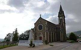
Semons
| Semons | |
|---|---|
 | |
 Semons | |
|
Location within Auvergne-Rhône-Alpes region  Semons | |
| Coordinates: 45°25′58″N 5°11′44″E / 45.4328°N 5.1956°ECoordinates: 45°25′58″N 5°11′44″E / 45.4328°N 5.1956°E | |
| Country | France |
| Region | Auvergne-Rhône-Alpes |
| Department | Isère |
| Arrondissement | Vienne |
| Canton | Côte-Saint-André |
| Intercommunality | Pays de Bièvre-Liers |
| Government | |
| • Mayor (2014–2020) | Jean-Paul Tournier-Fillon |
| Area1 | 10.55 km2 (4.07 sq mi) |
| Population (2011)2 | 368 |
| • Density | 35/km2 (90/sq mi) |
| Time zone | CET (UTC+1) |
| • Summer (DST) | CEST (UTC+2) |
| INSEE/Postal code | 38479 / 38260 |
| Elevation | 388–564 m (1,273–1,850 ft) |
|
1 French Land Register data, which excludes lakes, ponds, glaciers > 1 km² (0.386 sq mi or 247 acres) and river estuaries. 2 Population without double counting: residents of multiple communes (e.g., students and military personnel) only counted once. | |
Semons is a commune in the Isère department in southeastern France.
Population
| Historical population | ||
|---|---|---|
| Year | Pop. | ±% |
| 1793 | 233 | — |
| 1806 | 455 | +95.3% |
| 1821 | 453 | −0.4% |
| 1831 | 399 | −11.9% |
| 1841 | 454 | +13.8% |
| 1851 | 503 | +10.8% |
| 1861 | 503 | +0.0% |
| 1872 | 458 | −8.9% |
| 1881 | 447 | −2.4% |
| 1891 | 431 | −3.6% |
| 1901 | 384 | −10.9% |
| 1911 | 349 | −9.1% |
| 1921 | 328 | −6.0% |
| 1931 | 308 | −6.1% |
| 1946 | 225 | −26.9% |
| 1954 | 205 | −8.9% |
| 1962 | 237 | +15.6% |
| 1968 | 220 | −7.2% |
| 1975 | 255 | +15.9% |
| 1982 | 281 | +10.2% |
| 1990 | 301 | +7.1% |
| 1999 | 291 | −3.3% |
| 2006 | 351 | +20.6% |
| 2011 | 368 | +4.8% |
See also
References
| Wikimedia Commons has media related to Semons. |
This article is issued from Wikipedia - version of the 10/28/2016. The text is available under the Creative Commons Attribution/Share Alike but additional terms may apply for the media files.