Poisat
| Poisat | ||
|---|---|---|
|
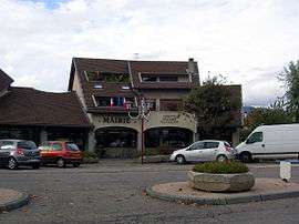
Town hall | ||
| ||
 Poisat | ||
|
Location within Auvergne-Rhône-Alpes region  Poisat | ||
| Coordinates: 45°09′31″N 5°45′33″E / 45.1587°N 5.7592°ECoordinates: 45°09′31″N 5°45′33″E / 45.1587°N 5.7592°E | ||
| Country | France | |
| Region | Auvergne-Rhône-Alpes | |
| Department | Isère | |
| Arrondissement | Grenoble | |
| Canton | Eybens | |
| Intercommunality | Grenoble Alpes Métropole | |
| Government | ||
| • Mayor (2014–2020) | Ludovic Bustos | |
| Area1 | 2.56 km2 (0.99 sq mi) | |
| Population (2011)2 | 2,070 | |
| • Density | 810/km2 (2,100/sq mi) | |
| Time zone | CET (UTC+1) | |
| • Summer (DST) | CEST (UTC+2) | |
| INSEE/Postal code | 38309 / 38320 | |
| Elevation |
214–724 m (702–2,375 ft) (avg. 250 m or 820 ft) | |
|
1 French Land Register data, which excludes lakes, ponds, glaciers > 1 km² (0.386 sq mi or 247 acres) and river estuaries. 2 Population without double counting: residents of multiple communes (e.g., students and military personnel) only counted once. | ||
Poisat is a commune in the Isère department in southeastern France.
Population
| Historical population | ||
|---|---|---|
| Year | Pop. | ±% |
| 1793 | 232 | — |
| 1806 | 260 | +12.1% |
| 1821 | 265 | +1.9% |
| 1831 | 340 | +28.3% |
| 1841 | 337 | −0.9% |
| 1851 | 315 | −6.5% |
| 1861 | 282 | −10.5% |
| 1872 | 263 | −6.7% |
| 1881 | 285 | +8.4% |
| 1891 | 257 | −9.8% |
| 1901 | 221 | −14.0% |
| 1911 | 216 | −2.3% |
| 1921 | 233 | +7.9% |
| 1931 | 257 | +10.3% |
| 1946 | 256 | −0.4% |
| 1954 | 456 | +78.1% |
| 1962 | 744 | +63.2% |
| 1968 | 1,074 | +44.4% |
| 1975 | 1,663 | +54.8% |
| 1982 | 2,056 | +23.6% |
| 1990 | 2,139 | +4.0% |
| 1999 | 2,081 | −2.7% |
| 2006 | 2,088 | +0.3% |
| 2011 | 2,070 | −0.9% |
See also
References
| Wikimedia Commons has media related to Poisat. |
This article is issued from Wikipedia - version of the 2/12/2016. The text is available under the Creative Commons Attribution/Share Alike but additional terms may apply for the media files.