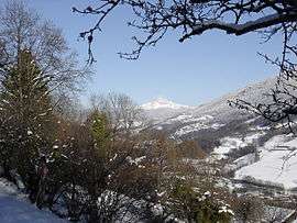
Le Moutaret
| Le Moutaret | |
|---|---|
 | |
 Le Moutaret | |
|
Location within Auvergne-Rhône-Alpes region  Le Moutaret | |
| Coordinates: 45°25′58″N 6°05′21″E / 45.4328°N 6.0892°ECoordinates: 45°25′58″N 6°05′21″E / 45.4328°N 6.0892°E | |
| Country | France |
| Region | Auvergne-Rhône-Alpes |
| Department | Isère |
| Arrondissement | Grenoble |
| Canton | Allevard |
| Intercommunality | Pays du Grésivaudan |
| Government | |
| • Mayor (2014–2020) | Alain Guilluy |
| Area1 | 5 km2 (2 sq mi) |
| Population (2011)2 | 228 |
| • Density | 46/km2 (120/sq mi) |
| Time zone | CET (UTC+1) |
| • Summer (DST) | CEST (UTC+2) |
| INSEE/Postal code | 38268 / 38580 |
| Elevation | 320–1,089 m (1,050–3,573 ft) |
|
1 French Land Register data, which excludes lakes, ponds, glaciers > 1 km² (0.386 sq mi or 247 acres) and river estuaries. 2 Population without double counting: residents of multiple communes (e.g., students and military personnel) only counted once. | |
Le Moutaret is a commune in the Isère department in southeastern France.
Population
| Historical population | ||
|---|---|---|
| Year | Pop. | ±% |
| 1793 | 436 | — |
| 1806 | 448 | +2.8% |
| 1821 | 456 | +1.8% |
| 1831 | 535 | +17.3% |
| 1841 | 534 | −0.2% |
| 1851 | 600 | +12.4% |
| 1861 | 530 | −11.7% |
| 1872 | 448 | −15.5% |
| 1881 | 419 | −6.5% |
| 1891 | 407 | −2.9% |
| 1901 | 343 | −15.7% |
| 1911 | 272 | −20.7% |
| 1921 | 258 | −5.1% |
| 1931 | 245 | −5.0% |
| 1946 | 202 | −17.6% |
| 1954 | 203 | +0.5% |
| 1962 | 179 | −11.8% |
| 1968 | 129 | −27.9% |
| 1975 | 127 | −1.6% |
| 1982 | 128 | +0.8% |
| 1990 | 142 | +10.9% |
| 1999 | 161 | +13.4% |
| 2006 | 198 | +23.0% |
| 2011 | 228 | +15.2% |
See also
References
| Wikimedia Commons has media related to Le Moutaret. |
This article is issued from Wikipedia - version of the 10/28/2016. The text is available under the Creative Commons Attribution/Share Alike but additional terms may apply for the media files.