Lavars
| Lavars | |
|---|---|
|
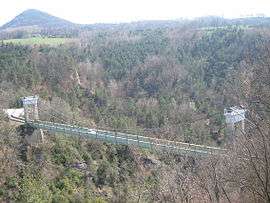
Brion Bridge | |
 Lavars | |
|
Location within Auvergne-Rhône-Alpes region  Lavars | |
| Coordinates: 44°50′58″N 5°40′23″E / 44.8494°N 5.6731°ECoordinates: 44°50′58″N 5°40′23″E / 44.8494°N 5.6731°E | |
| Country | France |
| Region | Auvergne-Rhône-Alpes |
| Department | Isère |
| Arrondissement | Grenoble |
| Canton | Mens |
| Intercommunality | Trièves |
| Government | |
| • Mayor (2014–2020) | Alain Hermile-Boudin |
| Area1 | 14.8 km2 (5.7 sq mi) |
| Population (2011)2 | 144 |
| • Density | 9.7/km2 (25/sq mi) |
| Time zone | CET (UTC+1) |
| • Summer (DST) | CEST (UTC+2) |
| INSEE/Postal code | 38208 / 38710 |
| Elevation | 484–1,080 m (1,588–3,543 ft) |
|
1 French Land Register data, which excludes lakes, ponds, glaciers > 1 km² (0.386 sq mi or 247 acres) and river estuaries. 2 Population without double counting: residents of multiple communes (e.g., students and military personnel) only counted once. | |
Lavars is a commune in the Isère department in southeastern France.
Population
| Historical population | ||
|---|---|---|
| Year | Pop. | ±% |
| 1793 | 348 | — |
| 1806 | 338 | −2.9% |
| 1821 | 279 | −17.5% |
| 1831 | 345 | +23.7% |
| 1941 | 364 | +5.5% |
| 1951 | 301 | −17.3% |
| 1861 | 301 | +0.0% |
| 1872 | 312 | +3.7% |
| 1881 | 304 | −2.6% |
| 1891 | 285 | −6.2% |
| 1901 | 222 | −22.1% |
| 1911 | 206 | −7.2% |
| 1921 | 176 | −14.6% |
| 1931 | 163 | −7.4% |
| 1946 | 140 | −14.1% |
| 1954 | 120 | −14.3% |
| 1962 | 101 | −15.8% |
| 1968 | 100 | −1.0% |
| 1975 | 105 | +5.0% |
| 1982 | 104 | −1.0% |
| 1990 | 117 | +12.5% |
| 1999 | 113 | −3.4% |
| 2007 | 129 | +14.2% |
| 2011 | 144 | +11.6% |
See also
References
| Wikimedia Commons has media related to Lavars. |
This article is issued from Wikipedia - version of the 10/28/2016. The text is available under the Creative Commons Attribution/Share Alike but additional terms may apply for the media files.