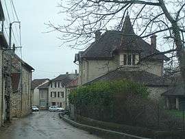
Vénérieu
| Vénérieu | |
|---|---|
 | |
 Vénérieu | |
|
Location within Auvergne-Rhône-Alpes region  Vénérieu | |
| Coordinates: 45°39′36″N 5°16′42″E / 45.66°N 5.2783°ECoordinates: 45°39′36″N 5°16′42″E / 45.66°N 5.2783°E | |
| Country | France |
| Region | Auvergne-Rhône-Alpes |
| Department | Isère |
| Arrondissement | La Tour-du-Pin |
| Canton | Crémieu |
| Intercommunality | Les Balmes Dauphinoises |
| Government | |
| • Mayor (2014–2020) | Bernard Odet |
| Area1 | 6 km2 (2 sq mi) |
| Population (2012)2 | 667 |
| • Density | 110/km2 (290/sq mi) |
| Time zone | CET (UTC+1) |
| • Summer (DST) | CEST (UTC+2) |
| INSEE/Postal code | 38532 / 38460 |
| Elevation |
217–420 m (712–1,378 ft) (avg. 250 m or 820 ft) |
|
1 French Land Register data, which excludes lakes, ponds, glaciers > 1 km² (0.386 sq mi or 247 acres) and river estuaries. 2 Population without double counting: residents of multiple communes (e.g., students and military personnel) only counted once. | |
Vénérieu is a commune in the Isère department in southeastern France.
Population
| Historical population | ||
|---|---|---|
| Year | Pop. | ±% |
| 1793 | 301 | — |
| 1806 | 314 | +4.3% |
| 1821 | 334 | +6.4% |
| 1831 | 331 | −0.9% |
| 1841 | 352 | +6.3% |
| 1851 | 422 | +19.9% |
| 1861 | 425 | +0.7% |
| 1872 | 450 | +5.9% |
| 1881 | 367 | −18.4% |
| 1891 | 420 | +14.4% |
| 1901 | 420 | +0.0% |
| 1911 | 412 | −1.9% |
| 1921 | 337 | −18.2% |
| 1931 | 336 | −0.3% |
| 1946 | 267 | −20.5% |
| 1954 | 277 | +3.7% |
| 1962 | 258 | −6.9% |
| 1968 | 221 | −14.3% |
| 1975 | 231 | +4.5% |
| 1982 | 270 | +16.9% |
| 1990 | 338 | +25.2% |
| 1999 | 382 | +13.0% |
| 2006 | 514 | +34.6% |
| 2012 | 667 | +29.8% |
See also
References
| Wikimedia Commons has media related to Vénérieu. |
This article is issued from Wikipedia - version of the 10/28/2016. The text is available under the Creative Commons Attribution/Share Alike but additional terms may apply for the media files.