Domarin
| Domarin | |
|---|---|
 | |
 Domarin | |
|
Location within Auvergne-Rhône-Alpes region  Domarin | |
| Coordinates: 45°35′11″N 5°14′42″E / 45.5864°N 5.245°ECoordinates: 45°35′11″N 5°14′42″E / 45.5864°N 5.245°E | |
| Country | France |
| Region | Auvergne-Rhône-Alpes |
| Department | Isère |
| Arrondissement | La Tour-du-Pin |
| Canton | Bourgoin-Jallieu-Sud |
| Intercommunality | Porte de l'Isère |
| Government | |
| • Mayor (2014–2020) | Alain Mary |
| Area1 | 2.99 km2 (1.15 sq mi) |
| Population (2011)2 | 1,423 |
| • Density | 480/km2 (1,200/sq mi) |
| Time zone | CET (UTC+1) |
| • Summer (DST) | CEST (UTC+2) |
| INSEE/Postal code | 38149 / 38300 |
| Elevation | 231–450 m (758–1,476 ft) |
|
1 French Land Register data, which excludes lakes, ponds, glaciers > 1 km² (0.386 sq mi or 247 acres) and river estuaries. 2 Population without double counting: residents of multiple communes (e.g., students and military personnel) only counted once. | |
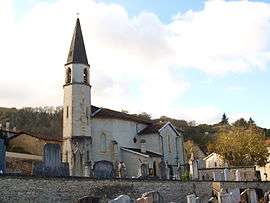
Domarin is a commune in the Isère department in southeastern France.
Population
| Historical population | ||
|---|---|---|
| Year | Pop. | ±% |
| 1800 | 321 | — |
| 1821 | 400 | +24.6% |
| 1831 | 434 | +8.5% |
| 1841 | 415 | −4.4% |
| 1851 | 388 | −6.5% |
| 1861 | 329 | −15.2% |
| 1872 | 300 | −8.8% |
| 1881 | 291 | −3.0% |
| 1891 | 381 | +30.9% |
| 1901 | 361 | −5.2% |
| 1911 | 338 | −6.4% |
| 1921 | 340 | +0.6% |
| 1931 | 404 | +18.8% |
| 1946 | 505 | +25.0% |
| 1954 | 516 | +2.2% |
| 1962 | 553 | +7.2% |
| 1968 | 610 | +10.3% |
| 1975 | 846 | +38.7% |
| 1982 | 1,253 | +48.1% |
| 1990 | 1,382 | +10.3% |
| 1999 | 1,428 | +3.3% |
| 2007 | 1,412 | −1.1% |
| 2011 | 1,423 | +0.8% |
See also
References
| Wikimedia Commons has media related to Domarin. |
This article is issued from Wikipedia - version of the 10/28/2016. The text is available under the Creative Commons Attribution/Share Alike but additional terms may apply for the media files.