La Verpillière
| La Verpillière | ||
|---|---|---|
|
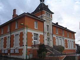
Town hall | ||
| ||
 La Verpillière | ||
|
Location within Auvergne-Rhône-Alpes region  La Verpillière | ||
| Coordinates: 45°38′16″N 5°08′37″E / 45.6378°N 5.1436°ECoordinates: 45°38′16″N 5°08′37″E / 45.6378°N 5.1436°E | ||
| Country | France | |
| Region | Auvergne-Rhône-Alpes | |
| Department | Isère | |
| Arrondissement | La Tour-du-Pin | |
| Canton | Verpillière | |
| Intercommunality | Porte de l'Isère | |
| Government | ||
| • Mayor (2014–2020) | Patrick Margier | |
| Area1 | 6.64 km2 (2.56 sq mi) | |
| Population (2012)2 | 6,528 | |
| • Density | 980/km2 (2,500/sq mi) | |
| Time zone | CET (UTC+1) | |
| • Summer (DST) | CEST (UTC+2) | |
| INSEE/Postal code | 38537 / 38290 | |
| Elevation | 205–305 m (673–1,001 ft) | |
|
1 French Land Register data, which excludes lakes, ponds, glaciers > 1 km² (0.386 sq mi or 247 acres) and river estuaries. 2 Population without double counting: residents of multiple communes (e.g., students and military personnel) only counted once. | ||

La Verpillière is a commune in the Isère department in southeastern France.
Geography
The Bourbre flows northwest through the northern part of the commune.
Population
| Historical population | ||
|---|---|---|
| Year | Pop. | ±% |
| 1793 | 559 | — |
| 1806 | 647 | +15.7% |
| 1821 | 775 | +19.8% |
| 1831 | 1,062 | +37.0% |
| 1841 | 1,186 | +11.7% |
| 1851 | 1,220 | +2.9% |
| 1861 | 1,229 | +0.7% |
| 1872 | 1,243 | +1.1% |
| 1881 | 1,210 | −2.7% |
| 1891 | 1,215 | +0.4% |
| 1901 | 1,328 | +9.3% |
| 1911 | 1,307 | −1.6% |
| 1921 | 1,424 | +9.0% |
| 1931 | 1,523 | +7.0% |
| 1946 | 1,381 | −9.3% |
| 1954 | 1,494 | +8.2% |
| 1962 | 1,795 | +20.1% |
| 1968 | 2,424 | +35.0% |
| 1975 | 3,285 | +35.5% |
| 1982 | 5,400 | +64.4% |
| 1990 | 5,595 | +3.6% |
| 1999 | 5,691 | +1.7% |
| 2006 | 5,982 | +5.1% |
| 2012 | 6,528 | +9.1% |
See also
References
| Wikimedia Commons has media related to La Verpillière. |
This article is issued from Wikipedia - version of the 10/28/2016. The text is available under the Creative Commons Attribution/Share Alike but additional terms may apply for the media files.