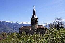
Saint-Vincent-de-Mercuze
| Saint-Vincent-de-Mercuze | |
|---|---|
 | |
 Saint-Vincent-de-Mercuze | |
|
Location within Auvergne-Rhône-Alpes region  Saint-Vincent-de-Mercuze | |
| Coordinates: 45°22′30″N 5°57′02″E / 45.375°N 5.9506°ECoordinates: 45°22′30″N 5°57′02″E / 45.375°N 5.9506°E | |
| Country | France |
| Region | Auvergne-Rhône-Alpes |
| Department | Isère |
| Arrondissement | Grenoble |
| Canton | Le Touvet |
| Intercommunality | Pays du Grésivaudan |
| Government | |
| • Mayor (2014–2020) | Philippe Baudain |
| Area1 | 8 km2 (3 sq mi) |
| Population (2011)2 | 1,392 |
| • Density | 170/km2 (450/sq mi) |
| Time zone | CET (UTC+1) |
| • Summer (DST) | CEST (UTC+2) |
| INSEE/Postal code | 38466 / 38660 |
| Elevation |
238–863 m (781–2,831 ft) (avg. 347 m or 1,138 ft) |
|
1 French Land Register data, which excludes lakes, ponds, glaciers > 1 km² (0.386 sq mi or 247 acres) and river estuaries. 2 Population without double counting: residents of multiple communes (e.g., students and military personnel) only counted once. | |
Saint-Vincent-de-Mercuze is a commune in the Isère department in southeastern France.
Population
| Historical population | ||
|---|---|---|
| Year | Pop. | ±% |
| 1793 | 429 | — |
| 1806 | 567 | +32.2% |
| 1821 | 531 | −6.3% |
| 1831 | 606 | +14.1% |
| 1841 | 605 | −0.2% |
| 1851 | 591 | −2.3% |
| 1861 | 582 | −1.5% |
| 1872 | 763 | +31.1% |
| 1881 | 730 | −4.3% |
| 1891 | 676 | −7.4% |
| 1901 | 653 | −3.4% |
| 1911 | 600 | −8.1% |
| 1921 | 500 | −16.7% |
| 1931 | 417 | −16.6% |
| 1946 | 447 | +7.2% |
| 1954 | 466 | +4.3% |
| 1962 | 447 | −4.1% |
| 1968 | 433 | −3.1% |
| 1975 | 572 | +32.1% |
| 1982 | 802 | +40.2% |
| 1990 | 1,060 | +32.2% |
| 1999 | 1,360 | +28.3% |
| 2006 | 1,383 | +1.7% |
| 2011 | 1,392 | +0.7% |
See also
References
| Wikimedia Commons has media related to Saint-Vincent-de-Mercuze. |
This article is issued from Wikipedia - version of the 10/28/2016. The text is available under the Creative Commons Attribution/Share Alike but additional terms may apply for the media files.