Qeshm
Coordinates: 26°41′43″N 55°37′06″E / 26.69528°N 55.61833°E
| Native name: قشم | |
|---|---|
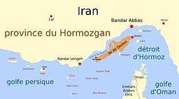 Map of Qeshm Island and surroundings, in French | |
 Qeshm | |
| Geography | |
| Location | Strait of Hormuz |
| Coordinates | 26°41′43″N 55°37′06″E / 26.69528°N 55.61833°E |
| Area | 1,491 km2 (576 sq mi) |
| Length | 135 km (83.9 mi) |
| Width | 40 km (25 mi) |
| Administration | |
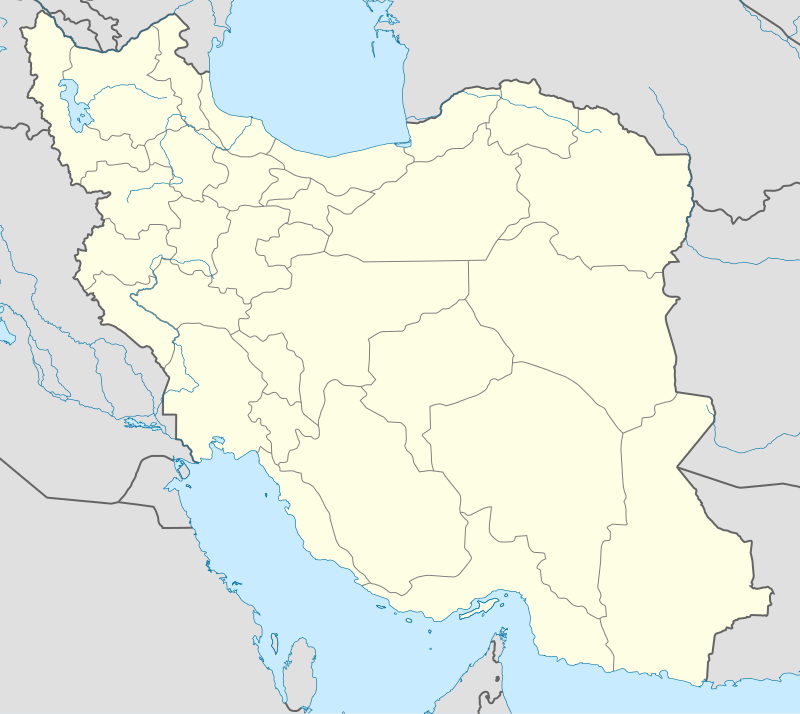
| Province | Hormozgān |
| County | Qeshm |
| Bakhsh | Central |
| Largest settlement | Qeshm (pop. 26 807) |
| Demographics | |
| Population | 117,774 (2011) |
| Pop. density | 67.07 /km2 (173.71 /sq mi) |
| Ethnic groups | Primarily Qeshmi, Minabi, Kumzari and Bandri Persian speaking Iranians and Iranian Arabs |
Qeshm (Persian: قشم, Persian pronunciation: [ɢeʃm]), formerly also known as Kishm, is an Iranian island in the Strait of Hormuz, separated from the mainland by the Clarence Strait/Khuran in the Persian Gulf (26°50′N 56°0′E / 26.833°N 56.000°E).
Geography

Qeshm Island is located a few kilometers off the southern coast of Iran (Persian Gulf), opposite the port cities of Bandar Abbas and Bandar Khamir. The island, which hosts a 300-square-kilometre (116-square-mile) free zone jurisdiction, is 135 km long, and lies strategically in the Strait of Hormuz, just 60 kilometres (37 miles) from the Omani port of Khasab, and about 180 kilometres (112 miles) from the UAE Port Rashid. The island, at its widest point, located near the center of the island, spans 40 kilometres (25 miles). Similarly, at it narrowest point, the island spans 9.4 kilometres (5.8 miles). The island has a surface area of 1,491 square kilometres (576 square miles) and is 2.5 times the size of Bahrain. Qeshm city, located at the easternmost point of the island, is 22 kilometres (14 miles) from Bandar Abbas while the closest point of the island is but two kilometres (1 mile) from the mainland.
The average temperature on the island is approximately 27 °C (81 °F). The warmest months are June through August, and the coldest from October to January. The average rainfall is 183.2 mm (7 3⁄16 in).
The island comprises 59 towns and villages and the population was 117,774 at the 2011 Census. The local population is involved in fishing, dhow construction, trade and services. An additional 30,000 are involved in administrative and industrial workforce and students.
Plans have also been made to build a bridge to connect Qeshm with the rest of Iran.[1][2]
History
.jpg)
Historical records concerning the Qeshm island date far back into the pre-Islamic era. Names as Qeshm, Keshm, Kish and Tunb mark the lengthy stay of Ilamids in the area, several centuries BC. It is, apparently, the island called Alexandria or Aracia by Ptolemy (Book 6, Chap. IV), in the 2nd century CE and as Alexandria by Ammianus Marcellinus (xxiii.6.42) in the 4th century. On account of its strategic geopolitical situation, near the mouth of the Persian Gulf, it has been frequently attacked by invaders including Ilamids (Elamites), Umayyads, Abbasids as well as the Portuguese and the English. During Sassanian Empire administration the island was called Abarkawan.[3] According to historical records, Qeshm Island has been famous as a trade and navigation center. Its economy flourished during the Dailamites and Buyid eras, as trade vessels sailed between Qeshm Island and China, India and Africa.
Explorer William Baffin was mortally wounded on Qeshm in 1622 during a battle against Portuguese forces who occupied the fort, known to the English as "Forte de Queixome".
Qeshm is also a supposed site of the Garden of Eden according to Cassells Bible.[4]
Economy
Fishing is a leading occupation practiced by the inhabitants of the island. On what little cultivated land there is, dates and melons are grown. Salt is mined on the southeastern coast. Qeshm is famous for its wide range of ecotourist attractions such as the Hara marine forests. According to environmentalists, about 1.5% of the world birds and 25% of Iran's native birds annually migrate to the forests, which are the first national geo park in Iran. An ancient Portuguese fort, historic mosques, the Seyyed Mozaffar and Bibi Maryam shrines, and various ponds and mangrove forests are among the tourism attractions in the island, which lays across the azure waters of the Persian Gulf. Several domes, salty caves, the preserved area in Shibderaz Village where Hawksbill turtles hatch, as well as numerous docks and wharfs are among the tourist potentials of the island. The Nazz Islands are located at the south wing of Qeshm Island. Oysters, corals, colorful fishes and sea birds in these islands attract many tourists. It is possible to walk toward the island on soft and wet gravel through a gravel connection way between these islands and Qeshm at the time of the ebb.
-

Naaz Islands, sea bed in the time of the ebb
-
.jpg)
Sea bed at Naaz Islands
-
.jpg)
Oysters in the holes of the Sea bed, Naaz Islands
.jpg)
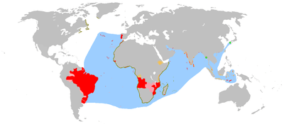
In the 1st ten-year plan, in note 19, the law provided for the creation of free trade zones and three locations were identified as such in the year 1991. They were Kish Island, Qeshm Island and Chabahar. In the Iranian year 1369, equivalent to 1991 in the Gregorian calendar, the island was transformed into a "Trade and Industrial Free Area" with the goal of creating the largest Free Area between Europe and the Far East.[5] To that end, Qeshm Island was granted considerable leeway to set its own policies, independent of the central government, which had often been seen as an impediment to growth in many sectors of the economy. However, the Island retains the advantages associated with its connection to the mainland, including the rights to explore and develop oil and gas opportunities.
-
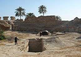
Portuguese castle at Qeshm Island
-

Chahkouh Valley at Qeshm Island
-

Stars Valley at Qeshm Island
-
.jpg)
Portuguese Castle of the Qeshm town (outside view)
-
.jpg)
Portuguese Castle of the Qeshm town (Inside view)
-

One of the cannons of Qeshm Portuguese castle
-

_003.jpg)
Iran Air Flight 655
On July 3, 1988, an Iran Air Airbus A300 (Iran Air Flight 655) was shot down by a United States Navy guided missile cruiser USS Vincennes just south of the island, resulting in 290 civilian fatalities. The wreckage crashed 2.5 kilometers off Qeshm's southern coast.
Qeshm Island Underground Military Facility
On 20 January 2012, OSGEOINT established the completion of an underground military facility at Qeshm island which accordingly could house Iran's Ghadir-Nahang class submarines.[6]
Economy, culture, and education
- Qeshm Institute of Higher Education
- Islamic Azad University of Medical Science Qeshm International Branch
See also
References
- ↑ "Austrians to Construct Persian Gulf Bridge to Connect Qeshm Island to the Main Island". payvand.com. Retrieved 2016-10-05.
- ↑ "Qeshm - Dictionary definition of Qeshm | Encyclopedia.com: FREE online dictionary". www.encyclopedia.com. Retrieved 2016-10-05.
- ↑ Hinds, Martin (1984). "The First Arab Conquests in Fārs". Iran. 22: 39–53. JSTOR 4299735.
- ↑ LTD, Kaspid. "Qeshm Island". www.arian-tour.com. Retrieved 2016-08-26.
- ↑ Qeshm Island Archived July 4, 2008, at the Wayback Machine., Qeshm Energy International
- ↑ Iran: Underground Naval Base at Qeshm Complete. Published by: OSGEOINT. OSGEOINT
- . الكوخردى ، محمد ، بن يوسف، (كُوخِرد حَاضِرَة اِسلامِيةَ عَلي ضِفافِ نَهر مِهران) الطبعة الثالثة ،دبى: سنة 199۷ للميلاد Mohammed Kookherdi (1997) Kookherd, an Islamic civil At Mehran river, third edition: Dubai
- . کامله،القاسمی، بنت شیخ عبدالله، (تاریخ لنجة) مکتبة دبي للتوزیع، الامارات: الطبعة الثانية عام ۱۹۹۳ للمیلاد
- . الوحیدی الخنجی، حسین بن علی بن احمد، «تاریخ لنجه» ، الطبعة الثانية دبی: دار الأمة للنشر والتوزیع، ۱۹۸۸ للمیلاد
- . اطلس گیتاشناسی استان های ایران [Atlas Gitashenasi Ostanhai Iran] (Gitashenasi Province Atlas of Iran)
External links
| Wikimedia Commons has media related to Qeshm Island. |
- Qeshmicty.Ir
- qeshm tourist
- Qeshm PressTV documentary on YouTube
- Qeshm Island entry In the Iranica.com
- Hormoz and Qeshm
- Qeshm history from Hormozgan university website
- Hormozgan'S townships
- Qeshm Island'S attractions
- Portuguese Castle At Wikimapia
|  | |||||||||||||||||||||||||||||||||||||||||||||||||||||||||||||||||||||||||
|
| ||||||||||||||||||||||||||||||||||||||||||||||||||||||||||||||||||||||||||
| ||||||||||||||||||||||||||||||||||||||||||||||||||||||||||||||||||||||||||
| ||||||||||||||||||||||||||||||||||||||||||||||||||||||||||||||||||||||||||
| ||||||||||||||||||||||||||||||||||||||||||||||||||||||||||||||||||||||||||
| ||||||||||||||||||||||||||||||||||||||||||||||||||||||||||||||||||||||||||
| Capital | 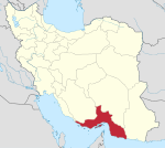 | ||||||||||||||||||||||||||||||||||||||||||||||
|---|---|---|---|---|---|---|---|---|---|---|---|---|---|---|---|---|---|---|---|---|---|---|---|---|---|---|---|---|---|---|---|---|---|---|---|---|---|---|---|---|---|---|---|---|---|---|---|
| Counties and cities | |||||||||||||||||||||||||||||||||||||||||||||||
| Sights |
| ||||||||||||||||||||||||||||||||||||||||||||||
| populated places | |||||||||||||||||||||||||||||||||||||||||||||||
| See also | |||||||||||||||||||||||||||||||||||||||||||||||
| Capital | |||||||||||||||||||||||||||||||||||||||||||||||||||||
|---|---|---|---|---|---|---|---|---|---|---|---|---|---|---|---|---|---|---|---|---|---|---|---|---|---|---|---|---|---|---|---|---|---|---|---|---|---|---|---|---|---|---|---|---|---|---|---|---|---|---|---|---|---|
| Districts |
| ||||||||||||||||||||||||||||||||||||||||||||||||||||