Dyerville, California
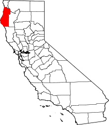
Dyerville, California is a former settlement in Humboldt County, California. It was located at an elevation of 246 ft on the northwest bank of the Eel River confluence with the South Fork Eel River 3 miles (4.8 km) west of Camp Grant.[1] Earliest known development at Dyerville was the operation of a ferry in the 1870s.[2] Dyerville had its own post office from April 17, 1890 to November 30, 1933, when it was moved to South Fork.[3]
References
- ↑ USGS Map Name: Weott, CA; N40° 21' 19" W123° 55' 33
- ↑ Hawk, Diane (2004). Touring the old redwood highway : Humboldt County. Arcata, Calif.: Hawk Mountaintop Pub. p. 80. ISBN 0-9672162-4-9.
- ↑ Frickstad, Walter N., A Century of California Post Offices 1848-1954, Philatelic Research Society, Oakland, CA. 1955, pp 40-49.
Coordinates: 40°21′19″N 123°55′33″W / 40.35528°N 123.92583°W
This article is issued from Wikipedia - version of the 9/27/2016. The text is available under the Creative Commons Attribution/Share Alike but additional terms may apply for the media files.