Benbow, California
| Benbow | |
|---|---|
| Census designated place | |
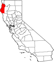
 Benbow Location in California | |
| Coordinates: 40°04′07″N 123°47′04″W / 40.06861°N 123.78444°WCoordinates: 40°04′07″N 123°47′04″W / 40.06861°N 123.78444°W | |
| Country |
|
| State |
|
| County | Humboldt County |
| Area[1] | |
| • Total | 4.881 sq mi (12.642 km2) |
| • Land | 4.881 sq mi (12.642 km2) |
| • Water | 0 sq mi (0 km2) 0% |
| Elevation[2] | 440 ft (134 m) |
| Population (April 1, 2010) | |
| • Total | 321 |
| • Density | 66/sq mi (25/km2) |
| Time zone | Pacific (UTC-8) |
| • Summer (DST) | PDT (UTC-7) |
| GNIS feature IDs | 1655827, 2611375 |
| U.S. Geological Survey Geographic Names Information System: Benbow, California; U.S. Geological Survey Geographic Names Information System: Benbow, California | |
Benbow is a census-designated place[3] in Humboldt County, California, located beside the South Fork Eel River.[2] It is located 2 miles (3.2 km) south-southeast of Garberville,[4] at an elevation of 440 feet (134 m).[2] Its population was 321 at the 2010 census.
History
The Children of Arthur Benbow purchased 1,288 acres from Ernest Linser and also some land from John Kamper, Jack Bowden and a Mr. Peirce in 1922.[5] It soon became apparent that ranching would not be sufficient to meet their needs so the family decided to construct the resort hotel that still stands today.[5] The children were Joseph, Evangeline, Burtis, Clara, Helen, Jessie, Loleta, Walter and Robert. Eight of these children were born in Humboldt County.[5] In the early years the Inn was known as the "Hotel Benbow."[5] It opened on July 17, 1926.[5] The electricity for the hotel came from two diesel generators until a dam and powerhouse was completed on the south fork of the Eel River.[6][4] The post office was established on December 30, 1929 and operated at Benbow from until it was merged with Garberville on January 31, 1953.[4] The Tudorbethan style inn is still in operation as the premier hotel property on US Route 101 between Humboldt Bay and the San Francisco Bay Area.[4]
Demographics
The 2010 United States Census[7] reported that Benbow had a population of 321. The population density was 65.8 people per square mile (25.4/km²). The racial makeup of Benbow was 294 (91.6%) White, 0 (0.0%) African American, 2 (0.6%) Native American, 1 (0.3%) Asian, 0 (0.0%) Pacific Islander, 13 (4.0%) from other races, and 11 (3.4%) from two or more races. Hispanic or Latino of any race were 25 persons (7.8%).
The Census reported that 319 people (99.4% of the population) lived in households, 2 (0.6%) lived in non-institutionalized group quarters, and 0 (0%) were institutionalized.
There were 150 households, out of which 39 (26.0%) had children under the age of 18 living in them, 60 (40.0%) were opposite-sex married couples living together, 17 (11.3%) had a female householder with no husband present, 9 (6.0%) had a male householder with no wife present. There were 16 (10.7%) unmarried opposite-sex partnerships, and 0 (0%) same-sex married couples or partnerships. 51 households (34.0%) were made up of individuals and 13 (8.7%) had someone living alone who was 65 years of age or older. The average household size was 2.13. There were 86 families (57.3% of all households); the average family size was 2.55.
The population was spread out with 59 people (18.4%) under the age of 18, 19 people (5.9%) aged 18 to 24, 79 people (24.6%) aged 25 to 44, 108 people (33.6%) aged 45 to 64, and 56 people (17.4%) who were 65 years of age or older. The median age was 46.2 years. For every 100 females there were 101.9 males. For every 100 females age 18 and over, there were 103.1 males.
There were 178 housing units at an average density of 36.5 per square mile (14.1/km²), of which 119 (79.3%) were owner-occupied, and 31 (20.7%) were occupied by renters. The homeowner vacancy rate was 2.4%; the rental vacancy rate was 0%. 257 people (80.1% of the population) lived in owner-occupied housing units and 62 people (19.3%) lived in rental housing units.
Politics
In the state legislature, Benbow is in the 2nd Senate District, represented by Democrat Mike McGuire,[8] and the 2nd Assembly District, represented by Democrat Jim Wood.[9]
Federally, it is in California's 2nd congressional district, represented by Democrat Jared Huffman.[10]
References
- ↑ "2010 Census U.S. Gazetteer Files – Places – California". United States Census Bureau.
- 1 2 3 U.S. Geological Survey Geographic Names Information System: Benbow, California
- ↑ U.S. Geological Survey Geographic Names Information System: Benbow, California
- 1 2 3 4 Durham, David L. (1998). California's Geographic Names: A Gazetteer of Historic and Modern Names of the State. Clovis, Calif.: Word Dancer Press. p. 16-17. ISBN 1-884995-14-4.
- 1 2 3 4 5 Turner, Dennis (1993). Place Names of Humboldt County, California: A Compendium, 1542–1992. Eureka, CA: Eureka Printing Company Incorporated. p. 18. ISBN 9780962961717.
- ↑ Estrada, Natalya; Benz, Kellie Ann (September 5, 2016). "Benbow Dam demolition on schedule". Eureka Times-Standard. Retrieved 11 September 2016.
- ↑ "2010 Census Interactive Population Search: CA - Benbow CDP". U.S. Census Bureau. Retrieved July 12, 2014.
- ↑ "Senators". State of California. Retrieved March 10, 2013.
- ↑ "Members Assembly". State of California. Retrieved March 2, 2013.
- ↑ "California's 2nd Congressional District - Representatives & District Map". Civic Impulse, LLC. Retrieved March 1, 2013.