Brock Creek, California
Coordinates: 40°14′53″N 123°42′58″W / 40.24806°N 123.71611°W
| Brock Creek | |
|---|---|
| Former settlement | |
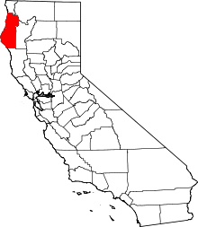
 Brock Creek Location in California | |
| Coordinates: 40°14′53″N 123°42′58″W / 40.24806°N 123.71611°W | |
| Country | United States |
| State | California |
| County | Humboldt County |
| Elevation[1] | 279 ft (85 m) |
Brock Creek is a former settlement in Humboldt County, California.[1] It was located on the Northwestern Pacific Railroad 7.5 miles (12 km) northwest of Alderpoint,[2] at an elevation of 279 feet (85 m).[1] It still appeared on maps as of 1949.[1]
References
This article is issued from Wikipedia - version of the 1/16/2011. The text is available under the Creative Commons Attribution/Share Alike but additional terms may apply for the media files.